The takeoff view from Leh is exceptional—the Ladakh Range and Indus Valley provide dramatic, sustained mountain scenery during the critical first 30 minutes of flight. While the landing approach into Bombay offers coastal views, the takeoff experience is more visually distinctive and geographically significant.
Flown IXL to BOM? Did we get it right?
Flight Path
Leh to Bombay is 1,079 miles (1,736 km), a flight of about 3 hours.
The flight path crosses the Thar Desert region and the Gujarat plains. Notably visible at cruise altitude: the Aravalli Range (eastern edge, appearing as a low ridge line around 45 minutes into flight), the Great Rann of Kutch (vast salt flat, appearing as a pale, featureless expanse), and the transition from desert to coastal plains as the aircraft approaches the Arabian Sea. The flight generally maintains a southwesterly heading, and at cruise altitude (around 30,000 feet), individual cities are difficult to distinguish, but the broad geographic transition from high-altitude Ladakh terrain to sea-level coastal plains is evident.
Great circle distance and headings ›


Phase by phase
Takeoff from IXL
LEFTLeh typically departs runway 24 (westbound). Left seats face north initially during climb-out, offering direct views of the Ladakh Range and the Indus Valley floor. Right seats turn away from the mountains toward barren plateau.
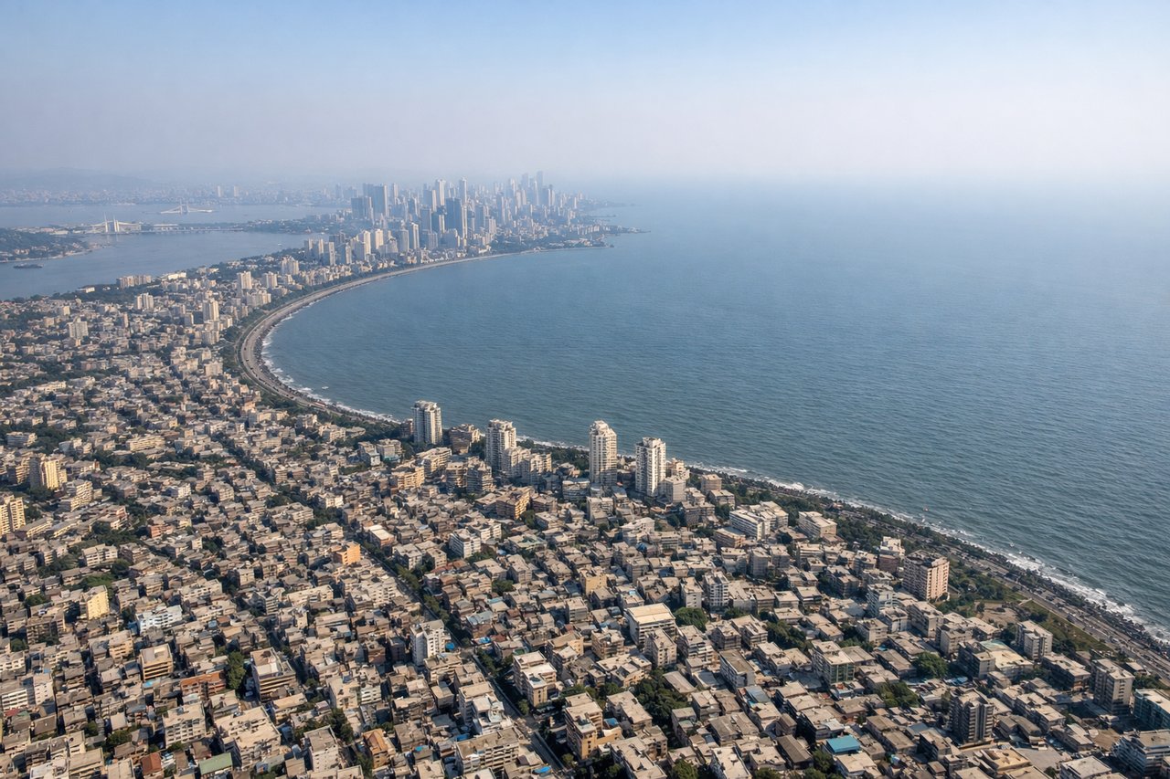
Landing at BOM
RIGHTBombay typically lands runway 09L or 09R (eastbound approach). Right seats on descent face south and southwest, providing views of the Arabian Sea coastline, the Thane Creek inlet, and the Mumbai harbor approach. Left seats face inland toward the Deccan Plateau.
Will your flight be in sunlight?
Pick a date and time in the Sun Map to watch the sun move across your whole flight.
About This Route
Which side of the plane should I sit on flying from Leh (IXL) to Chhatrapati Shivaji International (BOM)?
Sit on the Left side of the plane for the best views on flights from Leh to Bombay. The takeoff view from Leh is exceptional—the Ladakh Range and Indus Valley provide dramatic, sustained mountain scenery during the critical first 30 minutes of flight. While the landing approach into Bombay offers coastal views, the takeoff experience is more visually distinctive and geographically significant.
What can I see during takeoff from Leh in Leh?
During takeoff from Leh (IXL), sit on the Left side for the best views. Leh typically departs runway 24 (westbound). Left seats face north initially during climb-out, offering direct views of the Ladakh Range and the Indus Valley floor. Right seats turn away from the mountains toward barren plateau. Notable sights include: Ladakh Range (immediate north), Indus River valley (winding below), Stok Kangri massif (northeast), Leh city grid (directly beneath during initial climb).
What can I see when landing at Chhatrapati Shivaji International in Bombay?
When landing at Chhatrapati Shivaji International (BOM), sit on the Right side for the best views. Bombay typically lands runway 09L or 09R (eastbound approach). Right seats on descent face south and southwest, providing views of the Arabian Sea coastline, the Thane Creek inlet, and the Mumbai harbor approach. Left seats face inland toward the Deccan Plateau. Notable sights include: Arabian Sea (dominant feature to the south), Thane Creek and mangrove areas (northeast of approach path), Salsette Island geography (immediate landing area), Mumbai's coastal development (visible as urban sprawl along the shore).
How long is the flight from Leh to Bombay?
The flight from Leh (IXL) to Chhatrapati Shivaji International (BOM) takes about 3 hours. The shortest flight path between them is 1,079 miles (1,736 km); winds and air traffic control usually add a few percent.
What does the Leh to Bombay flight path pass over?
The flight path crosses the Thar Desert region and the Gujarat plains. Notably visible at cruise altitude: the Aravalli Range (eastern edge, appearing as a low ridge line around 45 minutes into flight), the Great Rann of Kutch (vast salt flat, appearing as a pale, featureless expanse), and the transition from desert to coastal plains as the aircraft approaches the Arabian Sea. The flight generally maintains a southwesterly heading, and at cruise altitude (around 30,000 feet), individual cities are difficult to distinguish, but the broad geographic transition from high-altitude Ladakh terrain to sea-level coastal plains is evident.