Right side scores higher (3.0 vs 2.5) due to superior landing experience. While both sides offer modest scenic value on a short 45-minute flight over relatively flat terrain, the right side's approach to Cochin's harbor, backwater system, and Chinese fishing nets provides distinctive visual landmarks during descent and landing. The takeoff from Madurai also favors the right with urban features. The left side faces primarily open agricultural plains and water with less landmark density.
Flown IXM to COK? Did we get it right?
Flight Path
Madurai to Kochi is 117 miles (189 km), a flight of about 45 minutes.
Periyar River valley, agricultural plains of central Tamil Nadu transitioning to Kerala's backwater region, scattered towns along NH44 corridor, transition from dry Tamil Nadu landscape to Kerala's greener, water-rich terrain
Great circle distance and headings ›Phase by phase
Takeoff from IXM
RIGHTRight side captures Madurai city and surrounding agricultural plains during climb-out. Madurai's temple spires and urban grid are visible from altitude, providing urban landmark interest absent on the left side, which faces open farmland.
Landing at COK
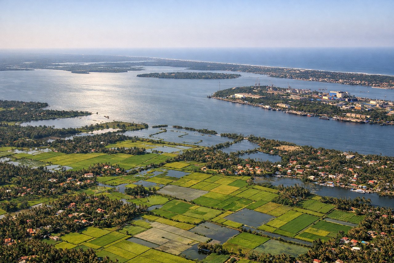
RIGHTRight side offers superior approach scenery: the Periyar River estuary, Cochin harbor with its distinctive Chinese fishing nets, and the backwater system create dramatic water features. The approach to Cochin typically descends over these waterways, making the right side the scenic advantage during final descent and landing.
Will your flight be in sunlight?
Pick a date and time in the Sun Map to watch the sun move across your whole flight.
About This Route
Which side of the plane should I sit on flying from Madurai (IXM) to Cochin International Airport (COK)?
Sit on the Right side of the plane for the best views on flights from Madurai to Kochi. Right side scores higher (3.0 vs 2.5) due to superior landing experience. While both sides offer modest scenic value on a short 45-minute flight over relatively flat terrain, the right side's approach to Cochin's harbor, backwater system, and Chinese fishing nets provides distinctive visual landmarks during descent and landing. The takeoff from Madurai also favors the right with urban features. The left side faces primarily open agricultural plains and water with less landmark density.
What can I see during takeoff from Madurai in Madurai?
During takeoff from Madurai (IXM), sit on the Right side for the best views. Right side captures Madurai city and surrounding agricultural plains during climb-out. Madurai's temple spires and urban grid are visible from altitude, providing urban landmark interest absent on the left side, which faces open farmland. Notable sights include: Madurai city center with Meenakshi Temple complex, Vaigai River valley, agricultural grid of Tamil Nadu plains.
What can I see when landing at Cochin International Airport in Kochi?
When landing at Cochin International Airport (COK), sit on the Right side for the best views. Right side offers superior approach scenery: the Periyar River estuary, Cochin harbor with its distinctive Chinese fishing nets, and the backwater system create dramatic water features. The approach to Cochin typically descends over these waterways, making the right side the scenic advantage during final descent and landing. Notable sights include: Cochin harbor with Chinese fishing nets, Periyar River estuary, Cochin backwaters system, Willingdon Island.
How long is the flight from Madurai to Kochi?
The flight from Madurai (IXM) to Cochin International Airport (COK) takes about 45 minutes. The shortest flight path between them is 117 miles (189 km); winds and air traffic control usually add a few percent.
What does the Madurai to Kochi flight path pass over?
Periyar River valley, agricultural plains of central Tamil Nadu transitioning to Kerala's backwater region, scattered towns along NH44 corridor, transition from dry Tamil Nadu landscape to Kerala's greener, water-rich terrain