Aurangabad to Hyderabad is 269 miles (433 km), a flight of about 1 hour 10 minutes.
Neither side offers dramatic terrain since the route crosses the flat-to-gently-rolling Deccan plateau, but the right side edges ahead by combining glimpses of Aurangabad's urban edge and volcanic plateau hills on departure with a partial view of Hyderabad's lake and skyline on arrival.
Flight Path
Flat Deccan plateau farmland and scattered basalt hill formations, with occasional small reservoirs and seasonal river channels crossing the route between Aurangabad and Hyderabad
Great circle distance and headings ›Phase by phase
Takeoff from IXU
RIGHTDeparting IXU, the right side gives a brief look back at Aurangabad's urban sprawl and the rolling, eroded volcanic hills of the Deccan trap plateau before the plane levels into cruise over flat farmland. It's subtle, but more visually varied than the left, which mostly shows open agricultural plains.
Landing at HYD
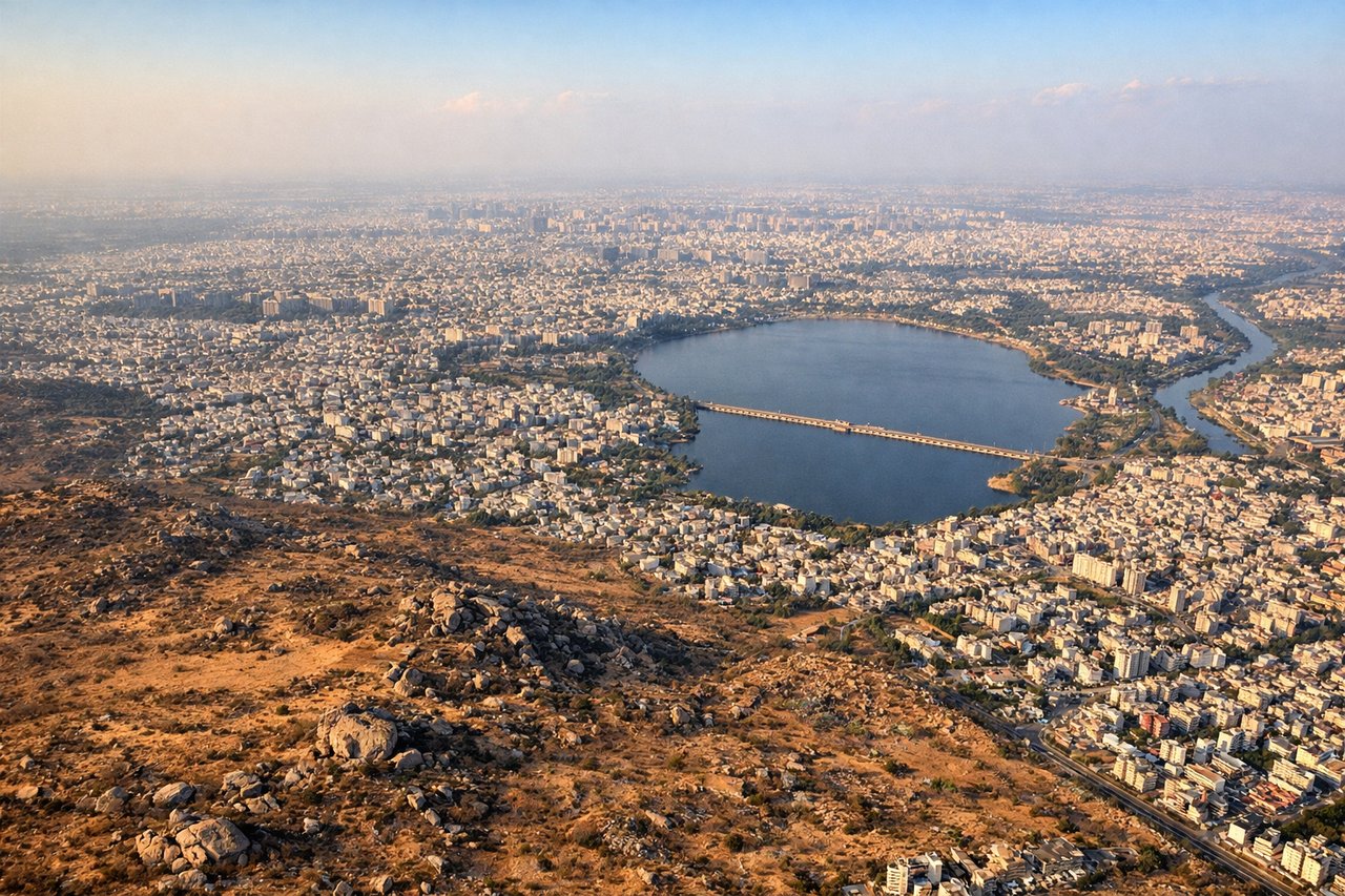
RIGHTOn approach into Hyderabad, the right side typically faces the city's western and southern districts, offering glimpses of Hussain Sagar lake's shoreline and the dense urban grid before touchdown. The left side mostly shows open scrubland and the airport perimeter.
Will your flight be in sunlight?
Pick a date and time in the Sun Map to watch the sun move across your whole flight.
About This Route
Which side of the plane should I sit on flying from Aurangabad (IXU) to Rajiv Gandhi International Airport (HYD)?
Sit on the Right side of the plane for the best views on flights from Aurangabad to Hyderabad. Neither side offers dramatic terrain since the route crosses the flat-to-gently-rolling Deccan plateau, but the right side edges ahead by combining glimpses of Aurangabad's urban edge and volcanic plateau hills on departure with a partial view of Hyderabad's lake and skyline on arrival.
What can I see during takeoff from Aurangabad in Aurangabad?
During takeoff from Aurangabad (IXU), sit on the Right side for the best views. Departing IXU, the right side gives a brief look back at Aurangabad's urban sprawl and the rolling, eroded volcanic hills of the Deccan trap plateau before the plane levels into cruise over flat farmland. It's subtle, but more visually varied than the left, which mostly shows open agricultural plains. Notable sights include: Aurangabad city outskirts, Deccan trap plateau hills, patchwork farmland, Kham River valley.
What can I see when landing at Rajiv Gandhi International Airport in Hyderabad?
When landing at Rajiv Gandhi International Airport (HYD), sit on the Right side for the best views. On approach into Hyderabad, the right side typically faces the city's western and southern districts, offering glimpses of Hussain Sagar lake's shoreline and the dense urban grid before touchdown. The left side mostly shows open scrubland and the airport perimeter. Notable sights include: Hussain Sagar lake, Hyderabad urban skyline, Musi River, granite outcrop hills near the city.
How long is the flight from Aurangabad to Hyderabad?
The flight from Aurangabad (IXU) to Rajiv Gandhi International Airport (HYD) takes about 1 hour 10 minutes. The shortest flight path between them is 269 miles (433 km); winds and air traffic control usually add a few percent.
What does the Aurangabad to Hyderabad flight path pass over?
Flat Deccan plateau farmland and scattered basalt hill formations, with occasional small reservoirs and seasonal river channels crossing the route between Aurangabad and Hyderabad