While takeoff from JFK favors the right side, the landing approach into Cali from the left provides more dramatic and sustained scenery—the Andes mountains and Cauca River valley are visually striking and occupy the final 90 minutes of descent. The left side captures the most memorable portion of this route.
Flown JFK to CLO? Did we get it right?
Flight Path
New York to Cali is 2,568 miles (4,133 km), a flight of about 5 hours 15 minutes.
The flight path crosses the Caribbean Sea and passes over the Yucatan Peninsula (visible as low-lying terrain with cenotes and limestone karst features), then continues south over Central America and into northern South America. Around the midpoint, you'll see the Isthmus of Panama and the Caribbean coastline of Colombia. The Magdalena River valley becomes visible as the aircraft approaches Colombian airspace, running north-south through the interior. The Sierra Nevada de Santa Marta (northernmost range of the Colombian Andes) may be visible to the east on clear days. The final approach descends through the Cauca River valley with increasingly dramatic views of the Western Cordillera.
Great circle distance and headings ›

Phase by phase

Takeoff from JFK
RIGHTRight-side seats offer views of Long Island Sound and the Connecticut coastline during the initial climb-out heading southwest. You'll see the sound's water body and the irregular shoreline receding beneath the aircraft.
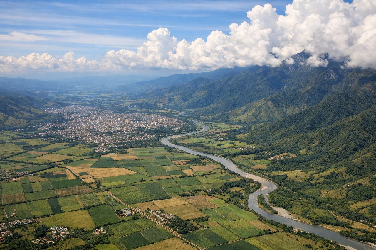
Landing at CLO
LEFTLeft-side seats provide excellent views of the Cauca River valley and the Cordillera Occidental (Western Range) of the Colombian Andes during descent into Cali. The river and mountain terrain are the dominant visual features on approach.
Will your flight be in sunlight?
Pick a date and time in the Sun Map to watch the sun move across your whole flight.
About This Route
Which side of the plane should I sit on flying from John F Kennedy International (JFK) to Alfonso Bonilla Aragon International (CLO)?
Sit on the Left side of the plane for the best views on flights from New York to Cali. While takeoff from JFK favors the right side, the landing approach into Cali from the left provides more dramatic and sustained scenery—the Andes mountains and Cauca River valley are visually striking and occupy the final 90 minutes of descent. The left side captures the most memorable portion of this route.
What can I see during takeoff from John F Kennedy International in New York?
During takeoff from John F Kennedy International (JFK), sit on the Right side for the best views. Right-side seats offer views of Long Island Sound and the Connecticut coastline during the initial climb-out heading southwest. You'll see the sound's water body and the irregular shoreline receding beneath the aircraft. Notable sights include: Long Island Sound, Connecticut coastline, New York City metropolitan area (receding behind), Hudson River estuary.
What can I see when landing at Alfonso Bonilla Aragon International in Cali?
When landing at Alfonso Bonilla Aragon International (CLO), sit on the Left side for the best views. Left-side seats provide excellent views of the Cauca River valley and the Cordillera Occidental (Western Range) of the Colombian Andes during descent into Cali. The river and mountain terrain are the dominant visual features on approach. Notable sights include: Cauca River valley, Cordillera Occidental mountains, Cali city sprawl in the valley floor, Pacific coastal plains to the west.
How long is the flight from New York to Cali?
The flight from John F Kennedy International (JFK) to Alfonso Bonilla Aragon International (CLO) takes about 5 hours 15 minutes. The shortest flight path between them is 2,568 miles (4,133 km); winds and air traffic control usually add a few percent.
What does the New York to Cali flight path pass over?
The flight path crosses the Caribbean Sea and passes over the Yucatan Peninsula (visible as low-lying terrain with cenotes and limestone karst features), then continues south over Central America and into northern South America. Around the midpoint, you'll see the Isthmus of Panama and the Caribbean coastline of Colombia. The Magdalena River valley becomes visible as the aircraft approaches Colombian airspace, running north-south through the interior. The Sierra Nevada de Santa Marta (northernmost range of the Colombian Andes) may be visible to the east on clear days. The final approach descends through the Cauca River valley with increasingly dramatic views of the Western Cordillera.