New York to Cartagena is 2,089 miles (3,362 km), a flight of about 5 hours 30 minutes.
While the left side wins at takeoff with the Jamaica Bay and Manhattan views, the right side delivers the more dramatic and sustained scenery — the Caribbean coastline of Colombia on descent and the spectacular arrival view over Cartagena Bay and the old city make it the better overall choice for the full flight experience.
Flight Path
After departing New York the route tracks southeast over the open Atlantic Ocean. Around the midpoint the flight passes east of Cuba and Haiti over the Caribbean Sea. The western tip of Hispaniola and the mountainous spine of Haiti (Massif du Nord, reaching over 8,000 ft) may be visible on the left side in clear conditions. The flight then crosses the northeastern corner of the Caribbean before descending toward Colombia's Caribbean coast. The Sierra Nevada de Santa Marta — the world's highest coastal mountain range, rising to nearly 19,000 ft — may be visible on the right horizon during descent if conditions are clear.
Great circle distance and headings ›.jpg?width=600)

Phase by phase
Takeoff from JFK
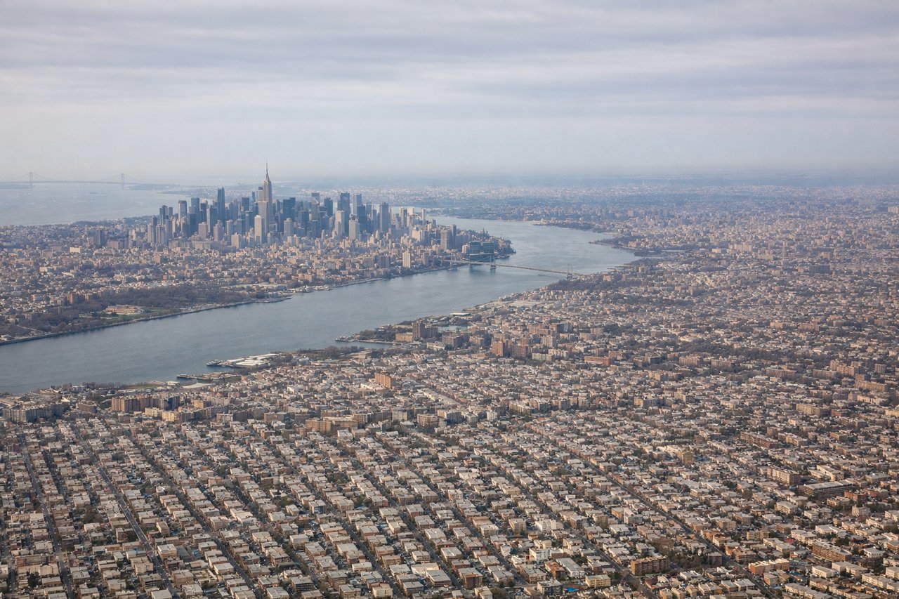
LEFTJFK's primary departure runways 22L/22R send aircraft southwest over Jamaica Bay and then curving south over the Atlantic. The left side gets a clear view back over Jamaica Bay, the Rockaway Peninsula, and lower Manhattan's skyline receding to the north. The right side faces open ocean almost immediately.
Landing at CTG
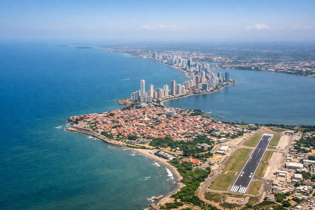
RIGHTRafael Nunez Airport sits on a peninsula north of Cartagena, and aircraft typically approach from the north or northeast over the Caribbean. On a right-side seat you get the view of Cartagena's old walled city, the Bocagrande peninsula, and the bay as the aircraft descends. The left side faces inland toward scrubby lowlands.
Landmarks on this routeAll landmarks →
Will your flight be in sunlight?
Pick a date and time in the Sun Map to watch the sun move across your whole flight.
About This Route
Which side of the plane should I sit on flying from John F Kennedy International (JFK) to Rafael Nunez (CTG)?
Sit on the Right side of the plane for the best views on flights from New York to Cartagena. While the left side wins at takeoff with the Jamaica Bay and Manhattan views, the right side delivers the more dramatic and sustained scenery — the Caribbean coastline of Colombia on descent and the spectacular arrival view over Cartagena Bay and the old city make it the better overall choice for the full flight experience.
What can I see during takeoff from John F Kennedy International in New York?
During takeoff from John F Kennedy International (JFK), sit on the Left side for the best views. JFK's primary departure runways 22L/22R send aircraft southwest over Jamaica Bay and then curving south over the Atlantic. The left side gets a clear view back over Jamaica Bay, the Rockaway Peninsula, and lower Manhattan's skyline receding to the north. The right side faces open ocean almost immediately. Notable sights include: Jamaica Bay and its barrier islands, Rockaway Peninsula, Lower Manhattan skyline to the north, Coney Island and Brighton Beach coastline.
What can I see when landing at Rafael Nunez in Cartagena?
When landing at Rafael Nunez (CTG), sit on the Right side for the best views. Rafael Nunez Airport sits on a peninsula north of Cartagena, and aircraft typically approach from the north or northeast over the Caribbean. On a right-side seat you get the view of Cartagena's old walled city, the Bocagrande peninsula, and the bay as the aircraft descends. The left side faces inland toward scrubby lowlands. Notable sights include: Cartagena's walled old city (Ciudad Amurallada), Bocagrande peninsula, Cartagena Bay, Caribbean Sea approach.
How long is the flight from New York to Cartagena?
The flight from John F Kennedy International (JFK) to Rafael Nunez (CTG) takes about 5 hours 30 minutes. The shortest flight path between them is 2,089 miles (3,362 km); winds and air traffic control usually add a few percent.
What does the New York to Cartagena flight path pass over?
After departing New York the route tracks southeast over the open Atlantic Ocean. Around the midpoint the flight passes east of Cuba and Haiti over the Caribbean Sea. The western tip of Hispaniola and the mountainous spine of Haiti (Massif du Nord, reaching over 8,000 ft) may be visible on the left side in clear conditions. The flight then crosses the northeastern corner of the Caribbean before descending toward Colombia's Caribbean coast. The Sierra Nevada de Santa Marta — the world's highest coastal mountain range, rising to nearly 19,000 ft — may be visible on the right horizon during descent if conditions are clear.