New York to Willemstad is 1,987 miles (3,198 km), a flight of about 5 hours.
Left side wins at both ends of the flight. During the cruise over the Caribbean, the left side also gives occasional views of Puerto Rico, Hispaniola's northern coast, and the island chain of the Lesser Antilles as the route tracks south-southwest — the right side faces open Atlantic for much of the journey.
Flight Path
The route tracks south-southwest over the Atlantic, passing the Outer Banks of North Carolina, then over open ocean before crossing the northeastern Caribbean. Puerto Rico and the Virgin Islands appear to the right around the midpoint. The flight then passes north of Hispaniola and Cuba's eastern tip before descending toward the southern Caribbean and Curaçao. The Dutch ABC islands — Aruba, Bonaire, and Curaçao — are visible as low flat outlines in the final descent.
Great circle distance and headings ›Phase by phase
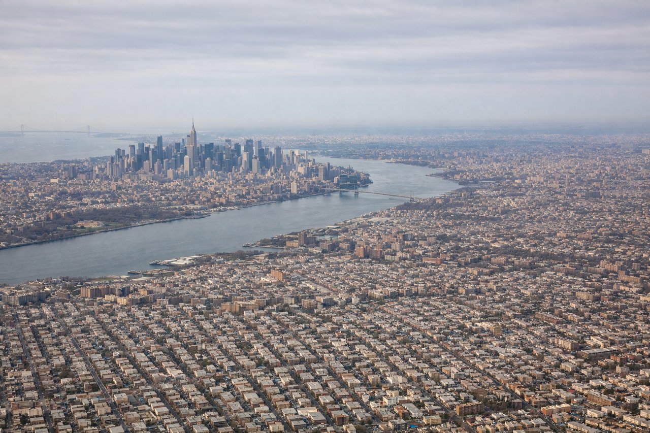
Takeoff from JFK
LEFTJFK primarily departs eastward over Jamaica Bay or westward over the city depending on wind. With the dominant easterly departures (runways 31L/31R), a left-side seat gives you the sweep back over Brooklyn, Lower Manhattan's skyline, and the Hudson River as the aircraft banks south. Right side faces the Atlantic with little to see.
Landing at CUR
LEFTHato Airport at Curaçao typically lands from the east on runway 11, meaning the aircraft approaches from the east over open Caribbean water and touches down heading west. A left-side seat gives you the best view of Willemstad's colorful Dutch colonial waterfront, the Queen Emma pontoon bridge, and the Schottegat harbor as you descend over the island.
Landmarks on this routeAll landmarks →
Will your flight be in sunlight?
Pick a date and time in the Sun Map to watch the sun move across your whole flight.
About This Route
Which side of the plane should I sit on flying from John F Kennedy International (JFK) to Hato (CUR)?
Sit on the Left side of the plane for the best views on flights from New York to Willemstad. Left side wins at both ends of the flight. During the cruise over the Caribbean, the left side also gives occasional views of Puerto Rico, Hispaniola's northern coast, and the island chain of the Lesser Antilles as the route tracks south-southwest — the right side faces open Atlantic for much of the journey.
What can I see during takeoff from John F Kennedy International in New York?
During takeoff from John F Kennedy International (JFK), sit on the Left side for the best views. JFK primarily departs eastward over Jamaica Bay or westward over the city depending on wind. With the dominant easterly departures (runways 31L/31R), a left-side seat gives you the sweep back over Brooklyn, Lower Manhattan's skyline, and the Hudson River as the aircraft banks south. Right side faces the Atlantic with little to see. Notable sights include: Lower Manhattan skyline, Verrazano-Narrows Bridge, Jamaica Bay wetlands, Brooklyn waterfront.
What can I see when landing at Hato in Willemstad?
When landing at Hato (CUR), sit on the Left side for the best views. Hato Airport at Curaçao typically lands from the east on runway 11, meaning the aircraft approaches from the east over open Caribbean water and touches down heading west. A left-side seat gives you the best view of Willemstad's colorful Dutch colonial waterfront, the Queen Emma pontoon bridge, and the Schottegat harbor as you descend over the island. Notable sights include: Willemstad waterfront (Punda and Otrobanda districts), Queen Emma pontoon bridge, Schottegat harbor, Sint Annabaai channel.
How long is the flight from New York to Willemstad?
The flight from John F Kennedy International (JFK) to Hato (CUR) takes about 5 hours. The shortest flight path between them is 1,987 miles (3,198 km); winds and air traffic control usually add a few percent.
What does the New York to Willemstad flight path pass over?
The route tracks south-southwest over the Atlantic, passing the Outer Banks of North Carolina, then over open ocean before crossing the northeastern Caribbean. Puerto Rico and the Virgin Islands appear to the right around the midpoint. The flight then passes north of Hispaniola and Cuba's eastern tip before descending toward the southern Caribbean and Curaçao. The Dutch ABC islands — Aruba, Bonaire, and Curaçao — are visible as low flat outlines in the final descent.