New York to Hanamaki is 6,484 miles (10,435 km), a flight of about 13 hours 30 minutes.
Left side wins both ends of the flight. During the transpacific crossing, the left side also faces generally south toward the Aleutian Island chain as the great-circle route arcs over the North Pacific, offering occasional glimpses of volcanic island peaks and sea ice depending on season. Right side faces north toward open Arctic waters with little to see.
Flight Path
The great-circle route from JFK to HNA arcs far north over southern Canada, crossing the Gulf of St. Lawrence, then Newfoundland's coastline, before heading out over the North Atlantic and curving northwest over the Labrador Sea. The route then crosses southern Greenland's ice sheet edge, tracks over the Bering Sea approaching the Aleutian Islands chain — where volcanic peaks like Shishaldin on Unimak Island may be visible on clear days — before descending over the Kamchatka Peninsula's volcanic spine and crossing the Sea of Japan toward Honshu.
Great circle distance and headings ›.jpg?width=600)
.jpeg?width=600)

Phase by phase
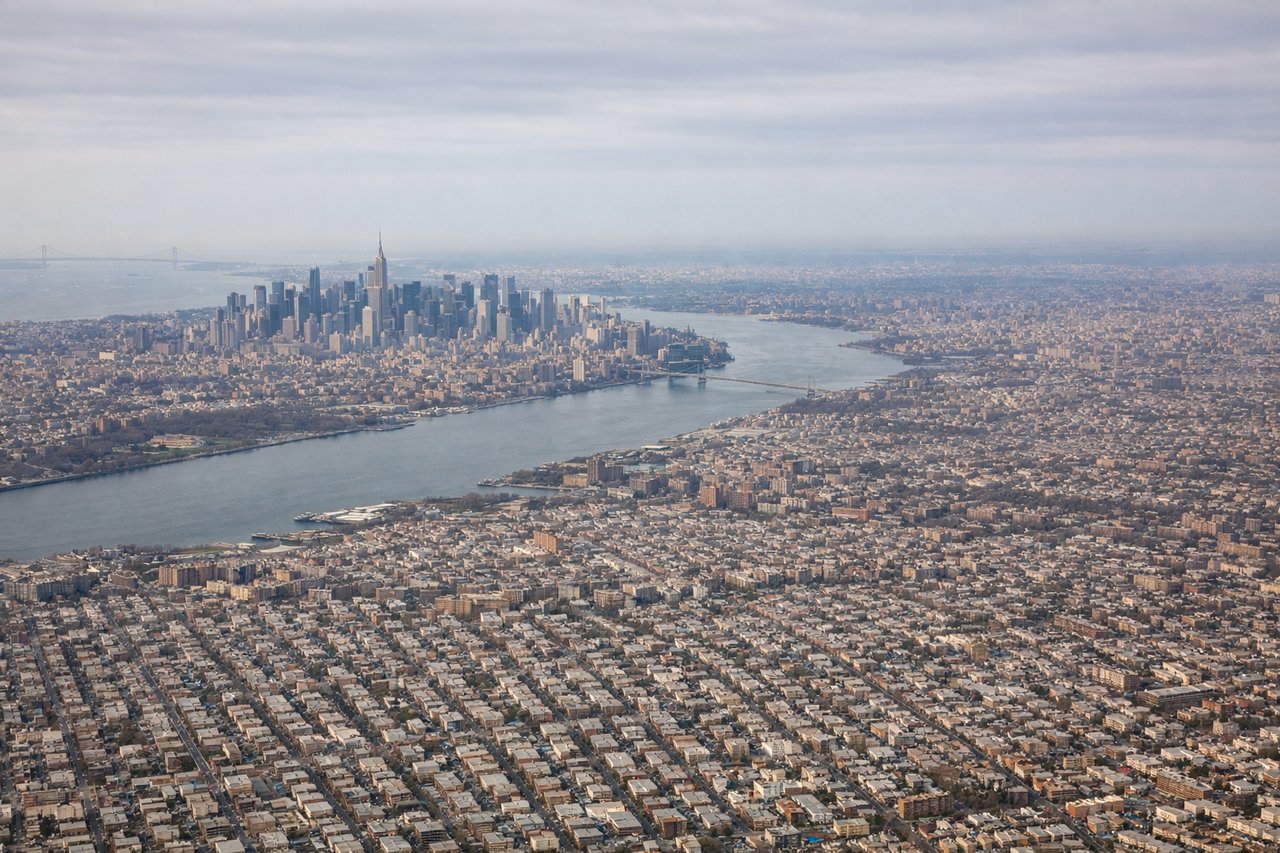
Takeoff from JFK
LEFTJFK's primary departure runways 22L/22R send aircraft southwest over Jamaica Bay before banking right toward the northeast. Left-side passengers get a sweeping view back over Lower Manhattan's skyline, the Verrazano-Narrows Bridge, and the full Upper New York Bay as the aircraft climbs and turns. Right-side passengers mostly see the Atlantic Ocean and the Rockaway Peninsula.
Landing at HNA
LEFTHanamaki Airport (HNA) sits in the Kitakami River valley in Iwate Prefecture, and aircraft typically approach from the east or southeast on runway 20, heading roughly south-southwest. Left-side passengers get views of the Kitakami Mountains and the broad agricultural valley floor. Right-side passengers look toward flatter terrain to the west.
Landmarks on this routeAll landmarks →
Will your flight be in sunlight?
Pick a date and time in the Sun Map to watch the sun move across your whole flight.
About This Route
Which side of the plane should I sit on flying from John F Kennedy International (JFK) to Hanamaki (HNA)?
Sit on the Left side of the plane for the best views on flights from New York to Hanamaki. Left side wins both ends of the flight. During the transpacific crossing, the left side also faces generally south toward the Aleutian Island chain as the great-circle route arcs over the North Pacific, offering occasional glimpses of volcanic island peaks and sea ice depending on season. Right side faces north toward open Arctic waters with little to see.
What can I see during takeoff from John F Kennedy International in New York?
During takeoff from John F Kennedy International (JFK), sit on the Left side for the best views. JFK's primary departure runways 22L/22R send aircraft southwest over Jamaica Bay before banking right toward the northeast. Left-side passengers get a sweeping view back over Lower Manhattan's skyline, the Verrazano-Narrows Bridge, and the full Upper New York Bay as the aircraft climbs and turns. Right-side passengers mostly see the Atlantic Ocean and the Rockaway Peninsula. Notable sights include: Lower Manhattan skyline, Verrazano-Narrows Bridge, Upper New York Bay, Jamaica Bay wildlife refuge grid of water channels.
What can I see when landing at Hanamaki in Hanamaki?
When landing at Hanamaki (HNA), sit on the Left side for the best views. Hanamaki Airport (HNA) sits in the Kitakami River valley in Iwate Prefecture, and aircraft typically approach from the east or southeast on runway 20, heading roughly south-southwest. Left-side passengers get views of the Kitakami Mountains and the broad agricultural valley floor. Right-side passengers look toward flatter terrain to the west. Notable sights include: Kitakami River valley, Kitakami Mountains, Iwate's patchwork rice paddies, Mount Hayachine (1,917m) on the distant horizon.
How long is the flight from New York to Hanamaki?
The flight from John F Kennedy International (JFK) to Hanamaki (HNA) takes about 13 hours 30 minutes. The shortest flight path between them is 6,484 miles (10,435 km); winds and air traffic control usually add a few percent.
What does the New York to Hanamaki flight path pass over?
The great-circle route from JFK to HNA arcs far north over southern Canada, crossing the Gulf of St. Lawrence, then Newfoundland's coastline, before heading out over the North Atlantic and curving northwest over the Labrador Sea. The route then crosses southern Greenland's ice sheet edge, tracks over the Bering Sea approaching the Aleutian Islands chain — where volcanic peaks like Shishaldin on Unimak Island may be visible on clear days — before descending over the Kamchatka Peninsula's volcanic spine and crossing the Sea of Japan toward Honshu.