Left side wins at both ends of this short flight. At takeoff you get the full New York Harbor panorama, and on approach you get Casco Bay's island-studded coastline and the Portland peninsula. The right side offers the Atlantic at departure and inland Maine on arrival — both considerably less scenic.
Flown JFK to PWM? Did we get it right?
Flight Path
New York to Portland is 273 miles (440 km), a flight of about 1 hour 10 minutes.
The flight tracks northeast over Connecticut and Rhode Island, crossing the Providence metro area and Narragansett Bay, then over the Massachusetts South Shore and Boston's outer suburbs. Over southern New Hampshire and coastal Maine, the landscape transitions to dense boreal forest broken by lakes and rivers. The Connecticut River valley is visible early in the flight, and on clear days Boston Harbor is identifiable to the left before the coast curves northeast toward Portland.
Great circle distance and headings ›Phase by phase
Takeoff from JFK
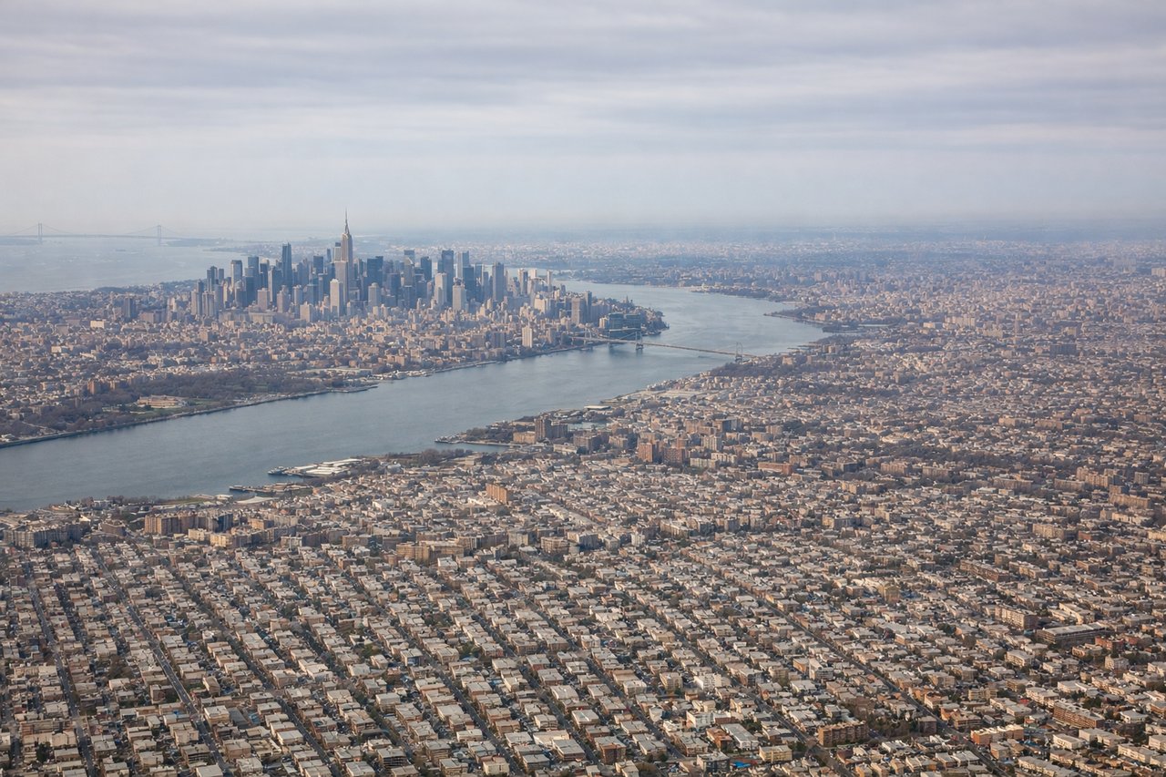
LEFTJFK typically departs eastward on runways 22L/22R or northward on 31L/31R. On a northeast departure toward PWM, the left side gives you Manhattan's skyline across Jamaica Bay, plus the Verrazano-Narrows Bridge and Upper New York Bay. The right side faces the Atlantic Ocean and Long Island suburbs with far less visual interest.
Landing at PWM
LEFTPWM typically lands on runway 29 (heading west) or runway 11 (heading east). On approach from the southwest, landing runway 29 puts Casco Bay and its islands on the left side, with the Portland peninsula and downtown visible just before touchdown. The right side faces inland toward suburban sprawl with little of note.
Will your flight be in sunlight?
Pick a date and time in the Sun Map to watch the sun move across your whole flight.
About This Route
Which side of the plane should I sit on flying from John F Kennedy International (JFK) to Portland International Jetport (PWM)?
Sit on the Left side of the plane for the best views on flights from New York to Portland. Left side wins at both ends of this short flight. At takeoff you get the full New York Harbor panorama, and on approach you get Casco Bay's island-studded coastline and the Portland peninsula. The right side offers the Atlantic at departure and inland Maine on arrival — both considerably less scenic.
What can I see during takeoff from John F Kennedy International in New York?
During takeoff from John F Kennedy International (JFK), sit on the Left side for the best views. JFK typically departs eastward on runways 22L/22R or northward on 31L/31R. On a northeast departure toward PWM, the left side gives you Manhattan's skyline across Jamaica Bay, plus the Verrazano-Narrows Bridge and Upper New York Bay. The right side faces the Atlantic Ocean and Long Island suburbs with far less visual interest. Notable sights include: Manhattan skyline across Jamaica Bay, Verrazano-Narrows Bridge, Upper New York Bay, Long Island Sound opening to the northeast.
What can I see when landing at Portland International Jetport in Portland?
When landing at Portland International Jetport (PWM), sit on the Left side for the best views. PWM typically lands on runway 29 (heading west) or runway 11 (heading east). On approach from the southwest, landing runway 29 puts Casco Bay and its islands on the left side, with the Portland peninsula and downtown visible just before touchdown. The right side faces inland toward suburban sprawl with little of note. Notable sights include: Casco Bay and its island chain, Portland peninsula and downtown, Fore River estuary, Sebago Lake visible to the northwest on clear days.
How long is the flight from New York to Portland?
The flight from John F Kennedy International (JFK) to Portland International Jetport (PWM) takes about 1 hour 10 minutes. The shortest flight path between them is 273 miles (440 km); winds and air traffic control usually add a few percent.
What does the New York to Portland flight path pass over?
The flight tracks northeast over Connecticut and Rhode Island, crossing the Providence metro area and Narragansett Bay, then over the Massachusetts South Shore and Boston's outer suburbs. Over southern New Hampshire and coastal Maine, the landscape transitions to dense boreal forest broken by lakes and rivers. The Connecticut River valley is visible early in the flight, and on clear days Boston Harbor is identifiable to the left before the coast curves northeast toward Portland.