New York to Raiatea Island is 6,347 miles (10,214 km), a flight of about 10 hours.
The right side wins overall because the Raiatea arrival view — volcanic peaks, the shared lagoon with Tahaa, and the barrier reef — is exceptionally scenic and unique. The left side is better at JFK departure, but the right side's landing view in French Polynesia is the more memorable payoff of the two.
Flight Path
The flight tracks southwest across the continental US, passing over the American Southwest desert and the Sierra Nevada range, before crossing the California coast near Los Angeles. From there it is an extended overwater crossing of the central Pacific Ocean — one of the longest stretches of open ocean on any commercial route — with no significant landmasses until the Tuamotu Archipelago atolls appear as tiny low-lying coral rings in the deep blue Pacific roughly 200 miles northeast of Tahiti, followed by the Society Islands including Huahine before reaching Raiatea.
Great circle distance and headings ›.jpg?width=600)
.jpeg?width=600)


Phase by phase
Takeoff from JFK
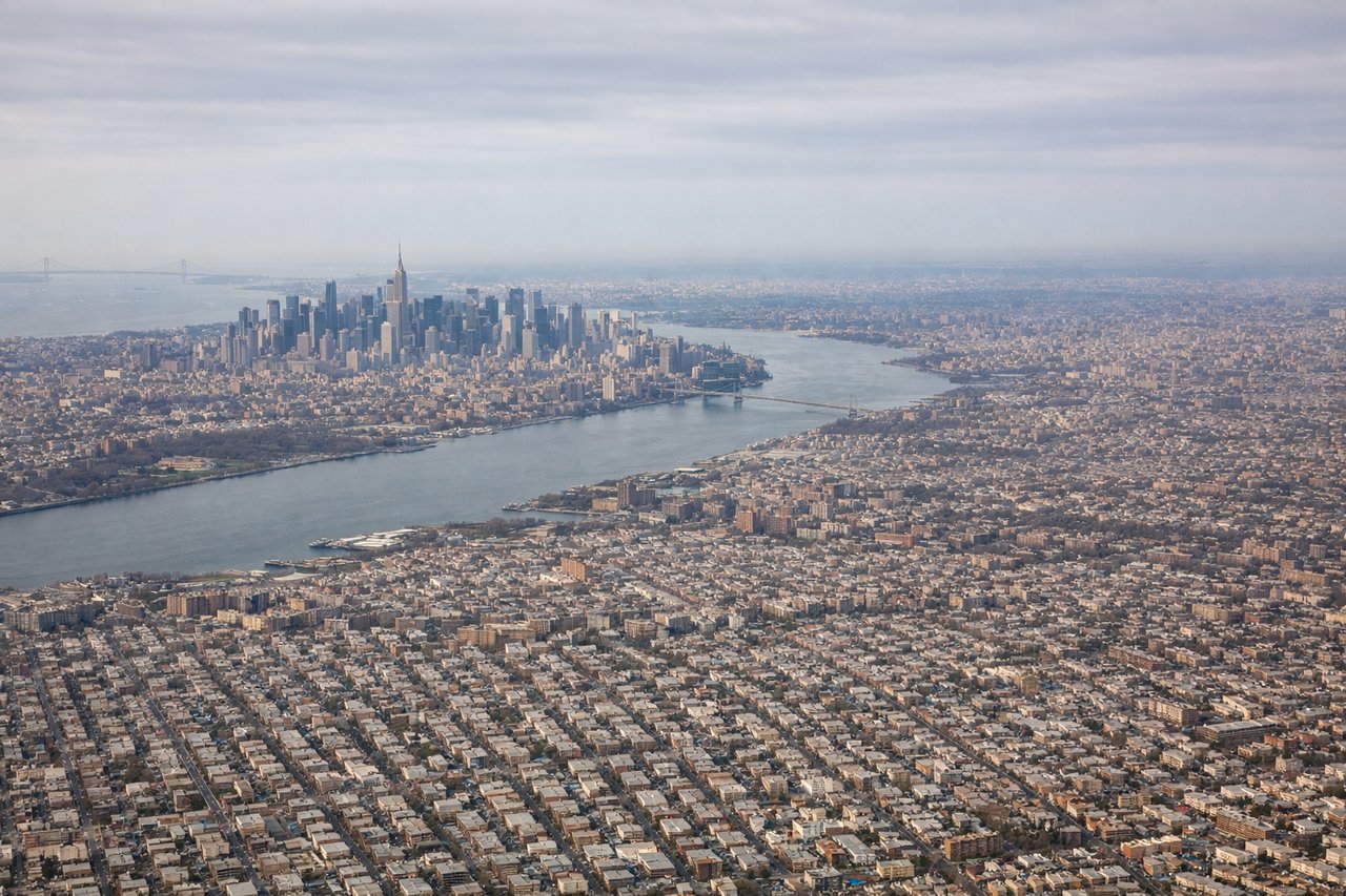
LEFTJFK departures on runway 31L/31R head northwest, putting Manhattan directly on the left side. You get a clear view of the full Manhattan skyline, the East River crossings, and Brooklyn below as the aircraft climbs out over Jamaica Bay and turns west.
Landing at RFP
RIGHTRaiatea's airport sits on the northwest coast of the island, and aircraft typically approach from the northwest over the lagoon. A right-side seat gives you the view over the interior of the island — the volcanic ridgeline of Mount Tefaafaiti and the lush green peaks — while also capturing the turquoise lagoon and the barrier reef surrounding both Raiatea and Tahaa.
Landmarks on this routeAll landmarks →
Will your flight be in sunlight?
Pick a date and time in the Sun Map to watch the sun move across your whole flight.
About This Route
Which side of the plane should I sit on flying from John F Kennedy International (JFK) to Uturoa (RFP)?
Sit on the Right side of the plane for the best views on flights from New York to Raiatea Island. The right side wins overall because the Raiatea arrival view — volcanic peaks, the shared lagoon with Tahaa, and the barrier reef — is exceptionally scenic and unique. The left side is better at JFK departure, but the right side's landing view in French Polynesia is the more memorable payoff of the two.
What can I see during takeoff from John F Kennedy International in New York?
During takeoff from John F Kennedy International (JFK), sit on the Left side for the best views. JFK departures on runway 31L/31R head northwest, putting Manhattan directly on the left side. You get a clear view of the full Manhattan skyline, the East River crossings, and Brooklyn below as the aircraft climbs out over Jamaica Bay and turns west. Notable sights include: Manhattan skyline, Verrazano-Narrows Bridge, Jamaica Bay, Brooklyn waterfront.
What can I see when landing at Uturoa in Raiatea Island?
When landing at Uturoa (RFP), sit on the Right side for the best views. Raiatea's airport sits on the northwest coast of the island, and aircraft typically approach from the northwest over the lagoon. A right-side seat gives you the view over the interior of the island — the volcanic ridgeline of Mount Tefaafaiti and the lush green peaks — while also capturing the turquoise lagoon and the barrier reef surrounding both Raiatea and Tahaa. Notable sights include: Mount Tefaafaiti volcanic ridgeline, Raiatea-Tahaa shared lagoon, barrier reef, island of Tahaa.
How long is the flight from New York to Raiatea Island?
The flight from John F Kennedy International (JFK) to Uturoa (RFP) takes about 10 hours. The shortest flight path between them is 6,347 miles (10,214 km); winds and air traffic control usually add a few percent.
What does the New York to Raiatea Island flight path pass over?
The flight tracks southwest across the continental US, passing over the American Southwest desert and the Sierra Nevada range, before crossing the California coast near Los Angeles. From there it is an extended overwater crossing of the central Pacific Ocean — one of the longest stretches of open ocean on any commercial route — with no significant landmasses until the Tuamotu Archipelago atolls appear as tiny low-lying coral rings in the deep blue Pacific roughly 200 miles northeast of Tahiti, followed by the Society Islands including Huahine before reaching Raiatea.