New York to St. Louis is 890 miles (1,433 km), a flight of about 2 hours 55 minutes.
Left side wins both ends of the flight. The Manhattan skyline on departure and the Gateway Arch and Mississippi River on approach are both on the left. The mid-flight view over Pennsylvania and Ohio is relatively flat and unremarkable on both sides, so the bookend views at departure and arrival are the deciding factor.
Flight Path
The flight tracks roughly along 40°N westward, crossing the Appalachian ridges of Pennsylvania (visible as parallel forested ridgelines from altitude), then the flat agricultural plains of Ohio and Indiana. The Ohio River may be visible as a winding line near the Indiana-Ohio border area. Indianapolis urban area is sometimes visible to the south. The terrain flattens considerably after crossing the Appalachians, with large-scale Midwest agricultural grid patterns dominating the view until the Mississippi River valley appears on descent.
Great circle distance and headings ›.jpg?width=600)
.jpeg?width=600)

Phase by phase
Takeoff from JFK
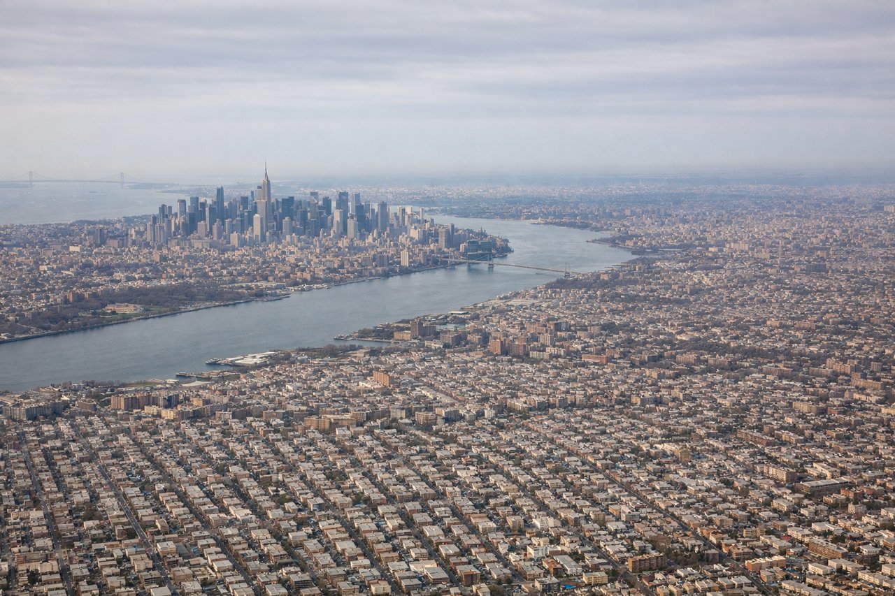
LEFTJFK typically departs westbound on runway 31L/31R or eastbound on 22L/22R. On a westbound departure toward STL, a left-side seat gives you Manhattan's skyline, the Hudson River, and New Jersey as you climb out and bank southwest. The entire New York metro layout is laid out clearly on the left.
Landing at STL
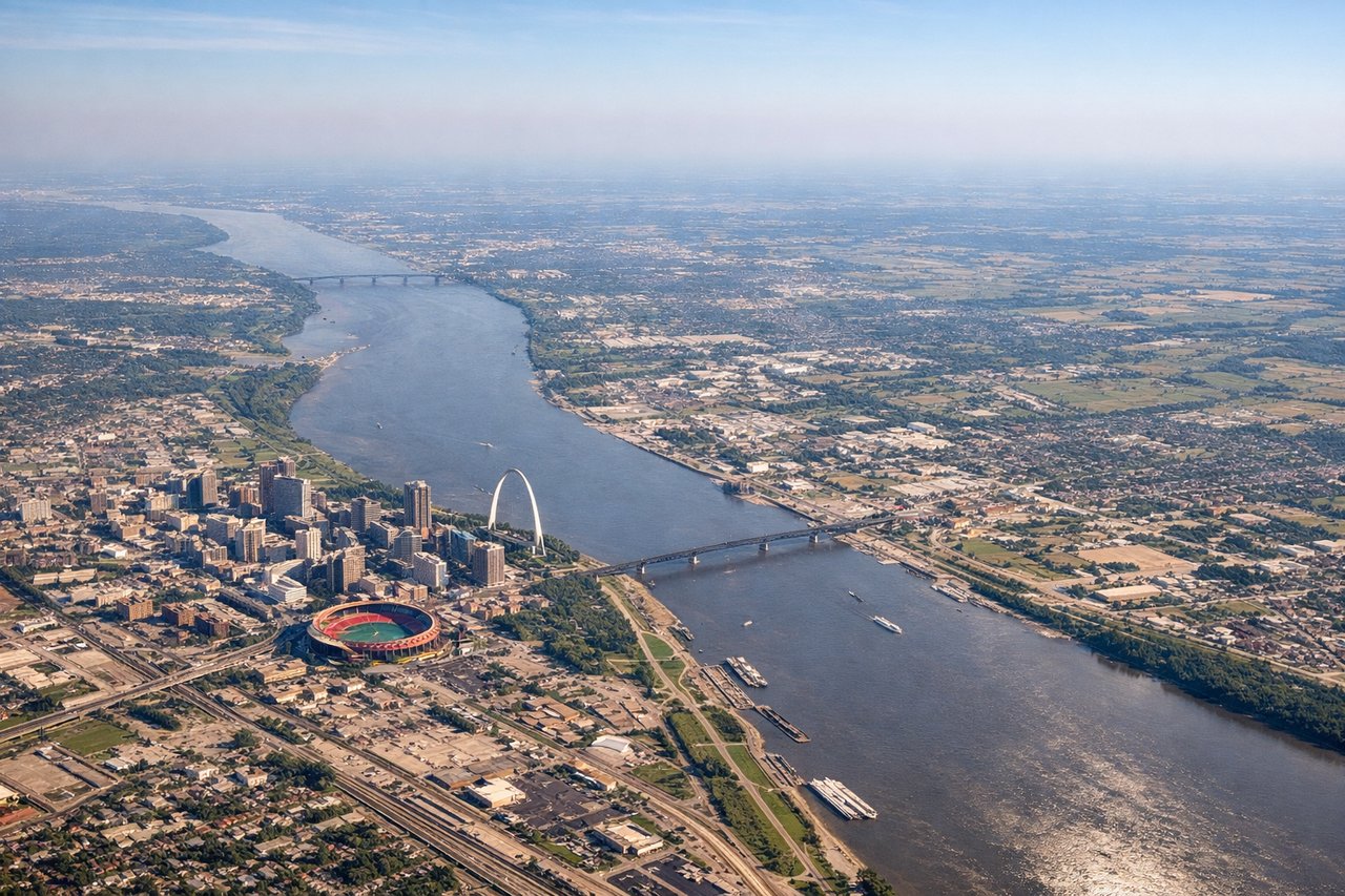
LEFTSTL typically lands westbound on runway 30L/30R or 12L/12R depending on winds. On a westbound approach, the left side gives you the Mississippi River and the Gateway Arch clearly visible as you descend into St. Louis from the east. The Arch is a distinctive and unmistakable landmark on final approach.
Landmarks on this routeAll landmarks →
Will your flight be in sunlight?
Pick a date and time in the Sun Map to watch the sun move across your whole flight.
About This Route
Which side of the plane should I sit on flying from John F Kennedy International (JFK) to Lambert St Louis International (STL)?
Sit on the Left side of the plane for the best views on flights from New York to St. Louis. Left side wins both ends of the flight. The Manhattan skyline on departure and the Gateway Arch and Mississippi River on approach are both on the left. The mid-flight view over Pennsylvania and Ohio is relatively flat and unremarkable on both sides, so the bookend views at departure and arrival are the deciding factor.
What can I see during takeoff from John F Kennedy International in New York?
During takeoff from John F Kennedy International (JFK), sit on the Left side for the best views. JFK typically departs westbound on runway 31L/31R or eastbound on 22L/22R. On a westbound departure toward STL, a left-side seat gives you Manhattan's skyline, the Hudson River, and New Jersey as you climb out and bank southwest. The entire New York metro layout is laid out clearly on the left. Notable sights include: Manhattan skyline, Hudson River, Newark and its bay, Verrazano-Narrows Bridge.
What can I see when landing at Lambert St Louis International in St. Louis?
When landing at Lambert St Louis International (STL), sit on the Left side for the best views. STL typically lands westbound on runway 30L/30R or 12L/12R depending on winds. On a westbound approach, the left side gives you the Mississippi River and the Gateway Arch clearly visible as you descend into St. Louis from the east. The Arch is a distinctive and unmistakable landmark on final approach. Notable sights include: Gateway Arch, Mississippi River, downtown St. Louis grid, Cahokia Mounds (Illinois side).
How long is the flight from New York to St. Louis?
The flight from John F Kennedy International (JFK) to Lambert St Louis International (STL) takes about 2 hours 55 minutes. The shortest flight path between them is 890 miles (1,433 km); winds and air traffic control usually add a few percent.
What does the New York to St. Louis flight path pass over?
The flight tracks roughly along 40°N westward, crossing the Appalachian ridges of Pennsylvania (visible as parallel forested ridgelines from altitude), then the flat agricultural plains of Ohio and Indiana. The Ohio River may be visible as a winding line near the Indiana-Ohio border area. Indianapolis urban area is sometimes visible to the south. The terrain flattens considerably after crossing the Appalachians, with large-scale Midwest agricultural grid patterns dominating the view until the Mississippi River valley appears on descent.