New York to Hewandorra is 2,014 miles (3,241 km), a flight of about 4 hours 30 minutes.
The right side combines a strong departure view of the Manhattan skyline with a rare, genuinely spectacular landing sequence past the Pitons, one of the Caribbean's most iconic volcanic landmarks, giving it a clear edge over the ocean-facing left side.
Flight Path
Open Atlantic Ocean, the Bahamian archipelago to the west, and the northern arc of the Lesser Antilles island chain as the route approaches Saint Lucia
Great circle distance and headings ›.jpg?width=600)

Phase by phase
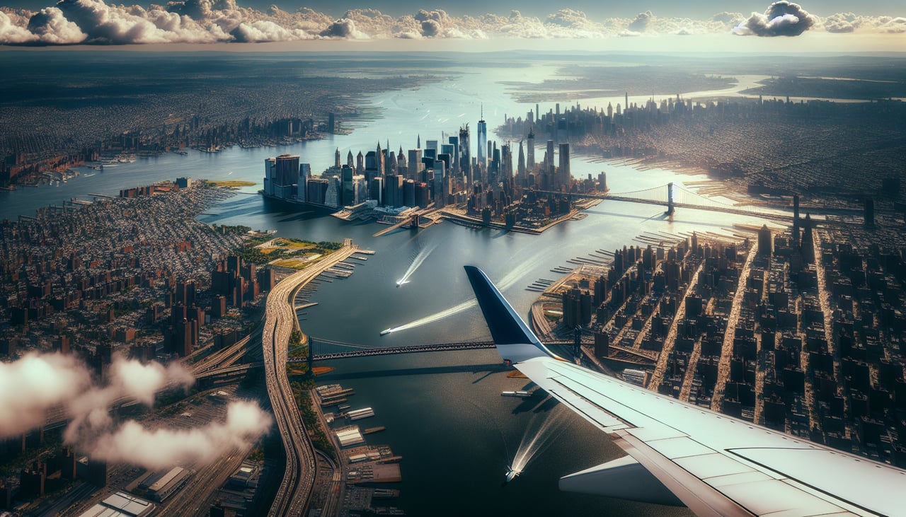
Takeoff from JFK
RIGHTDeparting on runway 13L/13R southeast from JFK, the right side of the aircraft faces southwest during the initial climb and turn, giving a clear view back over Jamaica Bay toward the Manhattan skyline, the Verrazzano-Narrows Bridge, and the New Jersey shoreline before the route turns out over open ocean.
Landing at UVF
RIGHTOn approach to UVF from the west over the Caribbean Sea, the airport's position in southern Saint Lucia means the final turn onto runway 10 brings the dramatic twin volcanic spires of the Pitons and the town of Soufriere into view on the right side of the aircraft just before touchdown.
Landmarks on this routeAll landmarks →
Will your flight be in sunlight?
Pick a date and time in the Sun Map to watch the sun move across your whole flight.
About This Route
Which side of the plane should I sit on flying from John F Kennedy International (JFK) to Hewanorra International (UVF)?
Sit on the Right side of the plane for the best views on flights from New York to Hewandorra. The right side combines a strong departure view of the Manhattan skyline with a rare, genuinely spectacular landing sequence past the Pitons, one of the Caribbean's most iconic volcanic landmarks, giving it a clear edge over the ocean-facing left side.
What can I see during takeoff from John F Kennedy International in New York?
During takeoff from John F Kennedy International (JFK), sit on the Right side for the best views. Departing on runway 13L/13R southeast from JFK, the right side of the aircraft faces southwest during the initial climb and turn, giving a clear view back over Jamaica Bay toward the Manhattan skyline, the Verrazzano-Narrows Bridge, and the New Jersey shoreline before the route turns out over open ocean. Notable sights include: Manhattan skyline, Verrazzano-Narrows Bridge, Jamaica Bay, Rockaway Peninsula.
What can I see when landing at Hewanorra International in Hewandorra?
When landing at Hewanorra International (UVF), sit on the Right side for the best views. On approach to UVF from the west over the Caribbean Sea, the airport's position in southern Saint Lucia means the final turn onto runway 10 brings the dramatic twin volcanic spires of the Pitons and the town of Soufriere into view on the right side of the aircraft just before touchdown. Notable sights include: The Pitons (Gros Piton and Petit Piton), Soufriere Bay, Saint Lucia's forested interior peaks.
How long is the flight from New York to Hewandorra?
The flight from John F Kennedy International (JFK) to Hewanorra International (UVF) takes about 4 hours 30 minutes. The shortest flight path between them is 2,014 miles (3,241 km); winds and air traffic control usually add a few percent.
What does the New York to Hewandorra flight path pass over?
Open Atlantic Ocean, the Bahamian archipelago to the west, and the northern arc of the Lesser Antilles island chain as the route approaches Saint Lucia