Johannesburg to Vilankulu is 529 miles (851 km), a flight of about 2 hours 15 minutes.
While takeoff favors the right for Johannesburg's geography, the landing view from the left is more dramatic and distinctive—the coastal approach to Vilankulo with Inhambane Bay's turquoise waters is more visually rewarding than the Highveld plateau departure.
Flight Path
The flight path crosses the Limpopo River valley (visible as a distinct linear feature and vegetation change marking the South Africa-Mozambique border), then traverses Mozambique's interior savanna and woodland terrain. The Gaza Province's relatively flat landscape dominates the midpoint, with scattered vegetation patterns visible at cruise altitude. As the aircraft descends toward Vilankulo, the terrain transitions from inland savanna to coastal lowlands, with the Inhambane Province's characteristic vegetation becoming visible. The Save River delta and associated wetlands may be visible on the approach if flying the southern routing.
Great circle distance and headings ›.jpg?width=600)

Phase by phase
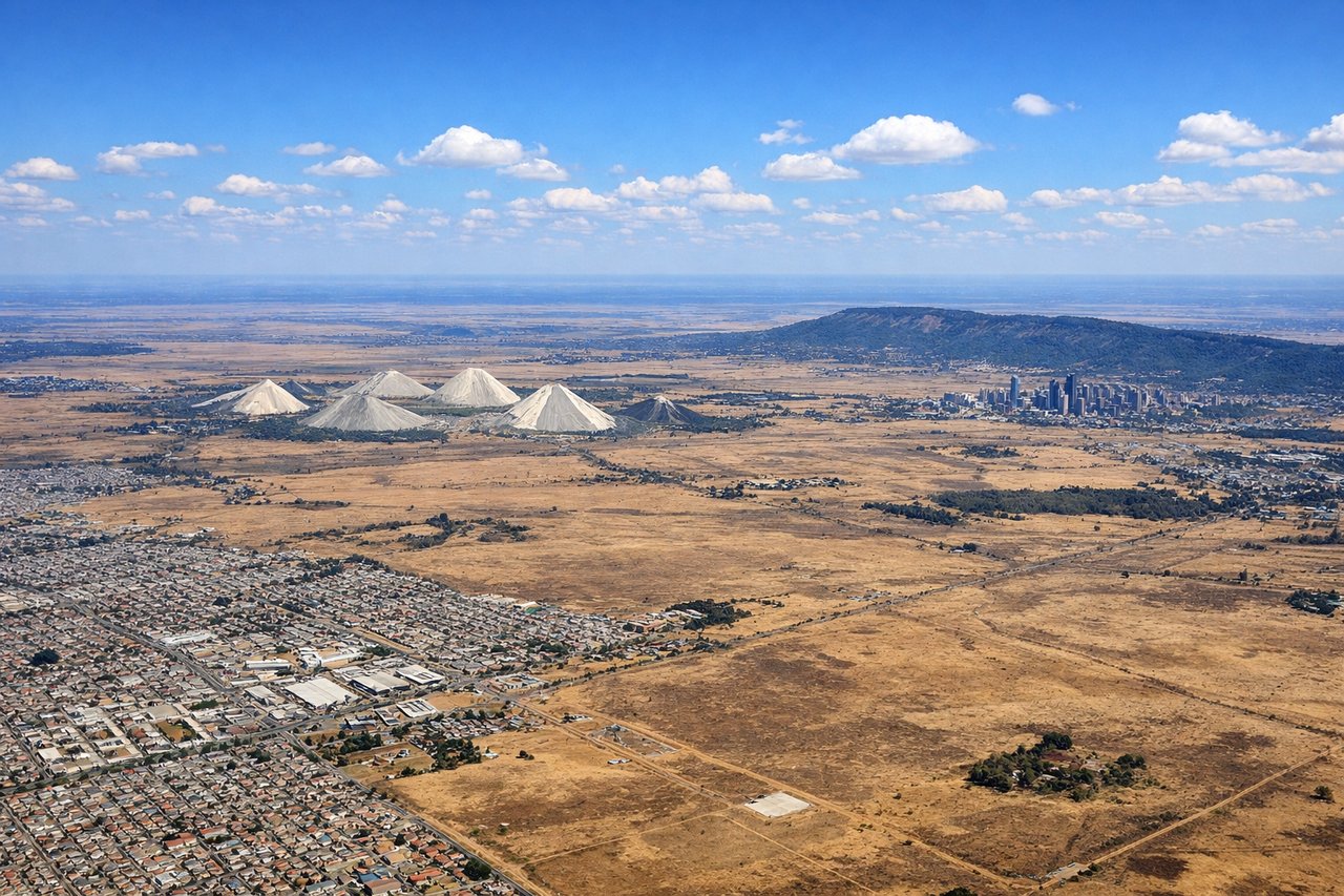
Takeoff from JNB
RIGHTRight-side seats capture the Witwatersrand ridge and Johannesburg's northern sprawl during northbound departure. JNB typically departs north on runways 03L/03R, so right windows show the city's eastern extent and the high-altitude plateau terrain that defines the Highveld.
Landing at VNX
LEFTLeft-side seats provide views of Vilankulo's coastal setting and the Inhambane Bay approach. Aircraft typically descend from the southwest and land on runway 09, so left windows show the Indian Ocean, the bay's distinctive turquoise waters, and the town's position on the peninsula.
Landmarks on this routeAll landmarks →
Will your flight be in sunlight?
Pick a date and time in the Sun Map to watch the sun move across your whole flight.
About This Route
Which side of the plane should I sit on flying from O.R. Tambo International Airport (JNB) to Vilankulo (VNX)?
Sit on the Left side of the plane for the best views on flights from Johannesburg to Vilankulu. While takeoff favors the right for Johannesburg's geography, the landing view from the left is more dramatic and distinctive—the coastal approach to Vilankulo with Inhambane Bay's turquoise waters is more visually rewarding than the Highveld plateau departure.
What can I see during takeoff from O.R. Tambo International Airport in Johannesburg?
During takeoff from O.R. Tambo International Airport (JNB), sit on the Right side for the best views. Right-side seats capture the Witwatersrand ridge and Johannesburg's northern sprawl during northbound departure. JNB typically departs north on runways 03L/03R, so right windows show the city's eastern extent and the high-altitude plateau terrain that defines the Highveld. Notable sights include: Witwatersrand ridge (visible as elevated terrain running east-west), Johannesburg city center and northern suburbs, Pretoria in the distance to the north, the flat Highveld plateau stretching toward the horizon.
What can I see when landing at Vilankulo in Vilankulu?
When landing at Vilankulo (VNX), sit on the Left side for the best views. Left-side seats provide views of Vilankulo's coastal setting and the Inhambane Bay approach. Aircraft typically descend from the southwest and land on runway 09, so left windows show the Indian Ocean, the bay's distinctive turquoise waters, and the town's position on the peninsula. Notable sights include: Inhambane Bay with its turquoise shallow waters, Vilankulo town on the peninsula, the Indian Ocean extending to the horizon, mangrove-lined estuaries and coastal lagoons.
How long is the flight from Johannesburg to Vilankulu?
The flight from O.R. Tambo International Airport (JNB) to Vilankulo (VNX) takes about 2 hours 15 minutes. The shortest flight path between them is 529 miles (851 km); winds and air traffic control usually add a few percent.
What does the Johannesburg to Vilankulu flight path pass over?
The flight path crosses the Limpopo River valley (visible as a distinct linear feature and vegetation change marking the South Africa-Mozambique border), then traverses Mozambique's interior savanna and woodland terrain. The Gaza Province's relatively flat landscape dominates the midpoint, with scattered vegetation patterns visible at cruise altitude. As the aircraft descends toward Vilankulo, the terrain transitions from inland savanna to coastal lowlands, with the Inhambane Province's characteristic vegetation becoming visible. The Save River delta and associated wetlands may be visible on the approach if flying the southern routing.