The left side offers a stronger takeoff view of Taiwan's mountains and, during cruise, occasional glimpses of the Vietnamese coastline and the Annamite foothills as the flight path crosses toward the Gulf of Tonkin, giving more terrain variety than the largely featureless open-water right side.
Flown KHH to BKK? Did we get it right?
Flight Path
Kaohsiung to Bangkok is 1,424 miles (2,292 km), a flight of about 3 hours 15 minutes.
South China Sea, Hainan Island region, northern Vietnam coastline near the Gulf of Tonkin, and the forested Annamite foothills before descending over Laos/Cambodia into the Chao Phraya delta
Great circle distance and headings ›Phase by phase
Takeoff from KHH
LEFTDeparting Kaohsiung, the left (east) side gives passengers a good look at Taiwan's Central Mountain Range rising sharply behind the city as the aircraft climbs and turns south toward the South China Sea. The right side mostly shows the flat Taiwan Strait with little definition.
Landing at BKK
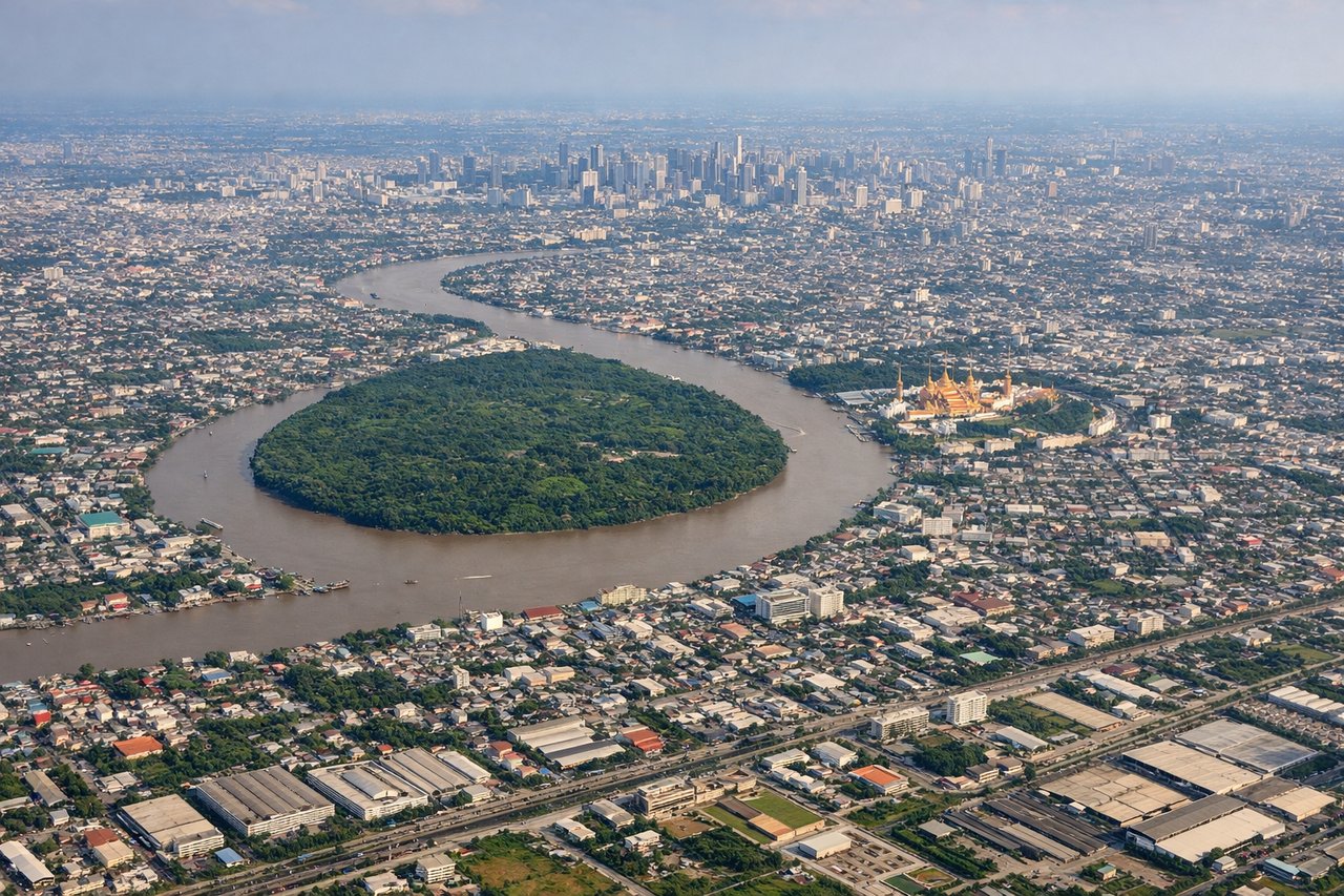
RIGHTOn approach into Suvarnabhumi from the north, the right (west) side faces central Bangkok, giving a view of the Chao Phraya River winding through the skyline and dense urban sprawl before the flat final approach over rice paddies. The left side shows mostly featureless agricultural land east of the airport.
Will your flight be in sunlight?
Pick a date and time in the Sun Map to watch the sun move across your whole flight.
About This Route
Which side of the plane should I sit on flying from Kaohsiung International (KHH) to Suvarnabhumi Airport (BKK)?
Sit on the Left side of the plane for the best views on flights from Kaohsiung to Bangkok. The left side offers a stronger takeoff view of Taiwan's mountains and, during cruise, occasional glimpses of the Vietnamese coastline and the Annamite foothills as the flight path crosses toward the Gulf of Tonkin, giving more terrain variety than the largely featureless open-water right side.
What can I see during takeoff from Kaohsiung International in Kaohsiung?
During takeoff from Kaohsiung International (KHH), sit on the Left side for the best views. Departing Kaohsiung, the left (east) side gives passengers a good look at Taiwan's Central Mountain Range rising sharply behind the city as the aircraft climbs and turns south toward the South China Sea. The right side mostly shows the flat Taiwan Strait with little definition. Notable sights include: Kaohsiung city and harbor, Central Mountain Range foothills, Kaoping River mouth, Taiwan Strait coastline.
What can I see when landing at Suvarnabhumi Airport in Bangkok?
When landing at Suvarnabhumi Airport (BKK), sit on the Right side for the best views. On approach into Suvarnabhumi from the north, the right (west) side faces central Bangkok, giving a view of the Chao Phraya River winding through the skyline and dense urban sprawl before the flat final approach over rice paddies. The left side shows mostly featureless agricultural land east of the airport. Notable sights include: Chao Phraya River, Bangkok skyline (including Sathorn high-rises), flooded rice paddies, Bang Na industrial corridor.
How long is the flight from Kaohsiung to Bangkok?
The flight from Kaohsiung International (KHH) to Suvarnabhumi Airport (BKK) takes about 3 hours 15 minutes. The shortest flight path between them is 1,424 miles (2,292 km); winds and air traffic control usually add a few percent.
What does the Kaohsiung to Bangkok flight path pass over?
South China Sea, Hainan Island region, northern Vietnam coastline near the Gulf of Tonkin, and the forested Annamite foothills before descending over Laos/Cambodia into the Chao Phraya delta