Kanazawa to Tokyo is 198 miles (318 km), a flight of about 1 hour 15 minutes.
Right-side seats win overall because the takeoff phase offers more dramatic and varied scenery (Noto Peninsula, Japan Sea, Hakusan mountain), while the landing approach is comparable on both sides. The flight's most distinctive visual moments occur during the initial climb from Komatsu.
Flight Path
The flight path crosses the Kuzuryu River valley and passes over the Echizen Plateau region. The Eiheiji temple area and surrounding forested mountains are visible from altitude. As the aircraft continues southeast, it crosses into Gifu Prefecture, passing over the Ibi River and approaching the Nobi Plain. The Kiso, Ibi, and Nagara river systems create visible linear features in the landscape. Mount Fuji becomes visible on the horizon approximately 30 minutes before landing at Haneda.
Great circle distance and headings ›

Phase by phase
Takeoff from KMQ
RIGHTRight-side seats offer views of the Japan Sea coastline and the Noto Peninsula as the aircraft climbs southeastward from Komatsu. The peninsula's distinctive shape and coastal features are clearly visible during the initial climb phase.
Landing at HND
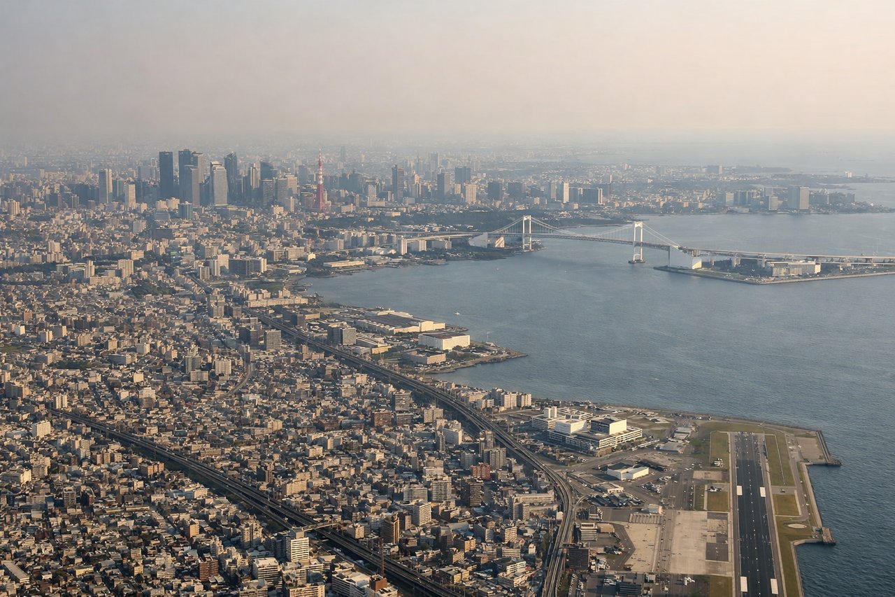
LEFTLeft-side seats provide excellent views during descent into Haneda. As the aircraft approaches from the northwest, you'll see Tokyo Bay, the Kanto Plain, and Mount Fuji in the distance. The approach path over the bay offers unobstructed views of urban Tokyo and the surrounding metropolitan area.
Landmarks on this routeAll landmarks →
Will your flight be in sunlight?
Pick a date and time in the Sun Map to watch the sun move across your whole flight.
About This Route
Which side of the plane should I sit on flying from Komatsu (KMQ) to Tokyo International (HND)?
Sit on the Right side of the plane for the best views on flights from Kanazawa to Tokyo. Right-side seats win overall because the takeoff phase offers more dramatic and varied scenery (Noto Peninsula, Japan Sea, Hakusan mountain), while the landing approach is comparable on both sides. The flight's most distinctive visual moments occur during the initial climb from Komatsu.
What can I see during takeoff from Komatsu in Kanazawa?
During takeoff from Komatsu (KMQ), sit on the Right side for the best views. Right-side seats offer views of the Japan Sea coastline and the Noto Peninsula as the aircraft climbs southeastward from Komatsu. The peninsula's distinctive shape and coastal features are clearly visible during the initial climb phase. Notable sights include: Noto Peninsula coastline, Japan Sea, Hakusan mountain range (distant), Kanazawa city grid.
What can I see when landing at Tokyo International in Tokyo?
When landing at Tokyo International (HND), sit on the Left side for the best views. Left-side seats provide excellent views during descent into Haneda. As the aircraft approaches from the northwest, you'll see Tokyo Bay, the Kanto Plain, and Mount Fuji in the distance. The approach path over the bay offers unobstructed views of urban Tokyo and the surrounding metropolitan area. Notable sights include: Tokyo Bay, Mount Fuji (distant), Kanto Plain urban sprawl, Boso Peninsula.
How long is the flight from Kanazawa to Tokyo?
The flight from Komatsu (KMQ) to Tokyo International (HND) takes about 1 hour 15 minutes. The shortest flight path between them is 198 miles (318 km); winds and air traffic control usually add a few percent.
What does the Kanazawa to Tokyo flight path pass over?
The flight path crosses the Kuzuryu River valley and passes over the Echizen Plateau region. The Eiheiji temple area and surrounding forested mountains are visible from altitude. As the aircraft continues southeast, it crosses into Gifu Prefecture, passing over the Ibi River and approaching the Nobi Plain. The Kiso, Ibi, and Nagara river systems create visible linear features in the landscape. Mount Fuji becomes visible on the horizon approximately 30 minutes before landing at Haneda.