Ketapang to Bangkok is 1,243 miles (2,001 km), a flight of about 3 hours 5 minutes.
The left side offers the only real terrain variety on this mostly overwater route — a coastal departure from Kalimantan and a river-and-skyline arrival into Bangkok — while the right side stays over featureless jungle and open sea for nearly the entire flight.
Flight Path
The route crosses the South China Sea south of the Natuna Islands and skirts the eastern edge of the Malay Peninsula before entering the Gulf of Thailand, with no significant landmasses directly beneath the cruise track.
Great circle distance and headings ›Phase by phase
Takeoff from KTG
LEFTDeparting Ketapang, the climb-out crosses the mangrove-lined coast of western Kalimantan and the Karimata Strait, giving a brief but genuine coastal view before the aircraft turns northwest over open water. The right side only shows the flat, featureless Kalimantan interior.
Landing at BKK
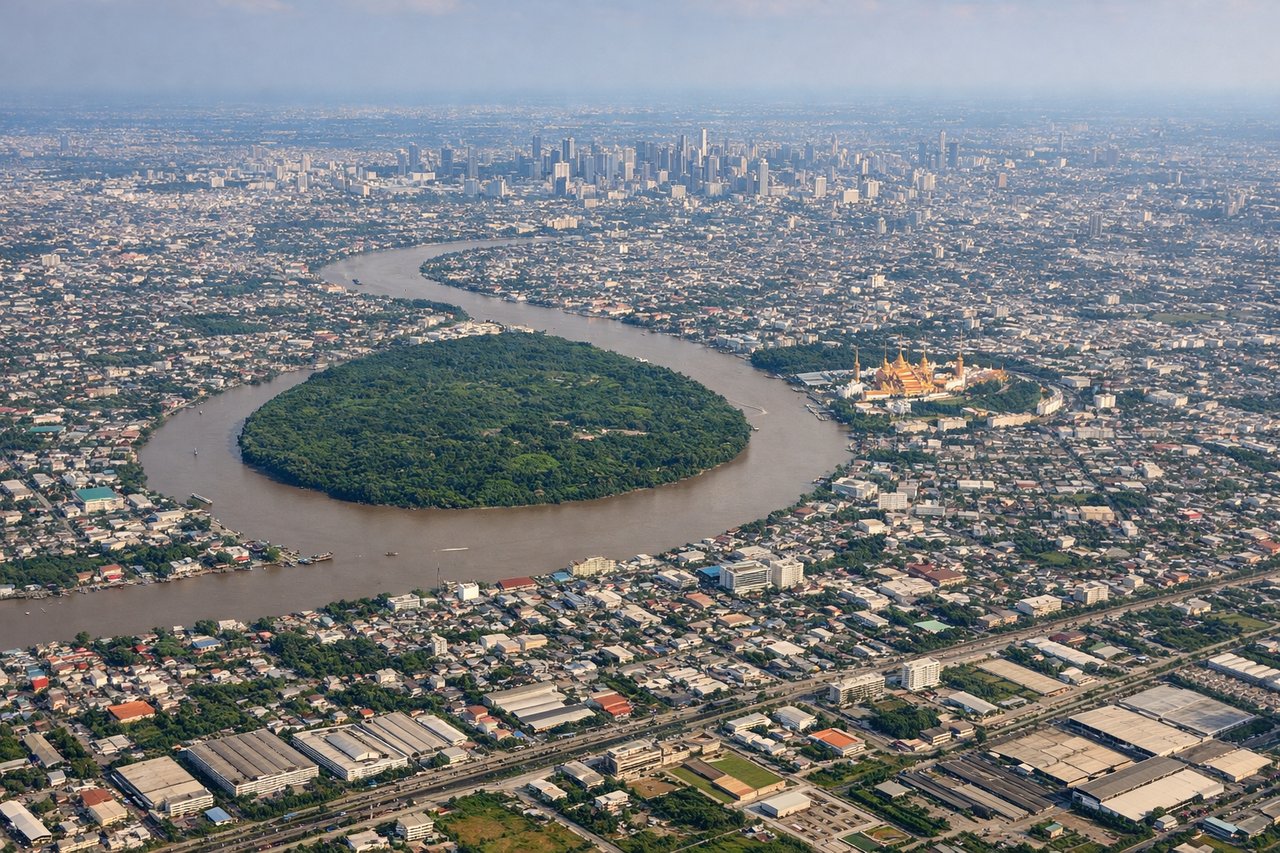
LEFTOn approach into Suvarnabhumi, the aircraft typically tracks up the Gulf of Thailand and turns over the Chao Phraya delta, putting Bangkok's dense skyline and the winding river visible on the left side as the plane lines up with the runway. The right side mostly shows flat agricultural land south of the city.
Landmarks on this routeAll landmarks →
Will your flight be in sunlight?
Pick a date and time in the Sun Map to watch the sun move across your whole flight.
About This Route
Which side of the plane should I sit on flying from Rahadi Usman (KTG) to Suvarnabhumi Airport (BKK)?
Sit on the Left side of the plane for the best views on flights from Ketapang to Bangkok. The left side offers the only real terrain variety on this mostly overwater route — a coastal departure from Kalimantan and a river-and-skyline arrival into Bangkok — while the right side stays over featureless jungle and open sea for nearly the entire flight.
What can I see during takeoff from Rahadi Usman in Ketapang?
During takeoff from Rahadi Usman (KTG), sit on the Left side for the best views. Departing Ketapang, the climb-out crosses the mangrove-lined coast of western Kalimantan and the Karimata Strait, giving a brief but genuine coastal view before the aircraft turns northwest over open water. The right side only shows the flat, featureless Kalimantan interior. Notable sights include: Ketapang coastline, Karimata Strait, scattered river deltas of western Kalimantan.
What can I see when landing at Suvarnabhumi Airport in Bangkok?
When landing at Suvarnabhumi Airport (BKK), sit on the Left side for the best views. On approach into Suvarnabhumi, the aircraft typically tracks up the Gulf of Thailand and turns over the Chao Phraya delta, putting Bangkok's dense skyline and the winding river visible on the left side as the plane lines up with the runway. The right side mostly shows flat agricultural land south of the city. Notable sights include: Chao Phraya River delta, Bangkok skyline, Gulf of Thailand coastline.
How long is the flight from Ketapang to Bangkok?
The flight from Rahadi Usman (KTG) to Suvarnabhumi Airport (BKK) takes about 3 hours 5 minutes. The shortest flight path between them is 1,243 miles (2,001 km); winds and air traffic control usually add a few percent.
What does the Ketapang to Bangkok flight path pass over?
The route crosses the South China Sea south of the Natuna Islands and skirts the eastern edge of the Malay Peninsula before entering the Gulf of Thailand, with no significant landmasses directly beneath the cruise track.