While the Tonle Sap views make the left side strong at takeoff, the right side offers the more consistently interesting sequence — glimpses of Vietnam's northern highlands during cruise followed by the Pearl River Delta and Guangzhou's skyline on approach.
Flown KTI to CAN? Did we get it right?
Flight Path
Phnom Penh to Guangzhou is 997 miles (1,605 km), a flight of about 2 hours 5 minutes.
Northern Vietnam's forested highlands near the China border, the Beibu Gulf coastline, and the karst hill country of Guangxi province leading into Guangdong
Great circle distance and headings ›Phase by phase
Takeoff from KTI
LEFTDeparting runway 05 to the northeast, the initial climb banks enough that the northwest-facing left side gets a clear view of Tonle Sap Lake, Southeast Asia's largest freshwater lake, along with the braided channels where it meets the Mekong near Phnom Penh.
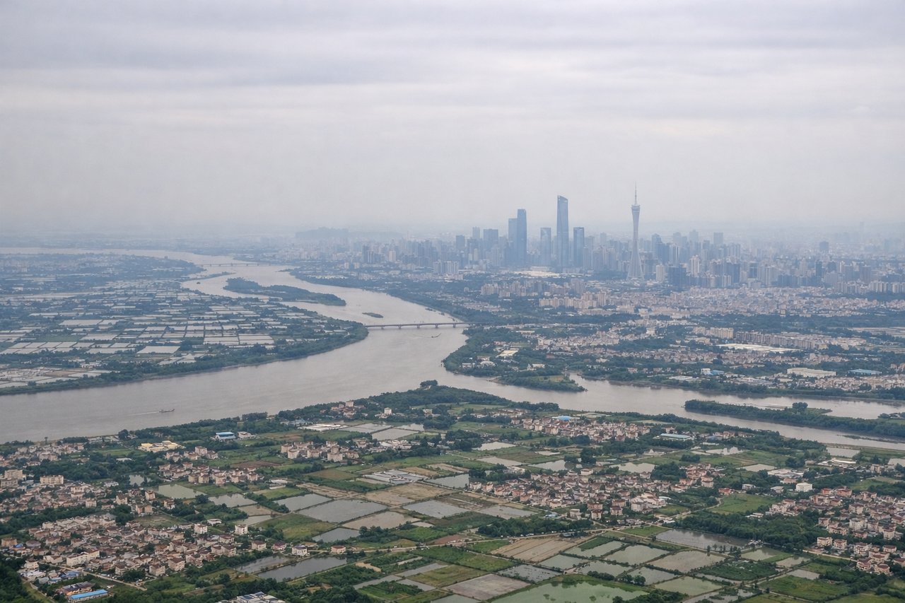
Landing at CAN
RIGHTOn approach into Guangzhou Baiyun from the north, the right side faces east over the Pearl River Delta, showing the river's braided channels, dense urban sprawl, and the karst-dotted hills of Guangdong before touchdown.
Will your flight be in sunlight?
Pick a date and time in the Sun Map to watch the sun move across your whole flight.
About This Route
Which side of the plane should I sit on flying from Techo International Airport (KTI) to Guangzhou Baiyun International Airport (CAN)?
Sit on the Right side of the plane for the best views on flights from Phnom Penh to Guangzhou. While the Tonle Sap views make the left side strong at takeoff, the right side offers the more consistently interesting sequence — glimpses of Vietnam's northern highlands during cruise followed by the Pearl River Delta and Guangzhou's skyline on approach.
What can I see during takeoff from Techo International Airport in Phnom Penh?
During takeoff from Techo International Airport (KTI), sit on the Left side for the best views. Departing runway 05 to the northeast, the initial climb banks enough that the northwest-facing left side gets a clear view of Tonle Sap Lake, Southeast Asia's largest freshwater lake, along with the braided channels where it meets the Mekong near Phnom Penh. Notable sights include: Tonle Sap Lake, Mekong-Tonle Sap confluence, Phnom Penh's riverside skyline, flooded rice paddies of the Cambodian plain.
What can I see when landing at Guangzhou Baiyun International Airport in Guangzhou?
When landing at Guangzhou Baiyun International Airport (CAN), sit on the Right side for the best views. On approach into Guangzhou Baiyun from the north, the right side faces east over the Pearl River Delta, showing the river's braided channels, dense urban sprawl, and the karst-dotted hills of Guangdong before touchdown. Notable sights include: Pearl River and its delta channels, Guangzhou's dense high-rise districts, White Cloud Mountain, scattered karst hills near the Guangdong-Guangxi border.
How long is the flight from Phnom Penh to Guangzhou?
The flight from Techo International Airport (KTI) to Guangzhou Baiyun International Airport (CAN) takes about 2 hours 5 minutes. The shortest flight path between them is 997 miles (1,605 km); winds and air traffic control usually add a few percent.
What does the Phnom Penh to Guangzhou flight path pass over?
Northern Vietnam's forested highlands near the China border, the Beibu Gulf coastline, and the karst hill country of Guangxi province leading into Guangdong