Los Angeles to Albuquerque is 676 miles (1,088 km), a flight of about 1 hour 30 minutes.
The right side delivers the dramatic LAX coastal departure with Santa Monica Bay and Palos Verdes, then transitions to views of the Mojave Desert, the Colorado River crossing, and the high desert plateau of Arizona and New Mexico. The left side has the edge only on landing into ABQ. Right wins overall for the superior takeoff and mid-flight scenery.
Flight Path
The flight crosses the Mojave Desert with its dry lake beds and Joshua Tree terrain, then the Colorado River near Needles, followed by the high plateau of western Arizona and the Painted Desert region. The route passes over the Zuni Mountains of western New Mexico before descending into the Rio Grande Rift valley toward Albuquerque.
Great circle distance and headings ›.jpg?width=600)


.jpg?width=600)
Phase by phase
Takeoff from LAX
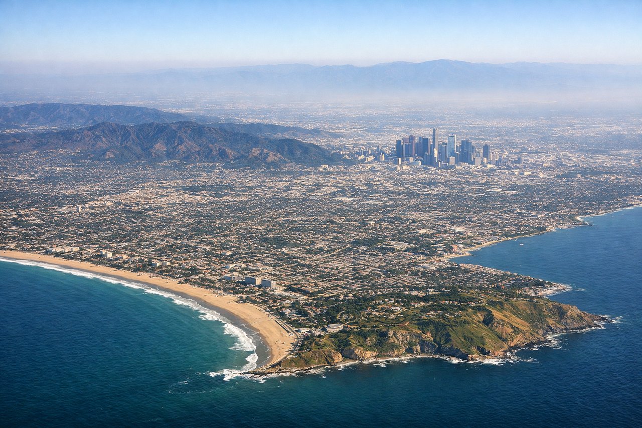
RIGHTLAX typically departs westward over the ocean on runways 24L/24R, then turns north or east. The right side captures the Santa Monica Bay coastline, the Palos Verdes Peninsula, and then the San Gabriel Mountains as the aircraft banks eastward. Left side faces inland toward urban sprawl with less dramatic scenery.
Landing at ABQ
LEFTABQ typically lands on runways 08/26 or 17/35. Approaching from the west on runway 08, the left side faces south toward the Sandia Mountains, which rise dramatically 5,000 feet above the city and are the defining visual feature of the Albuquerque approach. The Rio Grande valley is also visible on the left cutting through the high desert.
Landmarks on this routeAll landmarks →
Will your flight be in sunlight?
Pick a date and time in the Sun Map to watch the sun move across your whole flight.
About This Route
Which side of the plane should I sit on flying from Los Angeles International (LAX) to Albuquerque International Sunport (ABQ)?
Sit on the Right side of the plane for the best views on flights from Los Angeles to Albuquerque. The right side delivers the dramatic LAX coastal departure with Santa Monica Bay and Palos Verdes, then transitions to views of the Mojave Desert, the Colorado River crossing, and the high desert plateau of Arizona and New Mexico. The left side has the edge only on landing into ABQ. Right wins overall for the superior takeoff and mid-flight scenery.
What can I see during takeoff from Los Angeles International in Los Angeles?
During takeoff from Los Angeles International (LAX), sit on the Right side for the best views. LAX typically departs westward over the ocean on runways 24L/24R, then turns north or east. The right side captures the Santa Monica Bay coastline, the Palos Verdes Peninsula, and then the San Gabriel Mountains as the aircraft banks eastward. Left side faces inland toward urban sprawl with less dramatic scenery. Notable sights include: Santa Monica Bay, Palos Verdes Peninsula, San Gabriel Mountains, downtown Los Angeles skyline.
What can I see when landing at Albuquerque International Sunport in Albuquerque?
When landing at Albuquerque International Sunport (ABQ), sit on the Left side for the best views. ABQ typically lands on runways 08/26 or 17/35. Approaching from the west on runway 08, the left side faces south toward the Sandia Mountains, which rise dramatically 5,000 feet above the city and are the defining visual feature of the Albuquerque approach. The Rio Grande valley is also visible on the left cutting through the high desert. Notable sights include: Sandia Mountains, Rio Grande valley, Albuquerque city grid, Kirtland Air Force Base.
How long is the flight from Los Angeles to Albuquerque?
The flight from Los Angeles International (LAX) to Albuquerque International Sunport (ABQ) takes about 1 hour 30 minutes. The shortest flight path between them is 676 miles (1,088 km); winds and air traffic control usually add a few percent.
What does the Los Angeles to Albuquerque flight path pass over?
The flight crosses the Mojave Desert with its dry lake beds and Joshua Tree terrain, then the Colorado River near Needles, followed by the high plateau of western Arizona and the Painted Desert region. The route passes over the Zuni Mountains of western New Mexico before descending into the Rio Grande Rift valley toward Albuquerque.