The right side delivers the more dramatic takeoff view over the LA Basin and San Gabriel Mountains, and during cruise provides better angles on the desert Southwest terrain including the Sonoran Desert and the Guadalupe Mountains area of West Texas. The landing view on the left is excellent but shorter in duration, making right the stronger overall pick for the full flight experience.
Flight Path
The route crosses the Sonoran Desert of southern Arizona, the Rio Grande valley near El Paso, the Guadalupe Mountains and Davis Mountains of West Texas, and the Edwards Plateau before descending into the Texas Hill Country. The Guadalupe Mountains, including Guadalupe Peak at 8,751 ft, are the most visually striking terrain feature at roughly the midpoint of the flight.
Great circle distance and headings ›.jpg?width=600)
.jpg?width=600)
Phase by phase

Takeoff from LAX
RIGHTLAX typically departs westward over the ocean on runways 24L/24R, then turns east. Right side passengers get a sweeping view back over the LA Basin, the Santa Monica Mountains, and downtown LA as the aircraft banks. Left side faces the Pacific during the initial climb.
Landing at AUS
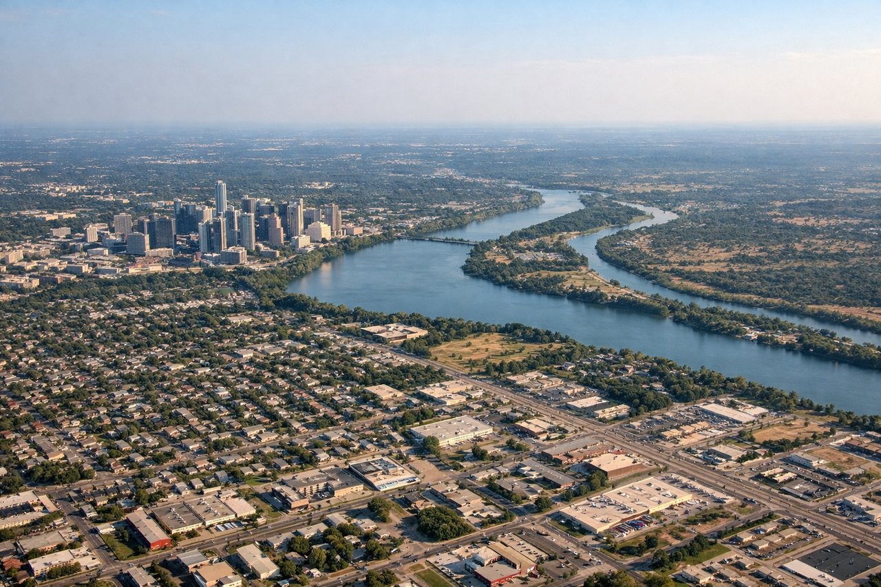
LEFTAUS typically lands on runway 17L/17R heading south, or runway 35L/35R heading north. On the common southward approach, the left side gets a clear view of downtown Austin, the Colorado River (Lady Bird Lake), and the Capitol building as the aircraft descends over the city from the north.
Landmarks on this routeAll landmarks →
Will your flight be in sunlight?
See exactly which side of the plane gets sun and shade at your departure time.
About This Route
Which side of the plane should I sit on flying from Los Angeles International (LAX) to Austin Bergstrom International (AUS)?
Sit on the Right side of the plane for the best views on flights from Los Angeles to Austin. The right side delivers the more dramatic takeoff view over the LA Basin and San Gabriel Mountains, and during cruise provides better angles on the desert Southwest terrain including the Sonoran Desert and the Guadalupe Mountains area of West Texas. The landing view on the left is excellent but shorter in duration, making right the stronger overall pick for the full flight experience.
What can I see during takeoff from Los Angeles International in Los Angeles?
During takeoff from Los Angeles International (LAX), sit on the Right side for the best views. LAX typically departs westward over the ocean on runways 24L/24R, then turns east. Right side passengers get a sweeping view back over the LA Basin, the Santa Monica Mountains, and downtown LA as the aircraft banks. Left side faces the Pacific during the initial climb. Notable sights include: Downtown Los Angeles skyline, Santa Monica Mountains, Griffith Observatory area, San Gabriel Mountains on the distant horizon.
What can I see when landing at Austin Bergstrom International in Austin?
When landing at Austin Bergstrom International (AUS), sit on the Left side for the best views. AUS typically lands on runway 17L/17R heading south, or runway 35L/35R heading north. On the common southward approach, the left side gets a clear view of downtown Austin, the Colorado River (Lady Bird Lake), and the Capitol building as the aircraft descends over the city from the north. Notable sights include: Downtown Austin skyline, Lady Bird Lake (Colorado River), Texas State Capitol, Hill Country terrain to the west.
How long is the flight from Los Angeles to Austin?
The flight from Los Angeles International (LAX) to Austin Bergstrom International (AUS) takes Approximately 2 hours 45 minutes.
What does the Los Angeles to Austin flight path pass over?
The route crosses the Sonoran Desert of southern Arizona, the Rio Grande valley near El Paso, the Guadalupe Mountains and Davis Mountains of West Texas, and the Edwards Plateau before descending into the Texas Hill Country. The Guadalupe Mountains, including Guadalupe Peak at 8,751 ft, are the most visually striking terrain feature at roughly the midpoint of the flight.