The right side captures the more dramatic terrain throughout the flight: the LA basin and San Gabriels at takeoff, the Great Salt Lake and Wasatch Range during cruise, and the Absaroka/Bridger mountains on arrival into Bozeman, giving it more consistent visual variety than the left side's desert basin views.
Flown LAX to BZN? Did we get it right?
Flight Path
Los Angeles to Bozeman is 903 miles (1,453 km), a flight of about 2 hours 20 minutes.
Great Salt Lake and the Wasatch Range in Utah, followed by the Snake River Plain and the southern edge of the Idaho batholith before crossing into the Rocky Mountain foothills of Montana
Great circle distance and headings ›


Phase by phase
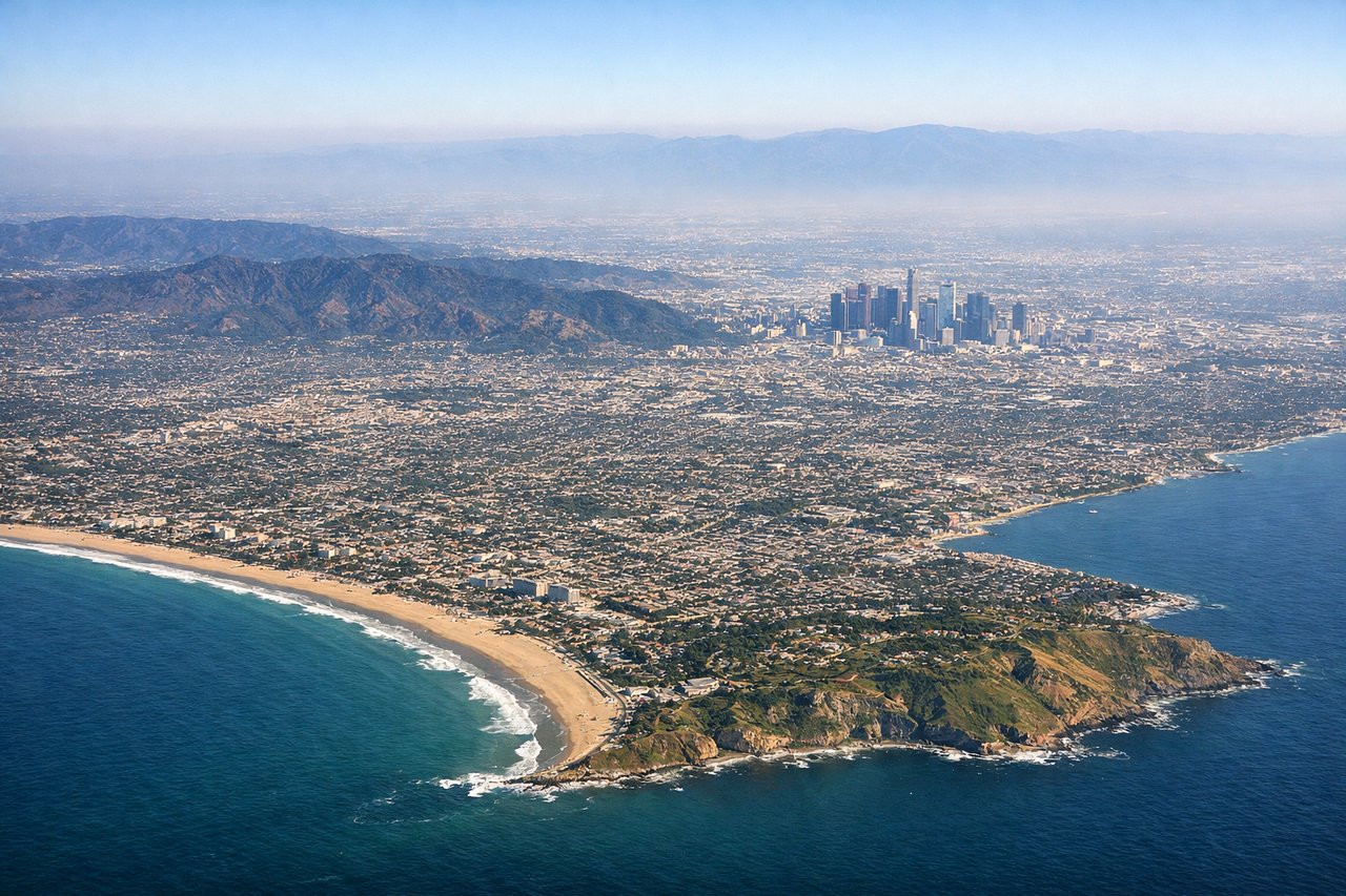
Takeoff from LAX
RIGHTAs the aircraft lifts off westbound over Santa Monica Bay and banks north toward Montana, the right side offers a sweeping view back over the Los Angeles basin, downtown skyline, and the San Gabriel Mountains rising sharply behind the city. The left side only shows open Pacific water during this brief turn.
Landing at BZN
RIGHTOn approach into Bozeman from the south, the right side reveals the dramatic edge of the Yellowstone Plateau and the Absaroka Range, along with the Bridger Range just north of the airport. The left side shows the Tobacco Root and Madison Ranges, which are scenic but less prominent during the final descent.
Will your flight be in sunlight?
Pick a date and time in the Sun Map to watch the sun move across your whole flight.
About This Route
Which side of the plane should I sit on flying from Los Angeles International (LAX) to Bozeman Yellowstone International Airport (BZN)?
Sit on the Right side of the plane for the best views on flights from Los Angeles to Bozeman. The right side captures the more dramatic terrain throughout the flight: the LA basin and San Gabriels at takeoff, the Great Salt Lake and Wasatch Range during cruise, and the Absaroka/Bridger mountains on arrival into Bozeman, giving it more consistent visual variety than the left side's desert basin views.
What can I see during takeoff from Los Angeles International in Los Angeles?
During takeoff from Los Angeles International (LAX), sit on the Right side for the best views. As the aircraft lifts off westbound over Santa Monica Bay and banks north toward Montana, the right side offers a sweeping view back over the Los Angeles basin, downtown skyline, and the San Gabriel Mountains rising sharply behind the city. The left side only shows open Pacific water during this brief turn. Notable sights include: Downtown Los Angeles skyline, San Gabriel Mountains, Santa Monica Bay coastline, Griffith Park hills.
What can I see when landing at Bozeman Yellowstone International Airport in Bozeman?
When landing at Bozeman Yellowstone International Airport (BZN), sit on the Right side for the best views. On approach into Bozeman from the south, the right side reveals the dramatic edge of the Yellowstone Plateau and the Absaroka Range, along with the Bridger Range just north of the airport. The left side shows the Tobacco Root and Madison Ranges, which are scenic but less prominent during the final descent. Notable sights include: Bridger Range, Absaroka Range, Yellowstone Plateau edge, Gallatin Valley farmland.
How long is the flight from Los Angeles to Bozeman?
The flight from Los Angeles International (LAX) to Bozeman Yellowstone International Airport (BZN) takes about 2 hours 20 minutes. The shortest flight path between them is 903 miles (1,453 km); winds and air traffic control usually add a few percent.
What does the Los Angeles to Bozeman flight path pass over?
Great Salt Lake and the Wasatch Range in Utah, followed by the Snake River Plain and the southern edge of the Idaho batholith before crossing into the Rocky Mountain foothills of Montana