Los Angeles to La Paz is 837 miles (1,347 km), a flight of about 2 hours 15 minutes.
The left side wins overall because the La Paz landing approach delivers genuinely spectacular scenery — the Bay of La Paz, Isla Espiritu Santo, and the Sierra de la Laguna together are more visually rewarding than the takeoff views. During the cruise portion, the left side also tracks closer to the Baja California peninsula's eastern coastline and the Sea of Cortez, offering periodic views of the rugged desert coast and island chains below.
Flight Path
The flight tracks southeast over the Pacific before crossing the northern tip of Baja California near Ensenada, then follows the spine of the Baja Peninsula southward. The Sea of Cortez (Gulf of California) becomes visible to the left side from roughly mid-flight, with the rugged Sierra de Baja California ranges running below. The volcanic islands of the Midriff Island group including Isla Angel de la Guarda and Isla Tiburon are visible in the Sea of Cortez at cruise altitude. The terrain transitions from coastal scrub to stark desert as the peninsula narrows toward La Paz.
Great circle distance and headings ›Phase by phase
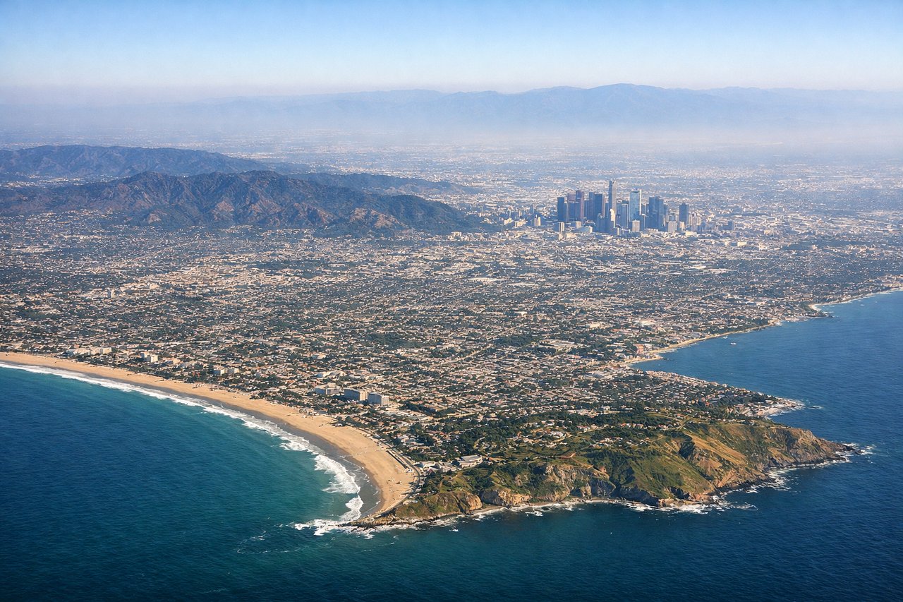
Takeoff from LAX
RIGHTLAX typically departs westward over the ocean on runways 24L/24R, then turns south. Right side gives you the Santa Monica Bay coastline, Palos Verdes Peninsula, and Catalina Island as the aircraft banks southeast. Left side faces inland toward the LA Basin smog layer.
Landing at LAP
LEFTLAP approaches from the north or northwest, landing on runway 16 heading southeast. The left side faces east toward the dramatic Sierra de la Laguna mountains and the rugged Baja interior, while also giving views of the turquoise waters of the Bay of La Paz and the city itself on final approach.
Landmarks on this routeAll landmarks →
Will your flight be in sunlight?
Pick a date and time in the Sun Map to watch the sun move across your whole flight.
About This Route
Which side of the plane should I sit on flying from Los Angeles International (LAX) to General Manuel Marquez De Leon International (LAP)?
Sit on the Left side of the plane for the best views on flights from Los Angeles to La Paz. The left side wins overall because the La Paz landing approach delivers genuinely spectacular scenery — the Bay of La Paz, Isla Espiritu Santo, and the Sierra de la Laguna together are more visually rewarding than the takeoff views. During the cruise portion, the left side also tracks closer to the Baja California peninsula's eastern coastline and the Sea of Cortez, offering periodic views of the rugged desert coast and island chains below.
What can I see during takeoff from Los Angeles International in Los Angeles?
During takeoff from Los Angeles International (LAX), sit on the Right side for the best views. LAX typically departs westward over the ocean on runways 24L/24R, then turns south. Right side gives you the Santa Monica Bay coastline, Palos Verdes Peninsula, and Catalina Island as the aircraft banks southeast. Left side faces inland toward the LA Basin smog layer. Notable sights include: Santa Monica Bay, Palos Verdes Peninsula, Catalina Island, Long Beach Harbor.
What can I see when landing at General Manuel Marquez De Leon International in La Paz?
When landing at General Manuel Marquez De Leon International (LAP), sit on the Left side for the best views. LAP approaches from the north or northwest, landing on runway 16 heading southeast. The left side faces east toward the dramatic Sierra de la Laguna mountains and the rugged Baja interior, while also giving views of the turquoise waters of the Bay of La Paz and the city itself on final approach. Notable sights include: Bay of La Paz, Sierra de la Laguna mountains, La Paz city waterfront (Malecon), Isla Espiritu Santo.
How long is the flight from Los Angeles to La Paz?
The flight from Los Angeles International (LAX) to General Manuel Marquez De Leon International (LAP) takes about 2 hours 15 minutes. The shortest flight path between them is 837 miles (1,347 km); winds and air traffic control usually add a few percent.
What does the Los Angeles to La Paz flight path pass over?
The flight tracks southeast over the Pacific before crossing the northern tip of Baja California near Ensenada, then follows the spine of the Baja Peninsula southward. The Sea of Cortez (Gulf of California) becomes visible to the left side from roughly mid-flight, with the rugged Sierra de Baja California ranges running below. The volcanic islands of the Midriff Island group including Isla Angel de la Guarda and Isla Tiburon are visible in the Sea of Cortez at cruise altitude. The terrain transitions from coastal scrub to stark desert as the peninsula narrows toward La Paz.