Right side scores higher (3.5 vs 2.5) due to superior scenic variety: the LAX departure offers dramatic coastal-mountain contrast with visible urban infrastructure, while the Loreto approach showcases the striking Sea of Cortez, desert mountains, and the transition from ocean to land. Left side is dominated by inland desert with minimal landmark density and less visual drama throughout the flight.
Flown LAX to LTO? Did we get it right?
Flight Path
Los Angeles to Loreto is 693 miles (1,115 km), a flight of about 2 hours 5 minutes.
Baja California peninsula interior (desert scrubland and bajadas), Sierra de la Laguna mountains in southern Baja, transition from Pacific-facing terrain to Sea of Cortez basin
Great circle distance and headings ›Phase by phase
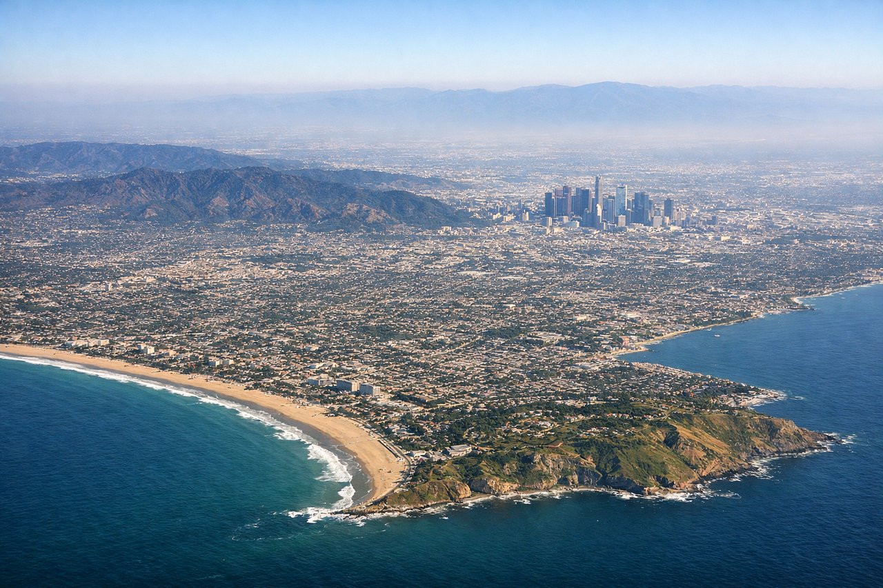
Takeoff from LAX
RIGHTRight side captures the Los Angeles basin, Pacific coastline, and Santa Monica Mountains during departure. Left side faces inland toward the San Gabriel Mountains but offers less dramatic urban-coastal contrast.
Landing at LTO
RIGHTRight side provides views of the Sea of Cortez (Gulf of California), the Baja California peninsula's desert terrain, and the approach to Loreto's coastal setting. Left side faces the interior Baja desert with minimal visual interest.
Will your flight be in sunlight?
Pick a date and time in the Sun Map to watch the sun move across your whole flight.
About This Route
Which side of the plane should I sit on flying from Los Angeles International (LAX) to Loreto International (LTO)?
Sit on the Right side of the plane for the best views on flights from Los Angeles to Loreto. Right side scores higher (3.5 vs 2.5) due to superior scenic variety: the LAX departure offers dramatic coastal-mountain contrast with visible urban infrastructure, while the Loreto approach showcases the striking Sea of Cortez, desert mountains, and the transition from ocean to land. Left side is dominated by inland desert with minimal landmark density and less visual drama throughout the flight.
What can I see during takeoff from Los Angeles International in Los Angeles?
During takeoff from Los Angeles International (LAX), sit on the Right side for the best views. Right side captures the Los Angeles basin, Pacific coastline, and Santa Monica Mountains during departure. Left side faces inland toward the San Gabriel Mountains but offers less dramatic urban-coastal contrast. Notable sights include: Santa Monica Mountains, Los Angeles Harbor, Pacific Ocean coastline, Long Beach port facilities.
What can I see when landing at Loreto International in Loreto?
When landing at Loreto International (LTO), sit on the Right side for the best views. Right side provides views of the Sea of Cortez (Gulf of California), the Baja California peninsula's desert terrain, and the approach to Loreto's coastal setting. Left side faces the interior Baja desert with minimal visual interest. Notable sights include: Sea of Cortez (Gulf of California), Baja California desert mountains, Loreto Bay, Sierra de la Giganta range.
How long is the flight from Los Angeles to Loreto?
The flight from Los Angeles International (LAX) to Loreto International (LTO) takes about 2 hours 5 minutes. The shortest flight path between them is 693 miles (1,115 km); winds and air traffic control usually add a few percent.
What does the Los Angeles to Loreto flight path pass over?
Baja California peninsula interior (desert scrubland and bajadas), Sierra de la Laguna mountains in southern Baja, transition from Pacific-facing terrain to Sea of Cortez basin