While the takeoff from LAX is scenic on the right, the approach into Missoula on the left is more visually rewarding. The descent offers continuous mountain scenery, river valleys, and a clear view of your destination, making it the better choice for the full flight experience.
Flown LAX to MSO? Did we get it right?
Flight Path
Los Angeles to Missoula is 924 miles (1,488 km), a flight of about 2 hours 30 minutes.
The flight path crosses the Mojave Desert (visible from both sides during mid-flight), then transitions into the Great Basin. You'll pass over or near the Sierra Nevada's eastern escarpment, then cross into Nevada and Idaho. The Salmon River Mountains and central Idaho's rugged terrain dominate the latter half of the flight. The Bitterroot Range becomes visible as you approach Montana, with the Flathead Valley opening up before descent into Missoula.
Great circle distance and headings ›


Phase by phase
Takeoff from LAX
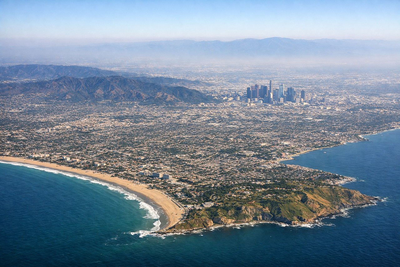
RIGHTRight-side seats capture the San Gabriel Mountains and the sprawling Los Angeles basin during the northeasterly climb-out. You'll see the urban grid of LA fade into foothills with excellent definition of the mountain ridgeline.
Landing at MSO
LEFTLeft-side seats offer the best views during the descent into Missoula. You'll see the Flathead Valley, the Mission Mountains, and the Clark Fork River valley as you approach from the southwest, with the Missoula valley opening up directly ahead.
Will your flight be in sunlight?
Pick a date and time in the Sun Map to watch the sun move across your whole flight.
About This Route
Which side of the plane should I sit on flying from Los Angeles International (LAX) to Missoula Montana Airport (MSO)?
Sit on the Left side of the plane for the best views on flights from Los Angeles to Missoula. While the takeoff from LAX is scenic on the right, the approach into Missoula on the left is more visually rewarding. The descent offers continuous mountain scenery, river valleys, and a clear view of your destination, making it the better choice for the full flight experience.
What can I see during takeoff from Los Angeles International in Los Angeles?
During takeoff from Los Angeles International (LAX), sit on the Right side for the best views. Right-side seats capture the San Gabriel Mountains and the sprawling Los Angeles basin during the northeasterly climb-out. You'll see the urban grid of LA fade into foothills with excellent definition of the mountain ridgeline. Notable sights include: San Gabriel Mountains, Los Angeles urban sprawl, San Fernando Valley, Pacific Ocean (western horizon).
What can I see when landing at Missoula Montana Airport in Missoula?
When landing at Missoula Montana Airport (MSO), sit on the Left side for the best views. Left-side seats offer the best views during the descent into Missoula. You'll see the Flathead Valley, the Mission Mountains, and the Clark Fork River valley as you approach from the southwest, with the Missoula valley opening up directly ahead. Notable sights include: Mission Mountains, Clark Fork River valley, Flathead Valley, Missoula urban area.
How long is the flight from Los Angeles to Missoula?
The flight from Los Angeles International (LAX) to Missoula Montana Airport (MSO) takes about 2 hours 30 minutes. The shortest flight path between them is 924 miles (1,488 km); winds and air traffic control usually add a few percent.
What does the Los Angeles to Missoula flight path pass over?
The flight path crosses the Mojave Desert (visible from both sides during mid-flight), then transitions into the Great Basin. You'll pass over or near the Sierra Nevada's eastern escarpment, then cross into Nevada and Idaho. The Salmon River Mountains and central Idaho's rugged terrain dominate the latter half of the flight. The Bitterroot Range becomes visible as you approach Montana, with the Flathead Valley opening up before descent into Missoula.