The right side wins overall primarily for the spectacular LAX departure view of the LA Basin and Santa Monica Mountains. The landing views at Nadi slightly favor left, but the departure spectacle on the right side is the more memorable and visually rich experience of the two endpoints. The long overwater cruise offers little to differentiate sides.
Flight Path
The route tracks southwest across the open Central Pacific, crossing the Hawaiian Island chain roughly 5 hours in — on a clear day you may glimpse the Big Island of Hawaii or Maui as distant volcanic peaks above the cloud layer. Beyond Hawaii the flight crosses the Equator and enters the South Pacific, passing over the Phoenix Islands (Kiribati) and then the Tokelau atolls, all extremely low and largely invisible from altitude. The final approach crosses the Lau Sea and the Koro Sea before reaching Fiji.
Great circle distance and headings ›.jpg?width=600)

Phase by phase
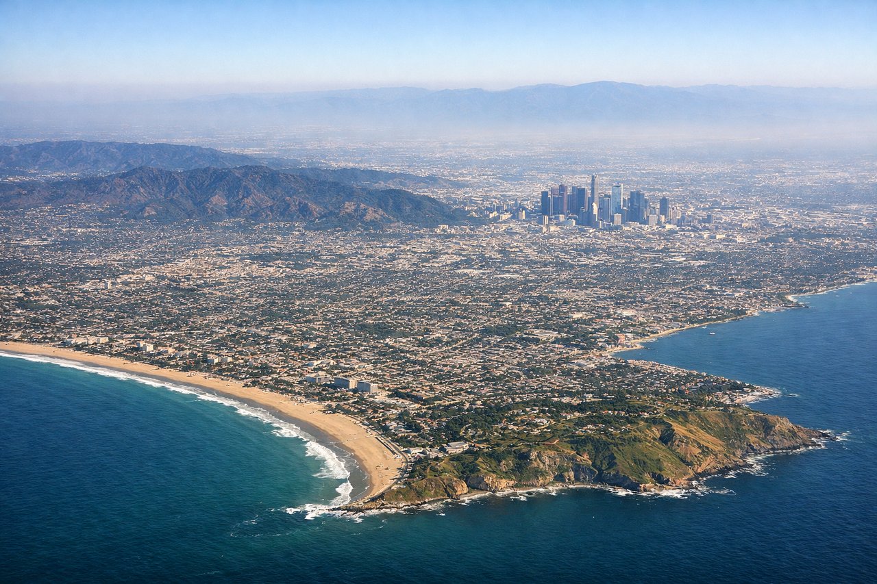
Takeoff from LAX
RIGHTLAX departures heading west over the Pacific typically use runways 24L/24R, meaning a right-side seat gives you a last look back at the LA Basin, the Santa Monica Mountains, and the sprawling city grid before you head out over open ocean. Left side faces south toward the South Bay and Long Beach with less dramatic scenery.
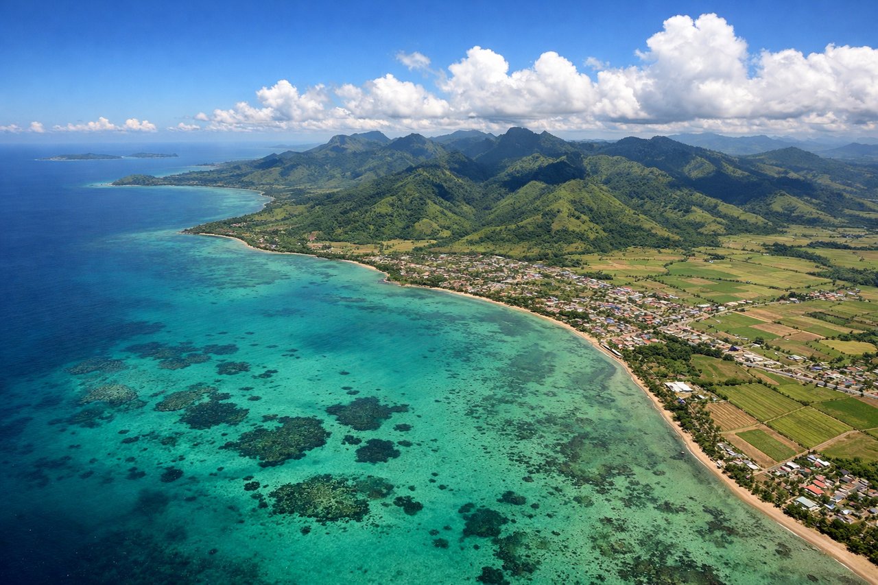
Landing at NAN
LEFTNadi International sits on the western coast of Viti Levu. Arrivals typically come in from the northwest or west over the ocean, and a left-side seat gives you the best view of the Mamanuca Islands scattered in the shallow turquoise water just offshore, plus the green volcanic interior of Viti Levu on approach. Right side faces mostly open ocean.
Landmarks on this routeAll landmarks →
Will your flight be in sunlight?
See exactly which side of the plane gets sun and shade at your departure time.
About This Route
Which side of the plane should I sit on flying from Los Angeles International (LAX) to Nadi International (NAN)?
Sit on the Right side of the plane for the best views on flights from Los Angeles to Nandi. The right side wins overall primarily for the spectacular LAX departure view of the LA Basin and Santa Monica Mountains. The landing views at Nadi slightly favor left, but the departure spectacle on the right side is the more memorable and visually rich experience of the two endpoints. The long overwater cruise offers little to differentiate sides.
What can I see during takeoff from Los Angeles International in Los Angeles?
During takeoff from Los Angeles International (LAX), sit on the Right side for the best views. LAX departures heading west over the Pacific typically use runways 24L/24R, meaning a right-side seat gives you a last look back at the LA Basin, the Santa Monica Mountains, and the sprawling city grid before you head out over open ocean. Left side faces south toward the South Bay and Long Beach with less dramatic scenery. Notable sights include: Santa Monica Mountains ridge, LA Basin city grid, Santa Monica Bay coastline, Palos Verdes Peninsula.
What can I see when landing at Nadi International in Nandi?
When landing at Nadi International (NAN), sit on the Left side for the best views. Nadi International sits on the western coast of Viti Levu. Arrivals typically come in from the northwest or west over the ocean, and a left-side seat gives you the best view of the Mamanuca Islands scattered in the shallow turquoise water just offshore, plus the green volcanic interior of Viti Levu on approach. Right side faces mostly open ocean. Notable sights include: Mamanuca Islands chain, Viti Levu western coastline, Nadi Bay, coral reef lagoon shallows.
How long is the flight from Los Angeles to Nandi?
The flight from Los Angeles International (LAX) to Nadi International (NAN) takes Approximately 10 to 11 hours.
What does the Los Angeles to Nandi flight path pass over?
The route tracks southwest across the open Central Pacific, crossing the Hawaiian Island chain roughly 5 hours in — on a clear day you may glimpse the Big Island of Hawaii or Maui as distant volcanic peaks above the cloud layer. Beyond Hawaii the flight crosses the Equator and enters the South Pacific, passing over the Phoenix Islands (Kiribati) and then the Tokelau atolls, all extremely low and largely invisible from altitude. The final approach crosses the Lau Sea and the Koro Sea before reaching Fiji.