The flight is very short — roughly 15 minutes — and the most dramatic single view is the San Gabriel Mountains on approach, which are on the left side. While the right side has the coastal views on departure, the mountain scenery on the left during descent into ONT is more visually striking and sustained.
Flown LAX to ONT? Did we get it right?
Flight Path
Los Angeles to Ontario is 47 miles (75 km), a flight of about 20 minutes.
The flight crosses directly over the eastern Los Angeles Basin and the Pomona Valley. Visible below are the cities of West Covina, Pomona, and the 10 and 60 freeway corridors. The transition from dense LA suburban grid to the wider-spaced Inland Empire warehouse and logistics districts is clearly visible. The San Gabriel Mountains run along the northern horizon throughout the flight.
Great circle distance and headings ›Phase by phase
Takeoff from LAX
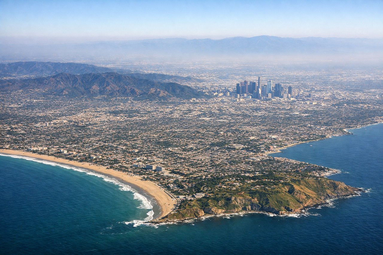
RIGHTLAX typically departs eastbound on runways 24L/24R (heading ~240°) or westbound over the ocean, but for an eastbound flight to ONT, aircraft often depart on runways 06L/06R heading east. On an eastbound departure, the right (south) side gives you a clear view of the South Bay coastline, Palos Verdes Peninsula, and Catalina Island on the horizon. The left side faces inland toward Inglewood and downtown LA.
Landing at ONT
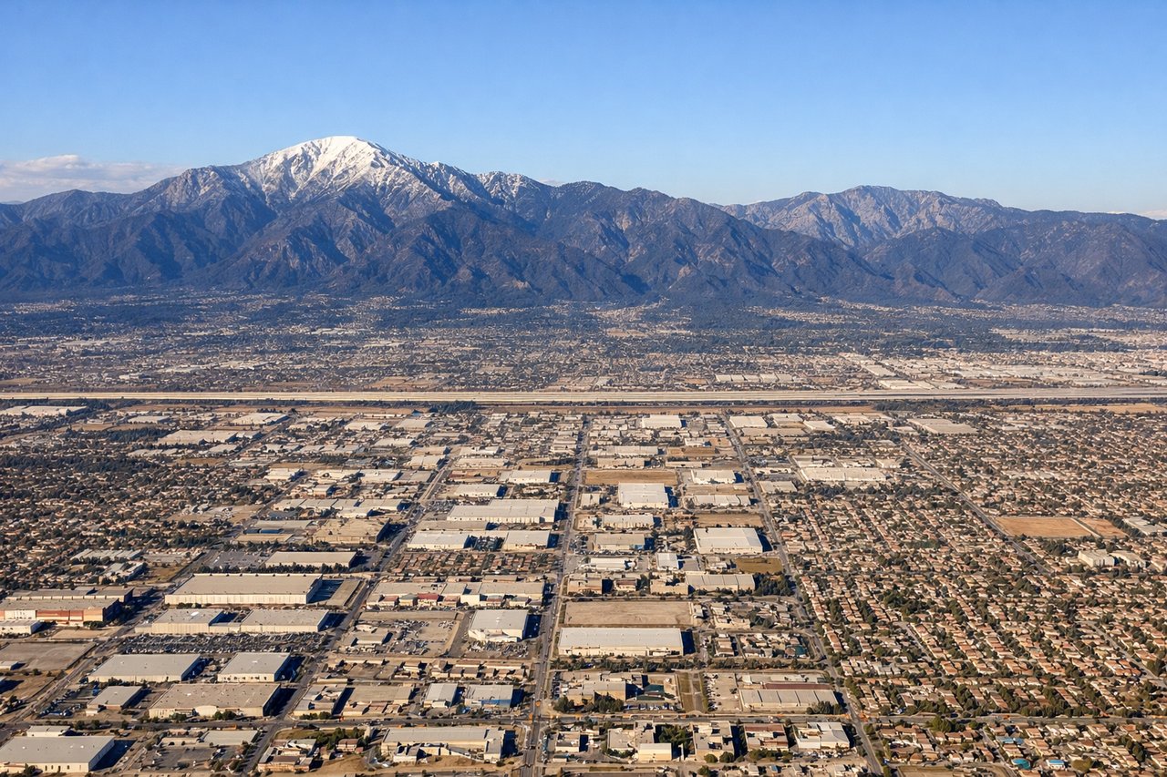
LEFTApproaching ONT from the west, aircraft typically land on runway 26L/26R heading west, meaning the approach comes from the east — but for a westbound arrival from LAX, the aircraft approaches heading roughly east and lands on runways 08L/08R. On this eastward approach, the left (north) side faces the San Gabriel Mountains directly, giving a dramatic close view of the range as the aircraft descends into the Inland Empire. The right side looks south toward the flat Inland Empire sprawl.
Will your flight be in sunlight?
Pick a date and time in the Sun Map to watch the sun move across your whole flight.
About This Route
Which side of the plane should I sit on flying from Los Angeles International (LAX) to Ontario International (ONT)?
Sit on the Left side of the plane for the best views on flights from Los Angeles to Ontario. The flight is very short — roughly 15 minutes — and the most dramatic single view is the San Gabriel Mountains on approach, which are on the left side. While the right side has the coastal views on departure, the mountain scenery on the left during descent into ONT is more visually striking and sustained.
What can I see during takeoff from Los Angeles International in Los Angeles?
During takeoff from Los Angeles International (LAX), sit on the Right side for the best views. LAX typically departs eastbound on runways 24L/24R (heading ~240°) or westbound over the ocean, but for an eastbound flight to ONT, aircraft often depart on runways 06L/06R heading east. On an eastbound departure, the right (south) side gives you a clear view of the South Bay coastline, Palos Verdes Peninsula, and Catalina Island on the horizon. The left side faces inland toward Inglewood and downtown LA. Notable sights include: Palos Verdes Peninsula, Santa Catalina Island (on clear days), South Bay coastline, Marina del Rey.
What can I see when landing at Ontario International in Ontario?
When landing at Ontario International (ONT), sit on the Left side for the best views. Approaching ONT from the west, aircraft typically land on runway 26L/26R heading west, meaning the approach comes from the east — but for a westbound arrival from LAX, the aircraft approaches heading roughly east and lands on runways 08L/08R. On this eastward approach, the left (north) side faces the San Gabriel Mountains directly, giving a dramatic close view of the range as the aircraft descends into the Inland Empire. The right side looks south toward the flat Inland Empire sprawl. Notable sights include: San Gabriel Mountains, Mount San Antonio (Mount Baldy) at 10,064 ft, Inland Empire urban grid, San Bernardino Valley.
How long is the flight from Los Angeles to Ontario?
The flight from Los Angeles International (LAX) to Ontario International (ONT) takes about 20 minutes. The shortest flight path between them is 47 miles (75 km); winds and air traffic control usually add a few percent.
What does the Los Angeles to Ontario flight path pass over?
The flight crosses directly over the eastern Los Angeles Basin and the Pomona Valley. Visible below are the cities of West Covina, Pomona, and the 10 and 60 freeway corridors. The transition from dense LA suburban grid to the wider-spaced Inland Empire warehouse and logistics districts is clearly visible. The San Gabriel Mountains run along the northern horizon throughout the flight.