Los Angeles to Everett is 985 miles (1,586 km), a flight of about 2 hours 25 minutes.
The left side wins overall because while the right side has a good LA departure view, the left side during the approach into PAE delivers the full Puget Sound and Olympic Mountains panorama, which is one of the most visually striking approach sequences in the Pacific Northwest. Mid-flight, the left side also picks up the Oregon and Washington coastline and the Columbia River mouth.
Flight Path
The flight tracks up the Pacific Coast corridor. Notable features include the Channel Islands off Ventura visible early on, the Central California coast near Big Sur and Monterey Bay, the San Francisco Bay Area and Golden Gate visible to the left around the midpoint, then the Oregon Coast Ranges and the Columbia River mouth marking the Oregon-Washington border, followed by the southern Puget Sound lowlands on descent.
Great circle distance and headings ›.jpg?width=600)


Phase by phase
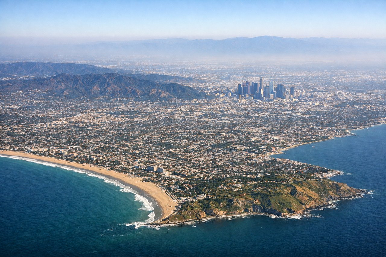
Takeoff from LAX
RIGHTLAX typically departs westward over the ocean on runways 24L/24R, then turns northward. The right (north) side gives you the Santa Monica Bay coastline, the Santa Monica Mountains, and the sprawling LA basin as you climb and bank north. The left side faces open Pacific.
Landing at PAE
LEFTPAE sits east of Puget Sound, and aircraft typically approach from the south on runway 34R/34L heading north. The left (west) side gives you Puget Sound, the Kitsap Peninsula, and the Olympic Mountains on the horizon. The right side faces the Cascades and Mount Rainier, which is also spectacular, so this is close.
Landmarks on this routeAll landmarks →
Will your flight be in sunlight?
Pick a date and time in the Sun Map to watch the sun move across your whole flight.
About This Route
Which side of the plane should I sit on flying from Los Angeles International (LAX) to Snohomish Co (PAE)?
Sit on the Left side of the plane for the best views on flights from Los Angeles to Everett. The left side wins overall because while the right side has a good LA departure view, the left side during the approach into PAE delivers the full Puget Sound and Olympic Mountains panorama, which is one of the most visually striking approach sequences in the Pacific Northwest. Mid-flight, the left side also picks up the Oregon and Washington coastline and the Columbia River mouth.
What can I see during takeoff from Los Angeles International in Los Angeles?
During takeoff from Los Angeles International (LAX), sit on the Right side for the best views. LAX typically departs westward over the ocean on runways 24L/24R, then turns northward. The right (north) side gives you the Santa Monica Bay coastline, the Santa Monica Mountains, and the sprawling LA basin as you climb and bank north. The left side faces open Pacific. Notable sights include: Santa Monica Bay, Santa Monica Mountains, Malibu coastline, LA basin grid stretching inland.
What can I see when landing at Snohomish Co in Everett?
When landing at Snohomish Co (PAE), sit on the Left side for the best views. PAE sits east of Puget Sound, and aircraft typically approach from the south on runway 34R/34L heading north. The left (west) side gives you Puget Sound, the Kitsap Peninsula, and the Olympic Mountains on the horizon. The right side faces the Cascades and Mount Rainier, which is also spectacular, so this is close. Notable sights include: Puget Sound, Olympic Mountains, Whidbey Island, Everett waterfront and Port Gardner Bay.
How long is the flight from Los Angeles to Everett?
The flight from Los Angeles International (LAX) to Snohomish Co (PAE) takes about 2 hours 25 minutes. The shortest flight path between them is 985 miles (1,586 km); winds and air traffic control usually add a few percent.
What does the Los Angeles to Everett flight path pass over?
The flight tracks up the Pacific Coast corridor. Notable features include the Channel Islands off Ventura visible early on, the Central California coast near Big Sur and Monterey Bay, the San Francisco Bay Area and Golden Gate visible to the left around the midpoint, then the Oregon Coast Ranges and the Columbia River mouth marking the Oregon-Washington border, followed by the southern Puget Sound lowlands on descent.