Los Angeles to Reno is 391 miles (630 km), a flight of about 1 hour 10 minutes.
Although the takeoff briefly favors the right side with a city and coastline view, the bulk of the flight tracks along the eastern Sierra Nevada, culminating in a dramatic left-side view of Lake Tahoe and the Sierra crest during descent into Reno, giving the left side the stronger overall scenic experience.
Flight Path
Eastern Sierra Nevada escarpment, Owens Valley, Mono Lake, White Mountains
Great circle distance and headings ›.jpg?width=600)


Phase by phase
Takeoff from LAX
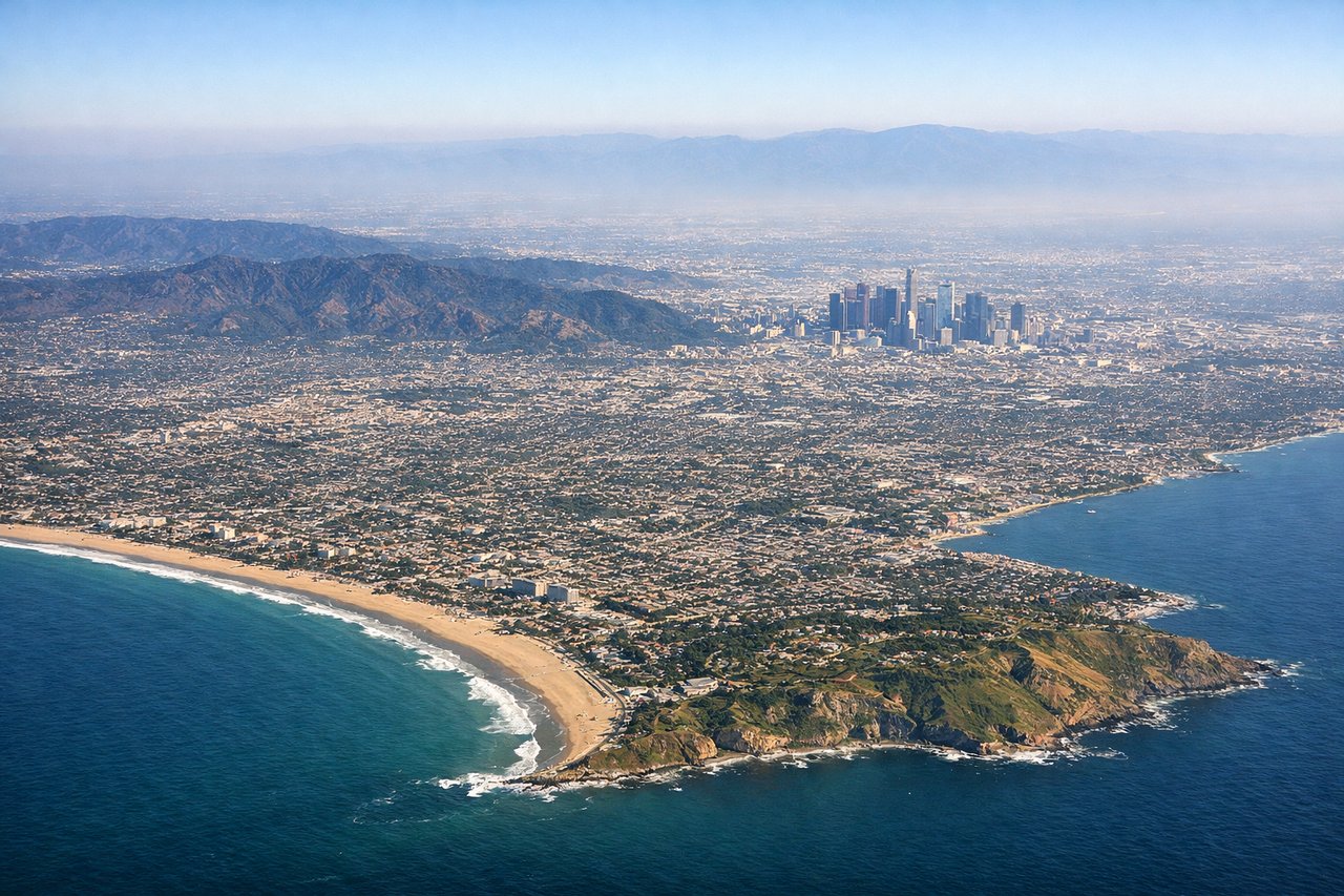
RIGHTIn LAX's typical west-flow departure, the aircraft climbs out over Santa Monica Bay before banking north, giving right-side passengers a last look at the Los Angeles basin, the Santa Monica Mountains, and the San Gabriel Mountains rising ahead as the turn begins.
Landing at RNO
LEFTFlights into Reno typically track up the eastern side of the Sierra Nevada before curving into the Truckee Meadows from the south, putting the jagged Sierra crest, Lake Tahoe's basin, and the Carson Range on the left side of the aircraft during final descent.
Landmarks on this routeAll landmarks →
Will your flight be in sunlight?
Pick a date and time in the Sun Map to watch the sun move across your whole flight.
About This Route
Which side of the plane should I sit on flying from Los Angeles International (LAX) to Reno Tahoe International (RNO)?
Sit on the Left side of the plane for the best views on flights from Los Angeles to Reno. Although the takeoff briefly favors the right side with a city and coastline view, the bulk of the flight tracks along the eastern Sierra Nevada, culminating in a dramatic left-side view of Lake Tahoe and the Sierra crest during descent into Reno, giving the left side the stronger overall scenic experience.
What can I see during takeoff from Los Angeles International in Los Angeles?
During takeoff from Los Angeles International (LAX), sit on the Right side for the best views. In LAX's typical west-flow departure, the aircraft climbs out over Santa Monica Bay before banking north, giving right-side passengers a last look at the Los Angeles basin, the Santa Monica Mountains, and the San Gabriel Mountains rising ahead as the turn begins. Notable sights include: Santa Monica Bay, Santa Monica Mountains, San Gabriel Mountains, Los Angeles basin skyline.
What can I see when landing at Reno Tahoe International in Reno?
When landing at Reno Tahoe International (RNO), sit on the Left side for the best views. Flights into Reno typically track up the eastern side of the Sierra Nevada before curving into the Truckee Meadows from the south, putting the jagged Sierra crest, Lake Tahoe's basin, and the Carson Range on the left side of the aircraft during final descent. Notable sights include: Sierra Nevada crest, Lake Tahoe basin, Carson Range, Truckee Meadows valley floor.
How long is the flight from Los Angeles to Reno?
The flight from Los Angeles International (LAX) to Reno Tahoe International (RNO) takes about 1 hour 10 minutes. The shortest flight path between them is 391 miles (630 km); winds and air traffic control usually add a few percent.
What does the Los Angeles to Reno flight path pass over?
Eastern Sierra Nevada escarpment, Owens Valley, Mono Lake, White Mountains