Los Angeles to Edmonton is 1,359 miles (2,187 km), a flight of about 2 hours 40 minutes.
Right side wins both departure and arrival. During the flight itself, the right side also faces east toward the Rocky Mountain foothills as the route tracks north through British Columbia and into Alberta, offering occasional views of the Canadian Rockies on the horizon depending on routing.
Flight Path
The route tracks north-northwest from LA over the Central Valley of California, then crosses into Oregon and Washington state over the Cascade Range. Mount Shasta is a prominent isolated volcanic cone visible from both sides near the California-Oregon border. The route then crosses into British Columbia over the interior plateau before descending into Alberta. The Canadian Rockies appear as a dramatic north-south wall on the right (east) side during the BC portion. The flat Alberta prairie patchwork dominates the final 200 miles before Edmonton.
Great circle distance and headings ›.jpg?width=600)

.jpg?width=600)

Phase by phase
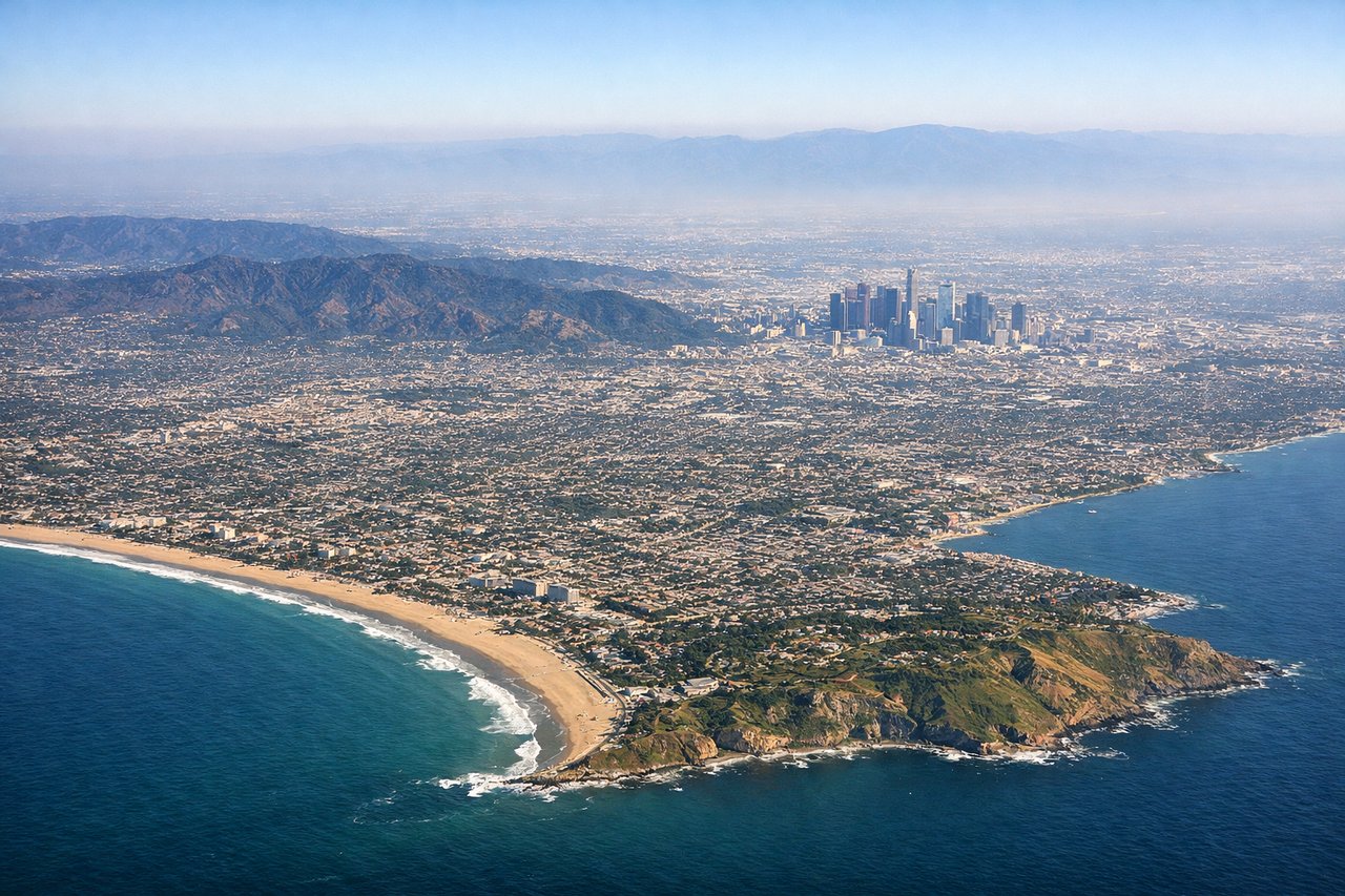
Takeoff from LAX
RIGHTLAX typically departs westward over the ocean on runways 24L/24R, then turns north. Right side gives you the Santa Monica Bay coastline, then the Santa Monica Mountains and the San Fernando Valley as the aircraft banks north. Left side faces inland toward Inglewood and is less interesting during the initial climb.
Landing at YEG
RIGHTEdmonton International approaches from the south on runway 12/30 or 02/20 depending on winds. A southerly approach on runway 02 puts the right side facing east toward the North Saskatchewan River valley cutting through Edmonton's urban grid, which is the most distinctive feature of the city from the air. The river valley parkland is clearly visible as a green or snow-covered corridor through the city.
Landmarks on this routeAll landmarks →
Will your flight be in sunlight?
Pick a date and time in the Sun Map to watch the sun move across your whole flight.
About This Route
Which side of the plane should I sit on flying from Los Angeles International (LAX) to Edmonton International (YEG)?
Sit on the Right side of the plane for the best views on flights from Los Angeles to Edmonton. Right side wins both departure and arrival. During the flight itself, the right side also faces east toward the Rocky Mountain foothills as the route tracks north through British Columbia and into Alberta, offering occasional views of the Canadian Rockies on the horizon depending on routing.
What can I see during takeoff from Los Angeles International in Los Angeles?
During takeoff from Los Angeles International (LAX), sit on the Right side for the best views. LAX typically departs westward over the ocean on runways 24L/24R, then turns north. Right side gives you the Santa Monica Bay coastline, then the Santa Monica Mountains and the San Fernando Valley as the aircraft banks north. Left side faces inland toward Inglewood and is less interesting during the initial climb. Notable sights include: Santa Monica Bay, Santa Monica Mountains, Malibu coastline, San Fernando Valley.
What can I see when landing at Edmonton International in Edmonton?
When landing at Edmonton International (YEG), sit on the Right side for the best views. Edmonton International approaches from the south on runway 12/30 or 02/20 depending on winds. A southerly approach on runway 02 puts the right side facing east toward the North Saskatchewan River valley cutting through Edmonton's urban grid, which is the most distinctive feature of the city from the air. The river valley parkland is clearly visible as a green or snow-covered corridor through the city. Notable sights include: North Saskatchewan River valley, Edmonton urban grid, Nisku industrial area, flat Alberta prairie patchwork.
How long is the flight from Los Angeles to Edmonton?
The flight from Los Angeles International (LAX) to Edmonton International (YEG) takes about 2 hours 40 minutes. The shortest flight path between them is 1,359 miles (2,187 km); winds and air traffic control usually add a few percent.
What does the Los Angeles to Edmonton flight path pass over?
The route tracks north-northwest from LA over the Central Valley of California, then crosses into Oregon and Washington state over the Cascade Range. Mount Shasta is a prominent isolated volcanic cone visible from both sides near the California-Oregon border. The route then crosses into British Columbia over the interior plateau before descending into Alberta. The Canadian Rockies appear as a dramatic north-south wall on the right (east) side during the BC portion. The flat Alberta prairie patchwork dominates the final 200 miles before Edmonton.