Labuhan Bajo to Denpasar is 323 miles (520 km), a flight of about 1 hour 15 minutes.
While takeoff favors the right, the landing approach over the Bali Strait with Mount Agung visible is the more dramatic and sustained view. Left-side seats capture the volcanic geography that defines this route's visual character.
Flight Path
The flight crosses the Savu Sea and Flores Sea. Midway, you'll pass near or over several small islands including Komodo National Park islands (Komodo, Rinca) to the east of the direct track. The waters show the transition from the deeper Flores Sea (east) to the shallower Bali Strait (west). Mount Rinjani on Lombok becomes visible on the left (east) side during the latter half of the flight, appearing as a distant peak. The approach to Bali shows the island's volcanic spine with Mount Agung dominating the northern landscape.
Great circle distance and headings ›


Phase by phase
Takeoff from LBJ
RIGHTLBJ typically departs to the east or northeast. Right-side seats capture the Flores volcanic landscape and the Savu Sea immediately after departure. The terrain rises steeply inland, creating dramatic relief visible during climb-out.
Landing at DPS
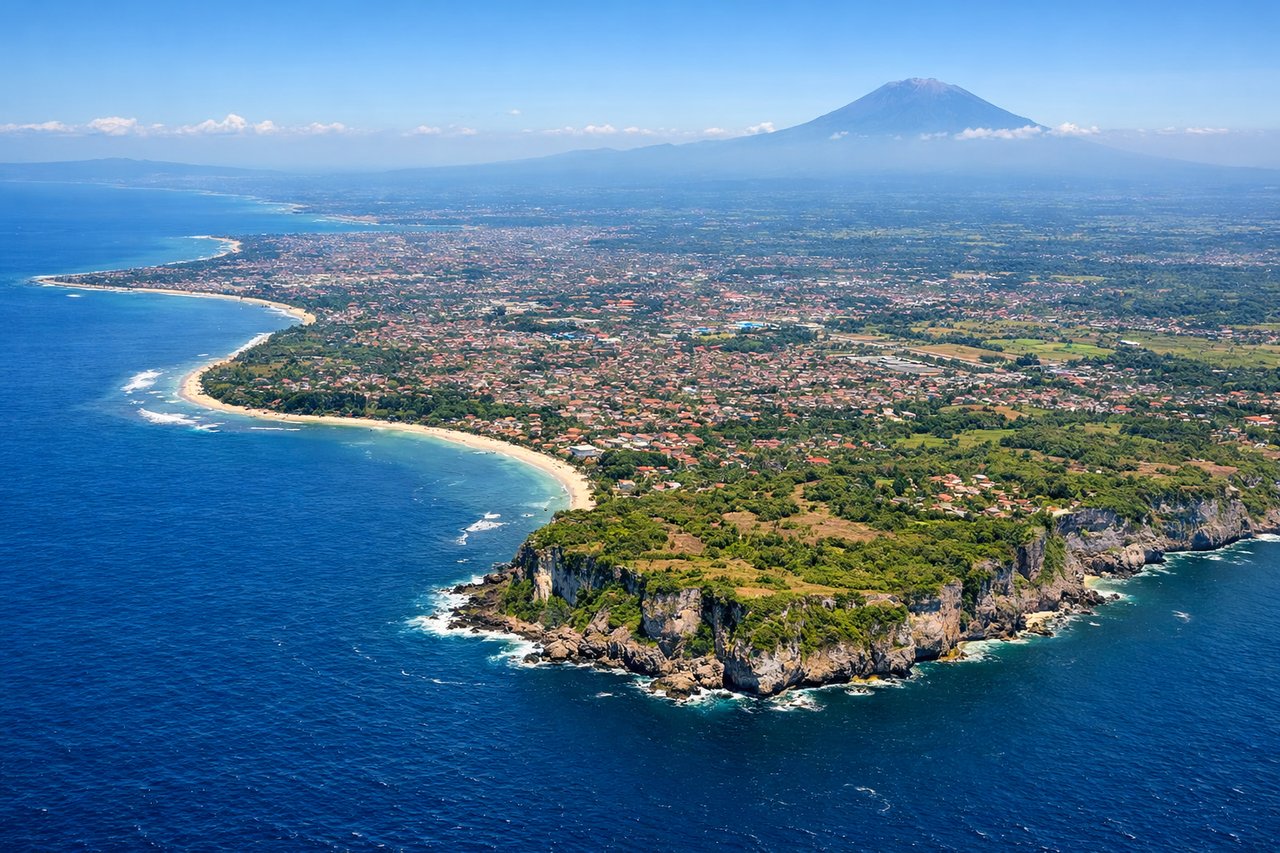
LEFTDPS typically lands from the north or northwest on runway 09L/09R. Left-side seats provide views of Bali's northern coast, Mount Agung (Bali's highest volcano at 3,031m) to the northwest, and the descent path over the Bali Strait. The approach crosses the strait with excellent visibility of the volcanic landscape.
Landmarks on this routeAll landmarks →
Will your flight be in sunlight?
Pick a date and time in the Sun Map to watch the sun move across your whole flight.
About This Route
Which side of the plane should I sit on flying from Komodo Airport (LBJ) to Denpasar I Gusti Ngurah Rai International Airport (DPS)?
Sit on the Left side of the plane for the best views on flights from Labuhan Bajo to Denpasar. While takeoff favors the right, the landing approach over the Bali Strait with Mount Agung visible is the more dramatic and sustained view. Left-side seats capture the volcanic geography that defines this route's visual character.
What can I see during takeoff from Komodo Airport in Labuhan Bajo?
During takeoff from Komodo Airport (LBJ), sit on the Right side for the best views. LBJ typically departs to the east or northeast. Right-side seats capture the Flores volcanic landscape and the Savu Sea immediately after departure. The terrain rises steeply inland, creating dramatic relief visible during climb-out. Notable sights include: Mount Inerie (1,559m) to the northeast, Savu Sea to the south and east, Labuhan Bajo coastal settlement below, volcanic ridgelines of central Flores.
What can I see when landing at Denpasar I Gusti Ngurah Rai International Airport in Denpasar?
When landing at Denpasar I Gusti Ngurah Rai International Airport (DPS), sit on the Left side for the best views. DPS typically lands from the north or northwest on runway 09L/09R. Left-side seats provide views of Bali's northern coast, Mount Agung (Bali's highest volcano at 3,031m) to the northwest, and the descent path over the Bali Strait. The approach crosses the strait with excellent visibility of the volcanic landscape. Notable sights include: Mount Agung to the northwest, Bali Strait waters, northern Bali coastal towns (Singaraja area), Lombok island visible across the strait to the east.
How long is the flight from Labuhan Bajo to Denpasar?
The flight from Komodo Airport (LBJ) to Denpasar I Gusti Ngurah Rai International Airport (DPS) takes about 1 hour 15 minutes. The shortest flight path between them is 323 miles (520 km); winds and air traffic control usually add a few percent.
What does the Labuhan Bajo to Denpasar flight path pass over?
The flight crosses the Savu Sea and Flores Sea. Midway, you'll pass near or over several small islands including Komodo National Park islands (Komodo, Rinca) to the east of the direct track. The waters show the transition from the deeper Flores Sea (east) to the shallower Bali Strait (west). Mount Rinjani on Lombok becomes visible on the left (east) side during the latter half of the flight, appearing as a distant peak. The approach to Bali shows the island's volcanic spine with Mount Agung dominating the northern landscape.