Denpasar to Labuhan Bajo is 323 miles (520 km), a flight of about 1 hour 15 minutes.
While takeoff favors right seats for Mount Agung views, the landing approach over the Komodo archipelago and Mount Inerie is more dramatic and visually distinctive. Left seats capture the volcanic landscape of Flores and the unique island geography that defines this route.
Flight Path
The flight crosses the Flores Sea at roughly 8,000-12,000 feet. Notable features include the Lombok Strait (between Lombok and Sumbawa), the volcanic islands of Sumbawa (Mount Tambora visible on clear days, though typically 40+ miles south of direct route), and the transition from Bali's lush tropical landscape to the drier volcanic terrain of the Lesser Sunda Islands. The route passes east of the main Komodo archipelago before descending toward Labuhan Bajo on Flores' western peninsula.
Great circle distance and headings ›


Phase by phase
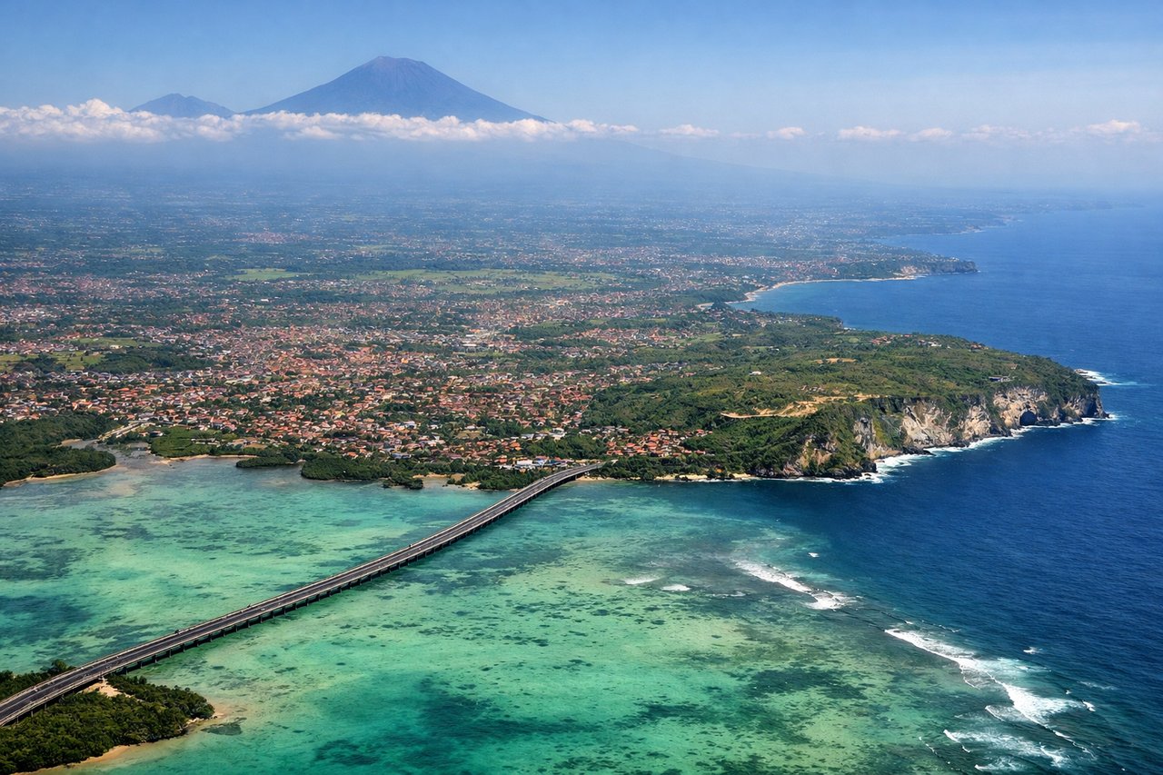
Takeoff from DPS
RIGHTDPS typically departs runway 09L/27R (east-west) or 09R/27L. Westbound departures use runway 09, climbing northwest. Right-side seats face the Bali Strait and Mount Agung's eastern slopes as you climb, with the volcanic ridge of central Bali visible to the left. Eastbound traffic on runway 27 would favor left seats, but westbound service to Labuhan Bajo uses runway 09.
Landing at LBJ
LEFTLabuhan Bajo airport (LBJ) sits on the western tip of Flores. Approach vectors typically come from the south or southeast, descending over the Flores Sea. Left-side seats face the dramatic volcanic landscape of western Flores, including the Komodo archipelago and Mount Inerie, while right seats see only open ocean.
Landmarks on this routeAll landmarks →
Will your flight be in sunlight?
Pick a date and time in the Sun Map to watch the sun move across your whole flight.
About This Route
Which side of the plane should I sit on flying from Denpasar I Gusti Ngurah Rai International Airport (DPS) to Komodo Airport (LBJ)?
Sit on the Left side of the plane for the best views on flights from Denpasar to Labuhan Bajo. While takeoff favors right seats for Mount Agung views, the landing approach over the Komodo archipelago and Mount Inerie is more dramatic and visually distinctive. Left seats capture the volcanic landscape of Flores and the unique island geography that defines this route.
What can I see during takeoff from Denpasar I Gusti Ngurah Rai International Airport in Denpasar?
During takeoff from Denpasar I Gusti Ngurah Rai International Airport (DPS), sit on the Right side for the best views. DPS typically departs runway 09L/27R (east-west) or 09R/27L. Westbound departures use runway 09, climbing northwest. Right-side seats face the Bali Strait and Mount Agung's eastern slopes as you climb, with the volcanic ridge of central Bali visible to the left. Eastbound traffic on runway 27 would favor left seats, but westbound service to Labuhan Bajo uses runway 09. Notable sights include: Mount Agung (3,031 m, Bali's dominant stratovolcano), Bali Strait (water body separating Bali from Lombok), central Bali volcanic ridge, Lombok's northern coast.
What can I see when landing at Komodo Airport in Labuhan Bajo?
When landing at Komodo Airport (LBJ), sit on the Left side for the best views. Labuhan Bajo airport (LBJ) sits on the western tip of Flores. Approach vectors typically come from the south or southeast, descending over the Flores Sea. Left-side seats face the dramatic volcanic landscape of western Flores, including the Komodo archipelago and Mount Inerie, while right seats see only open ocean. Notable sights include: Mount Inerie (1,559 m, Flores' prominent stratovolcano), Komodo Island (largest island in the Komodo archipelago), Flores Sea, Labuhan Bajo harbor and settlement.
How long is the flight from Denpasar to Labuhan Bajo?
The flight from Denpasar I Gusti Ngurah Rai International Airport (DPS) to Komodo Airport (LBJ) takes about 1 hour 15 minutes. The shortest flight path between them is 323 miles (520 km); winds and air traffic control usually add a few percent.
What does the Denpasar to Labuhan Bajo flight path pass over?
The flight crosses the Flores Sea at roughly 8,000-12,000 feet. Notable features include the Lombok Strait (between Lombok and Sumbawa), the volcanic islands of Sumbawa (Mount Tambora visible on clear days, though typically 40+ miles south of direct route), and the transition from Bali's lush tropical landscape to the drier volcanic terrain of the Lesser Sunda Islands. The route passes east of the main Komodo archipelago before descending toward Labuhan Bajo on Flores' western peninsula.