Labuhan Bajo to Jakarta is 921 miles (1,483 km), a flight of about 2 hours 30 minutes.
While landing favors the left, the takeoff scenery from the right side—featuring Flores's dramatic volcanic landscape and the Savu Sea—is more visually striking and distinctive than Jakarta's urban sprawl on approach. Right-side seats offer the more memorable scenic experience overall.
Flight Path
The flight path crosses the Java Sea westward from Flores. Notable features include the Bali Strait (separating Bali and Lombok islands, visible around the midpoint), Mount Agung on Bali (visible as a distant volcanic peak if weather permits), and the transition from the eastern volcanic archipelago to the more densely populated islands of central Java. The Sunda Strait region appears near the final approach phase. Most of the flight crosses open water with limited ground features visible except at the beginning and end of the route.
Great circle distance and headings ›

Phase by phase
Takeoff from LBJ
RIGHTRight-side seats offer views of Flores Island's dramatic volcanic terrain and the Savu Sea as the aircraft climbs westward toward Jakarta. The left side faces inland toward less visually distinctive terrain.
Landing at CGK
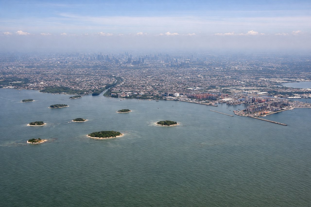
LEFTLeft-side seats provide excellent views during descent into Jakarta, showing the Java Sea, the Thousand Islands (Kepulauan Seribu), and the Jakarta metropolitan area sprawl. The approach path from the east naturally favors left-side visibility of these features.
Landmarks on this routeAll landmarks →
Will your flight be in sunlight?
Pick a date and time in the Sun Map to watch the sun move across your whole flight.
About This Route
Which side of the plane should I sit on flying from Komodo Airport (LBJ) to Soekarno Hatta International (CGK)?
Sit on the Right side of the plane for the best views on flights from Labuhan Bajo to Jakarta. While landing favors the left, the takeoff scenery from the right side—featuring Flores's dramatic volcanic landscape and the Savu Sea—is more visually striking and distinctive than Jakarta's urban sprawl on approach. Right-side seats offer the more memorable scenic experience overall.
What can I see during takeoff from Komodo Airport in Labuhan Bajo?
During takeoff from Komodo Airport (LBJ), sit on the Right side for the best views. Right-side seats offer views of Flores Island's dramatic volcanic terrain and the Savu Sea as the aircraft climbs westward toward Jakarta. The left side faces inland toward less visually distinctive terrain. Notable sights include: Mount Inerie (volcanic peak on Flores), Savu Sea coastline, Labuhan Bajo harbor and settlement, Komodo Strait waters.
What can I see when landing at Soekarno Hatta International in Jakarta?
When landing at Soekarno Hatta International (CGK), sit on the Left side for the best views. Left-side seats provide excellent views during descent into Jakarta, showing the Java Sea, the Thousand Islands (Kepulauan Seribu), and the Jakarta metropolitan area sprawl. The approach path from the east naturally favors left-side visibility of these features. Notable sights include: Thousand Islands (Kepulauan Seribu) archipelago, Java Sea, Jakarta urban sprawl and coastal development, Soekarno-Hatta airport area.
How long is the flight from Labuhan Bajo to Jakarta?
The flight from Komodo Airport (LBJ) to Soekarno Hatta International (CGK) takes about 2 hours 30 minutes. The shortest flight path between them is 921 miles (1,483 km); winds and air traffic control usually add a few percent.
What does the Labuhan Bajo to Jakarta flight path pass over?
The flight path crosses the Java Sea westward from Flores. Notable features include the Bali Strait (separating Bali and Lombok islands, visible around the midpoint), Mount Agung on Bali (visible as a distant volcanic peak if weather permits), and the transition from the eastern volcanic archipelago to the more densely populated islands of central Java. The Sunda Strait region appears near the final approach phase. Most of the flight crosses open water with limited ground features visible except at the beginning and end of the route.