Jakarta to Labuhan Bajo is 921 miles (1,483 km), a flight of about 2 hours 15 minutes.
While takeoff favors the right for Jakarta's coastal views, the landing approach to Labuhan Bajo—the longer and more visually dramatic segment—strongly favors left seats. The volcanic landscape of Flores and Mount Inerie are the flight's most distinctive geographic features, making left the better overall choice.
Flight Path
The flight path crosses the Java Sea heading east-southeast, passing north of the Sunda Strait region. Midway, you'll be over open water with scattered small islands of the Lesser Sunda chain becoming gradually more visible. The transition from the flat Java coastal plain to the increasingly mountainous volcanic terrain of the Lesser Sundas occurs gradually across the flight path. No major landmarks dominate the midpoint, but the water gradually shifts from the shallow Java Sea to deeper Flores Sea waters, and the horizon ahead shows the rising volcanic profile of Flores becoming more pronounced in the final 30 minutes of flight.
Great circle distance and headings ›

Phase by phase
Takeoff from CGK
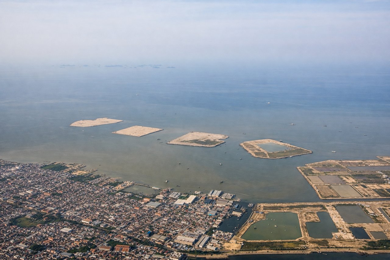
RIGHTCGK typically departs to the west or northwest. Right-side seats offer views of Jakarta's sprawl, the Java Sea coastline, and the transition from urban to open water. Left seats face inland toward the congested city center with less distinctive geography.
Landing at LBJ
LEFTLabuhan Bajo sits on the western tip of Flores. Approach vectors typically come from the north or northeast, making left-side seats ideal for viewing the dramatic volcanic landscape of Flores' western mountains and the Sape Strait. Right seats would face open ocean with less visual interest.
Landmarks on this routeAll landmarks →
Will your flight be in sunlight?
Pick a date and time in the Sun Map to watch the sun move across your whole flight.
About This Route
Which side of the plane should I sit on flying from Soekarno Hatta International (CGK) to Komodo Airport (LBJ)?
Sit on the Left side of the plane for the best views on flights from Jakarta to Labuhan Bajo. While takeoff favors the right for Jakarta's coastal views, the landing approach to Labuhan Bajo—the longer and more visually dramatic segment—strongly favors left seats. The volcanic landscape of Flores and Mount Inerie are the flight's most distinctive geographic features, making left the better overall choice.
What can I see during takeoff from Soekarno Hatta International in Jakarta?
During takeoff from Soekarno Hatta International (CGK), sit on the Right side for the best views. CGK typically departs to the west or northwest. Right-side seats offer views of Jakarta's sprawl, the Java Sea coastline, and the transition from urban to open water. Left seats face inland toward the congested city center with less distinctive geography. Notable sights include: Jakarta's northern coastal districts (Penjaringan, Ancol), Java Sea, Thousand Islands archipelago (Kepulauan Seribu) scattered across the horizon.
What can I see when landing at Komodo Airport in Labuhan Bajo?
When landing at Komodo Airport (LBJ), sit on the Left side for the best views. Labuhan Bajo sits on the western tip of Flores. Approach vectors typically come from the north or northeast, making left-side seats ideal for viewing the dramatic volcanic landscape of Flores' western mountains and the Sape Strait. Right seats would face open ocean with less visual interest. Notable sights include: Mount Inerie (volcanic peak, 2,245 m), Sape Strait, Flores' rugged volcanic terrain, Labuhan Bajo harbor nestled in coastal hills.
How long is the flight from Jakarta to Labuhan Bajo?
The flight from Soekarno Hatta International (CGK) to Komodo Airport (LBJ) takes about 2 hours 15 minutes. The shortest flight path between them is 921 miles (1,483 km); winds and air traffic control usually add a few percent.
What does the Jakarta to Labuhan Bajo flight path pass over?
The flight path crosses the Java Sea heading east-southeast, passing north of the Sunda Strait region. Midway, you'll be over open water with scattered small islands of the Lesser Sunda chain becoming gradually more visible. The transition from the flat Java coastal plain to the increasingly mountainous volcanic terrain of the Lesser Sundas occurs gradually across the flight path. No major landmarks dominate the midpoint, but the water gradually shifts from the shallow Java Sea to deeper Flores Sea waters, and the horizon ahead shows the rising volcanic profile of Flores becoming more pronounced in the final 30 minutes of flight.