While takeoff offers London views, the landing approach into Belfast provides more dramatic and distinctive scenery—Lough Neagh and the drumlin landscape are visually striking and unique to this region. The left side captures the most memorable part of the journey.
Flown LCY to BFS? Did we get it right?
Flight Path
London to Belfast is 339 miles (546 km), a flight of about 1 hour 15 minutes.
The flight path crosses the Irish Sea at roughly 15,000-25,000 feet. At midpoint, you'll be over open water with no major landmarks visible. The Welsh coast (Anglesey and Conwy Bay) may be visible to the left during the crossing if conditions are clear, appearing as a distant coastline with mountains inland. The Mourne Mountains become visible on the right as you approach Northern Ireland's airspace, appearing as a low ridge on the horizon roughly 30 miles south of Belfast.
Great circle distance and headings ›Phase by phase
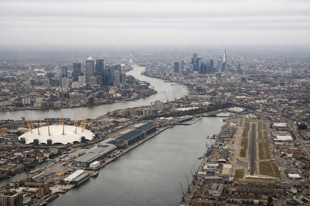
Takeoff from LCY
RIGHTRight-side seats offer views of the Thames estuary and the London skyline as you climb out northwestward. You'll see the river's meanders and the urban sprawl of Greater London receding beneath you.
Landing at BFS
LEFTLeft-side seats provide excellent views during descent into Belfast. You'll see the Lough Neagh (Northern Ireland's largest lake) and the surrounding drumlins landscape, plus the Antrim Plateau to the northeast.
Will your flight be in sunlight?
Pick a date and time in the Sun Map to watch the sun move across your whole flight.
About This Route
Which side of the plane should I sit on flying from City (LCY) to Aldergrove (BFS)?
Sit on the Left side of the plane for the best views on flights from London to Belfast. While takeoff offers London views, the landing approach into Belfast provides more dramatic and distinctive scenery—Lough Neagh and the drumlin landscape are visually striking and unique to this region. The left side captures the most memorable part of the journey.
What can I see during takeoff from City in London?
During takeoff from City (LCY), sit on the Right side for the best views. Right-side seats offer views of the Thames estuary and the London skyline as you climb out northwestward. You'll see the river's meanders and the urban sprawl of Greater London receding beneath you. Notable sights include: River Thames, London city center (recognizable cluster of tall buildings), North Sea coast to the east, Essex countryside.
What can I see when landing at Aldergrove in Belfast?
When landing at Aldergrove (BFS), sit on the Left side for the best views. Left-side seats provide excellent views during descent into Belfast. You'll see the Lough Neagh (Northern Ireland's largest lake) and the surrounding drumlins landscape, plus the Antrim Plateau to the northeast. Notable sights include: Lough Neagh, Antrim Plateau, Belfast Lough, Cave Hill mountain.
How long is the flight from London to Belfast?
The flight from City (LCY) to Aldergrove (BFS) takes about 1 hour 15 minutes. The shortest flight path between them is 339 miles (546 km); winds and air traffic control usually add a few percent.
What does the London to Belfast flight path pass over?
The flight path crosses the Irish Sea at roughly 15,000-25,000 feet. At midpoint, you'll be over open water with no major landmarks visible. The Welsh coast (Anglesey and Conwy Bay) may be visible to the left during the crossing if conditions are clear, appearing as a distant coastline with mountains inland. The Mourne Mountains become visible on the right as you approach Northern Ireland's airspace, appearing as a low ridge on the horizon roughly 30 miles south of Belfast.