Right-side seats capture the most dramatic scenery: the Thames estuary and English coastline on departure, then the Alps and Mediterranean coastline during the long cruise and descent into Sardinia. Left seats offer good landing views but miss the northern European geography.
Flown LCY to CAG? Did we get it right?
Flight Path
London to Cagliari is 951 miles (1,530 km), a flight of about 2 hours 15 minutes.
The flight path crosses the English Channel, then proceeds over northern France (Seine valley visible), continues southeast over the Rhône valley and approaches the Alps from the north. The Alps' snow-capped peaks are visible on the right side during cruise at altitude, particularly Mont Blanc and the higher peaks of the Graian Alps. The flight then descends over the Mediterranean, with the Ligurian coast and eventually Corsica visible before reaching Sardinia. The Tyrrhenian Sea dominates the final approach.
Great circle distance and headings ›


Phase by phase
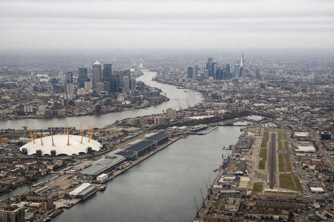
Takeoff from LCY
RIGHTRight-side seats offer views of the Thames estuary and Kent coastline as the aircraft climbs southeastward from City Airport. The river's distinctive meanders and the surrounding marshland are clearly visible during the initial climb.
Landing at CAG
LEFTLeft-side seats provide excellent views of Sardinia's western and southwestern coastline during descent into Cagliari. The Tyrrhenian Sea, coastal cliffs, and the distinctive geography around the Campidano Plain are visible on approach.
Will your flight be in sunlight?
Pick a date and time in the Sun Map to watch the sun move across your whole flight.
About This Route
Which side of the plane should I sit on flying from City (LCY) to Elmas (CAG)?
Sit on the Right side of the plane for the best views on flights from London to Cagliari. Right-side seats capture the most dramatic scenery: the Thames estuary and English coastline on departure, then the Alps and Mediterranean coastline during the long cruise and descent into Sardinia. Left seats offer good landing views but miss the northern European geography.
What can I see during takeoff from City in London?
During takeoff from City (LCY), sit on the Right side for the best views. Right-side seats offer views of the Thames estuary and Kent coastline as the aircraft climbs southeastward from City Airport. The river's distinctive meanders and the surrounding marshland are clearly visible during the initial climb. Notable sights include: River Thames and estuary, Kent coastline, North Sea horizon, Greater London urban sprawl receding northward.
What can I see when landing at Elmas in Cagliari?
When landing at Elmas (CAG), sit on the Left side for the best views. Left-side seats provide excellent views of Sardinia's western and southwestern coastline during descent into Cagliari. The Tyrrhenian Sea, coastal cliffs, and the distinctive geography around the Campidano Plain are visible on approach. Notable sights include: Tyrrhenian Sea, Sardinian coastline with limestone cliffs, Campidano Plain, Cagliari city and harbor.
How long is the flight from London to Cagliari?
The flight from City (LCY) to Elmas (CAG) takes about 2 hours 15 minutes. The shortest flight path between them is 951 miles (1,530 km); winds and air traffic control usually add a few percent.
What does the London to Cagliari flight path pass over?
The flight path crosses the English Channel, then proceeds over northern France (Seine valley visible), continues southeast over the Rhône valley and approaches the Alps from the north. The Alps' snow-capped peaks are visible on the right side during cruise at altitude, particularly Mont Blanc and the higher peaks of the Graian Alps. The flight then descends over the Mediterranean, with the Ligurian coast and eventually Corsica visible before reaching Sardinia. The Tyrrhenian Sea dominates the final approach.