While takeoff offers Thames estuary interest, the landing descent provides the more dramatic and memorable scenery with the High Atlas Mountains. Left side captures this signature feature of the approach.
Flown LCY to RAK? Did we get it right?
Flight Path
London to Marrakech is 1,435 miles (2,310 km), a flight of about 3 hours.
English Channel crossing (visible as water body separating UK from France), Normandy and northern French coastline, Bay of Biscay (if routed westerly), Pyrenees mountains on the Spain-France border (visible as distant peaks if flight path permits), Spanish interior plateau, Portuguese coastline, and finally the transition from coastal plains to the Atlas foothills approaching Morocco
Great circle distance and headings ›


Phase by phase
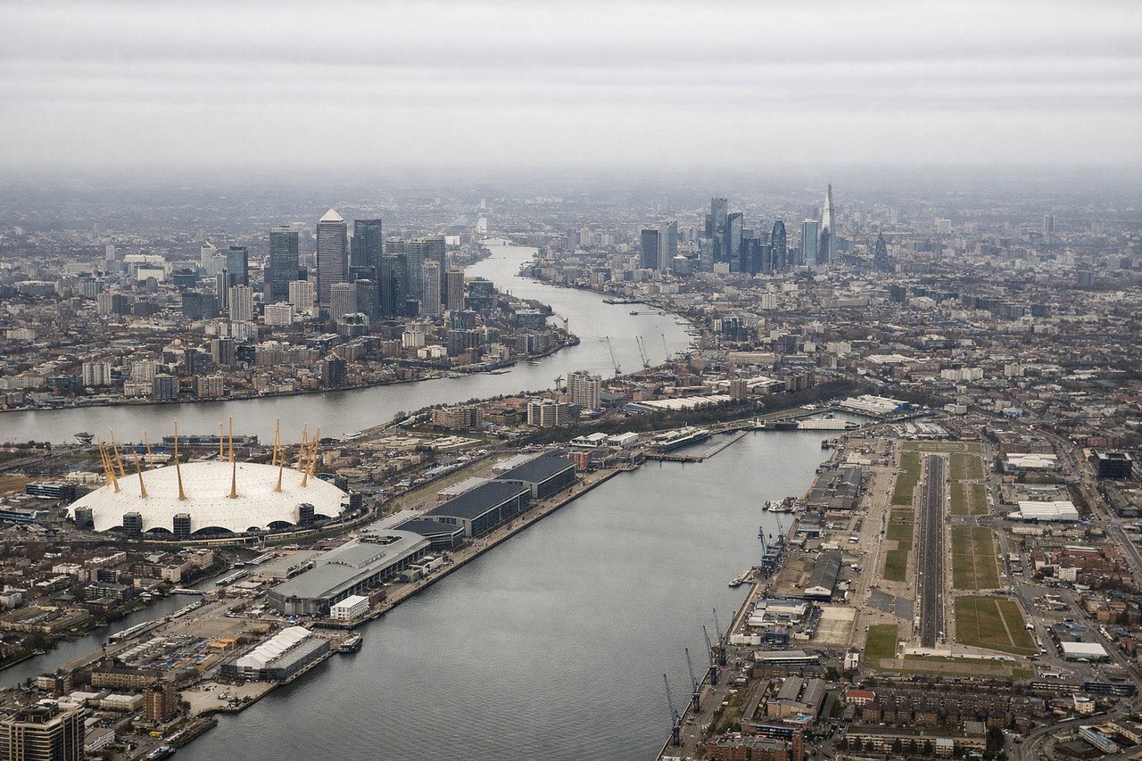
Takeoff from LCY
RIGHTRight side captures the Thames estuary and North Sea coast as you climb out eastward. London City typically departs runways 09/27, and eastbound departures offer immediate views of the river's winding path toward the North Sea.

Landing at RAK
LEFTLeft side provides the best approach views of the Atlas Mountains as you descend into Marrakech. Standard approaches to RAK come from the north, and the High Atlas range rises dramatically to the south of the airport, visible on the left during descent.
Will your flight be in sunlight?
Pick a date and time in the Sun Map to watch the sun move across your whole flight.
About This Route
Which side of the plane should I sit on flying from City (LCY) to Menara (RAK)?
Sit on the Left side of the plane for the best views on flights from London to Marrakech. While takeoff offers Thames estuary interest, the landing descent provides the more dramatic and memorable scenery with the High Atlas Mountains. Left side captures this signature feature of the approach.
What can I see during takeoff from City in London?
During takeoff from City (LCY), sit on the Right side for the best views. Right side captures the Thames estuary and North Sea coast as you climb out eastward. London City typically departs runways 09/27, and eastbound departures offer immediate views of the river's winding path toward the North Sea. Notable sights include: Thames estuary, Canary Wharf and Isle of Dogs, North Sea coast, Essex marshlands.
What can I see when landing at Menara in Marrakech?
When landing at Menara (RAK), sit on the Left side for the best views. Left side provides the best approach views of the Atlas Mountains as you descend into Marrakech. Standard approaches to RAK come from the north, and the High Atlas range rises dramatically to the south of the airport, visible on the left during descent. Notable sights include: High Atlas Mountains, Marrakech medina and city sprawl, Haouz plain, Anti-Atlas foothills.
How long is the flight from London to Marrakech?
The flight from City (LCY) to Menara (RAK) takes about 3 hours. The shortest flight path between them is 1,435 miles (2,310 km); winds and air traffic control usually add a few percent.
What does the London to Marrakech flight path pass over?
English Channel crossing (visible as water body separating UK from France), Normandy and northern French coastline, Bay of Biscay (if routed westerly), Pyrenees mountains on the Spain-France border (visible as distant peaks if flight path permits), Spanish interior plateau, Portuguese coastline, and finally the transition from coastal plains to the Atlas foothills approaching Morocco