Right-side seats offer superior views for the entire journey: London's Thames and urban landmarks during takeoff, then Essex countryside and Stansted's approach during landing. The northeastward flight path favors right-side viewing throughout.
Flown LCY to STN? Did we get it right?
Flight Path
City to Stansted is 27 miles (44 km), a flight of about 15 minutes.
Epping Forest (woodland area visible from altitude), Loughton and Theydon Bois settlements, agricultural Essex landscape with field patterns, River Roding (tributary system), transition from Greater London suburbs to rural Essex
Great circle distance and headings ›Phase by phase
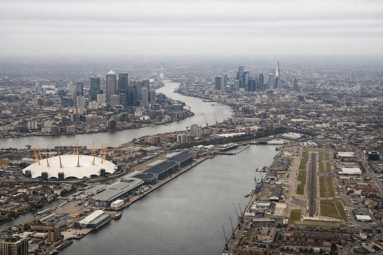
Takeoff from LCY
RIGHTRight-side seats offer views of central London during climb-out, including the Thames winding through the City and Canary Wharf. The northeastward departure path from LCY means right-side passengers see the urban sprawl and river clearly before heading toward Stansted.
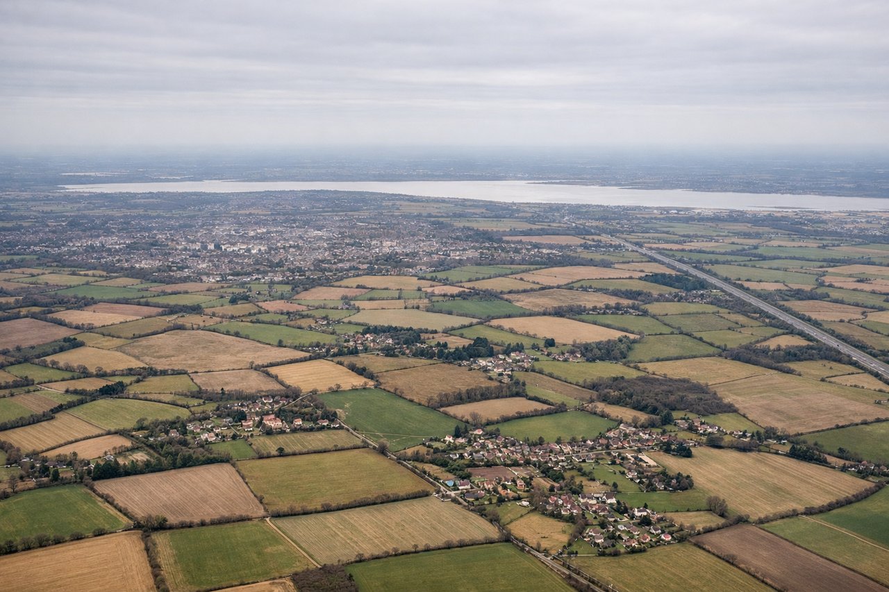
Landing at STN
LEFTLeft-side seats provide views during descent into Stansted, showing the Essex countryside and the distinctive Stansted terminal building. The southwestern approach means left-side passengers see the rural landscape and airport infrastructure clearly.
Will your flight be in sunlight?
Pick a date and time in the Sun Map to watch the sun move across your whole flight.
About This Route
Which side of the plane should I sit on flying from City (LCY) to Stansted (STN)?
Sit on the Right side of the plane for the best views on flights from London to London. Right-side seats offer superior views for the entire journey: London's Thames and urban landmarks during takeoff, then Essex countryside and Stansted's approach during landing. The northeastward flight path favors right-side viewing throughout.
What can I see during takeoff from City in London?
During takeoff from City (LCY), sit on the Right side for the best views. Right-side seats offer views of central London during climb-out, including the Thames winding through the City and Canary Wharf. The northeastward departure path from LCY means right-side passengers see the urban sprawl and river clearly before heading toward Stansted. Notable sights include: River Thames (curving through central London), Canary Wharf (distinctive tall cluster), City of London financial district, Greenwich Peninsula.
What can I see when landing at Stansted in London?
When landing at Stansted (STN), sit on the Left side for the best views. Left-side seats provide views during descent into Stansted, showing the Essex countryside and the distinctive Stansted terminal building. The southwestern approach means left-side passengers see the rural landscape and airport infrastructure clearly. Notable sights include: Essex countryside (agricultural fields and woodland), Stansted Airport terminal (modern white building), River Stort (visible as linear feature), Uttlesford district towns.
How long is the flight from London to London?
The flight from City (LCY) to Stansted (STN) takes about 15 minutes. The shortest flight path between them is 27 miles (44 km); winds and air traffic control usually add a few percent.
What does the London to London flight path pass over?
Epping Forest (woodland area visible from altitude), Loughton and Theydon Bois settlements, agricultural Essex landscape with field patterns, River Roding (tributary system), transition from Greater London suburbs to rural Essex