Both sides score equally at 2.0 due to the short flight duration (1h 15m) over predominantly flat terrain with limited dramatic geography. However, the right side edges ahead for takeoff scenery with the Kentucky River valley and Bluegrass rolling hills providing more visual interest during the initial climb phase. The landing on the left side offers urban Dallas views, but the overall flight lacks the sustained scenic variety needed for a higher score. This route is fundamentally limited by its geography—central Kentucky to north-central Texas crosses the Cumberland Plateau's eastern edge and then flat to gently rolling Great Plains with no mountains, coastlines, or major water features dominating the view.
Flown LEX to DAL? Did we get it right?
Flight Path
Lexington to Dallas is 776 miles (1,249 km), a flight of about 2 hours 15 minutes.
Cumberland Plateau eastern edge near Tennessee border, Tennessee River valley, Mississippi River valley near Memphis, Arkansas Delta flatlands, Red River valley approaching Dallas
Great circle distance and headings ›Phase by phase
Takeoff from LEX
RIGHTRight side captures the Bluegrass region's rolling terrain and the Kentucky River valley during initial climb, offering slightly more topographic variation than the flat western approach. Lexington's urban grid is visible on the right during departure.
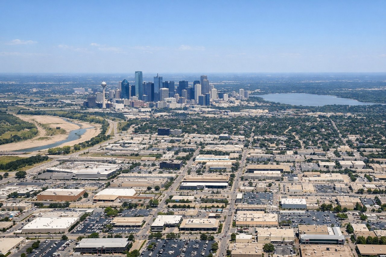
Landing at DAL
LEFTLeft side (north) provides views of the Dallas-Fort Worth metroplex's urban sprawl and the Trinity River during approach to Love Field. The city skyline and suburban development create more visual interest than the southern approach over flat terrain.
Will your flight be in sunlight?
Pick a date and time in the Sun Map to watch the sun move across your whole flight.
About This Route
Which side of the plane should I sit on flying from Blue Grass Airport (LEX) to Dallas Love Fld (DAL)?
Sit on the Right side of the plane for the best views on flights from Lexington to Dallas. Both sides score equally at 2.0 due to the short flight duration (1h 15m) over predominantly flat terrain with limited dramatic geography. However, the right side edges ahead for takeoff scenery with the Kentucky River valley and Bluegrass rolling hills providing more visual interest during the initial climb phase. The landing on the left side offers urban Dallas views, but the overall flight lacks the sustained scenic variety needed for a higher score. This route is fundamentally limited by its geography—central Kentucky to north-central Texas crosses the Cumberland Plateau's eastern edge and then flat to gently rolling Great Plains with no mountains, coastlines, or major water features dominating the view.
What can I see during takeoff from Blue Grass Airport in Lexington?
During takeoff from Blue Grass Airport (LEX), sit on the Right side for the best views. Right side captures the Bluegrass region's rolling terrain and the Kentucky River valley during initial climb, offering slightly more topographic variation than the flat western approach. Lexington's urban grid is visible on the right during departure. Notable sights include: Kentucky River valley, Lexington urban area, rolling Bluegrass hills, Fayette County farmland.
What can I see when landing at Dallas Love Fld in Dallas?
When landing at Dallas Love Fld (DAL), sit on the Left side for the best views. Left side (north) provides views of the Dallas-Fort Worth metroplex's urban sprawl and the Trinity River during approach to Love Field. The city skyline and suburban development create more visual interest than the southern approach over flat terrain. Notable sights include: Dallas downtown skyline, Trinity River, Dallas-Fort Worth urban sprawl, Love Field airport complex.
How long is the flight from Lexington to Dallas?
The flight from Blue Grass Airport (LEX) to Dallas Love Fld (DAL) takes about 2 hours 15 minutes. The shortest flight path between them is 776 miles (1,249 km); winds and air traffic control usually add a few percent.
What does the Lexington to Dallas flight path pass over?
Cumberland Plateau eastern edge near Tennessee border, Tennessee River valley, Mississippi River valley near Memphis, Arkansas Delta flatlands, Red River valley approaching Dallas