The left side wins both ends of this flight. During climb-out you get the spectacular Atchafalaya Basin wetlands, and on approach into Atlanta you pick up the city skyline and Stone Mountain. The right side offers little of comparable interest at either end.
Flown LFT to ATL? Did we get it right?
Flight Path
Lafayette to Atlanta is 503 miles (809 km), a flight of about 1 hour 20 minutes.
The flight tracks northeast over the Mississippi coastal plain, crossing the Pearl River and then into Mississippi and Alabama. You pass over the rolling pine forests of central Mississippi and Alabama, the Black Belt agricultural region, and the transition into the Georgia Piedmont. No major mountain ranges or large water bodies cross the direct route, though the Tennessee River system is visible to the north if the flight tracks that way.
Great circle distance and headings ›

Phase by phase
Takeoff from LFT
LEFTLafayette Regional typically departs runway 11 (eastbound), so the left (north) side gives you a view back over the Atchafalaya Basin and its sprawling wetlands and bayous as you climb out. The right side faces south toward open agricultural flatlands with less visual interest.
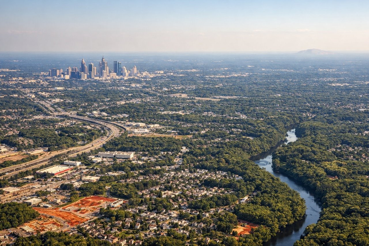
Landing at ATL
LEFTAtlanta Hartsfield typically lands traffic from the west on runways 26L/26R or 27L/27R, meaning the approach comes from the east side of the city. On a northeast-to-southwest approach, the left side faces southeast toward downtown Atlanta's skyline and Stone Mountain in the distance. The right side looks toward the southern suburbs with less distinctive geography.
Will your flight be in sunlight?
Pick a date and time in the Sun Map to watch the sun move across your whole flight.
About This Route
Which side of the plane should I sit on flying from Lafayette Rgnl (LFT) to The William B Hartsfield Atlanta International (ATL)?
Sit on the Left side of the plane for the best views on flights from Lafayette to Atlanta. The left side wins both ends of this flight. During climb-out you get the spectacular Atchafalaya Basin wetlands, and on approach into Atlanta you pick up the city skyline and Stone Mountain. The right side offers little of comparable interest at either end.
What can I see during takeoff from Lafayette Rgnl in Lafayette?
During takeoff from Lafayette Rgnl (LFT), sit on the Left side for the best views. Lafayette Regional typically departs runway 11 (eastbound), so the left (north) side gives you a view back over the Atchafalaya Basin and its sprawling wetlands and bayous as you climb out. The right side faces south toward open agricultural flatlands with less visual interest. Notable sights include: Atchafalaya Basin wetlands, Vermilion Bay in the far distance, Interstate 10 corridor cutting east-west, Bayou Teche drainage patterns.
What can I see when landing at The William B Hartsfield Atlanta International in Atlanta?
When landing at The William B Hartsfield Atlanta International (ATL), sit on the Left side for the best views. Atlanta Hartsfield typically lands traffic from the west on runways 26L/26R or 27L/27R, meaning the approach comes from the east side of the city. On a northeast-to-southwest approach, the left side faces southeast toward downtown Atlanta's skyline and Stone Mountain in the distance. The right side looks toward the southern suburbs with less distinctive geography. Notable sights include: Downtown Atlanta skyline, Stone Mountain (granite dome visible to the northeast), Chattahoochee River corridor, Lake Lanier on the distant northern horizon.
How long is the flight from Lafayette to Atlanta?
The flight from Lafayette Rgnl (LFT) to The William B Hartsfield Atlanta International (ATL) takes about 1 hour 20 minutes. The shortest flight path between them is 503 miles (809 km); winds and air traffic control usually add a few percent.
What does the Lafayette to Atlanta flight path pass over?
The flight tracks northeast over the Mississippi coastal plain, crossing the Pearl River and then into Mississippi and Alabama. You pass over the rolling pine forests of central Mississippi and Alabama, the Black Belt agricultural region, and the transition into the Georgia Piedmont. No major mountain ranges or large water bodies cross the direct route, though the Tennessee River system is visible to the north if the flight tracks that way.