While the takeoff offers urban scenery, the landing descent provides the most dramatic and sustained scenic value. The Rocky Mountains dominate the final 90 minutes of flight, with the Continental Divide and surrounding peaks offering genuine alpine scenery that defines this route.
Flown LGA to BTM? Did we get it right?
Flight Path
New York to Butte is 1,953 miles (3,143 km), a flight of about 4 hours 45 minutes.
Pennsylvania Appalachian ridges and valleys (first 90 minutes), Ohio River basin, Great Lakes region (Michigan/Wisconsin), transition into Great Plains around Illinois-Iowa border, Missouri River valley in Iowa, then increasingly mountainous terrain as you approach the Rockies in Montana. The Beartooth Range and Gallatin Range become visible in the final approach phase.
Great circle distance and headings ›


Phase by phase
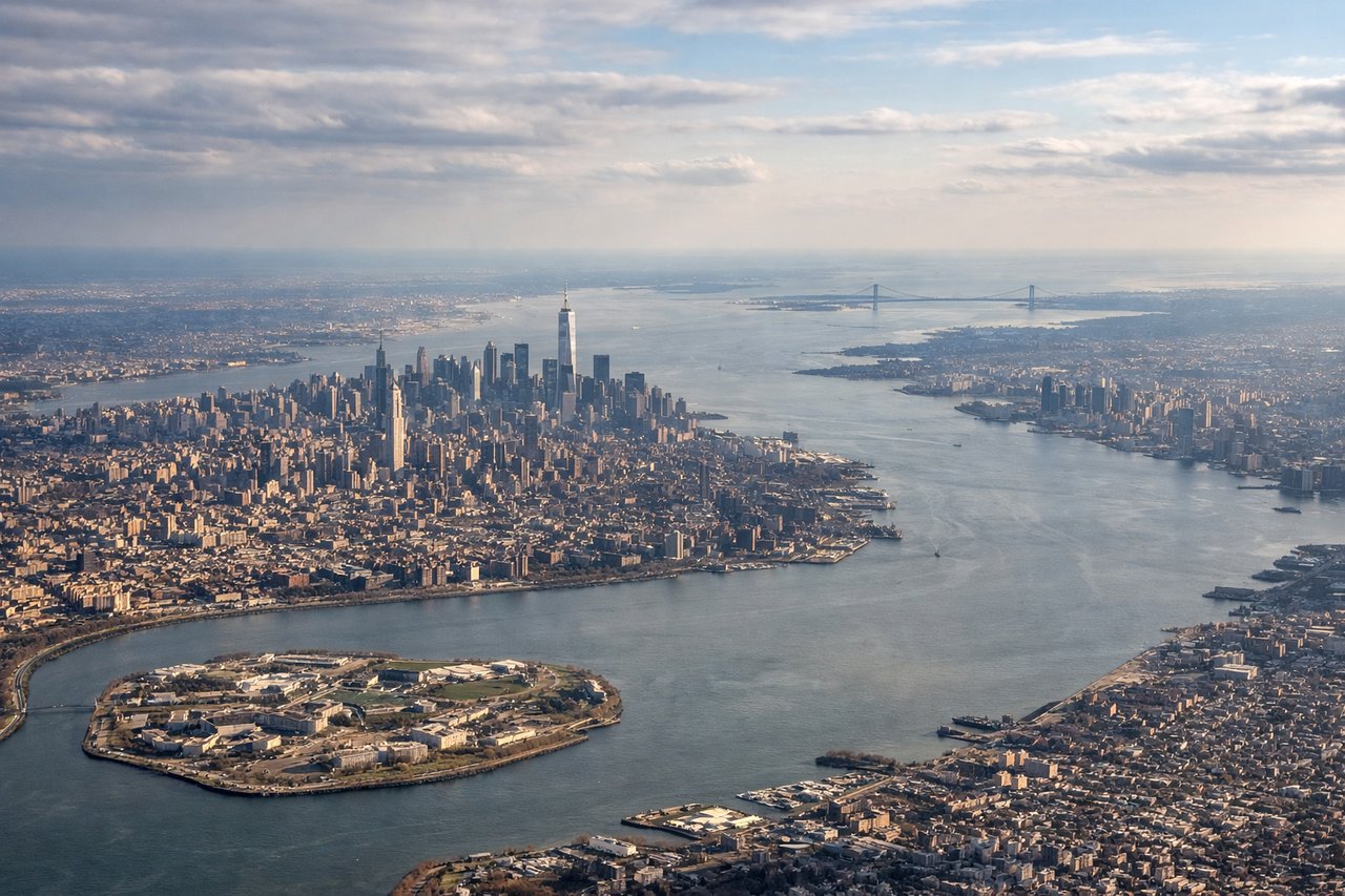
Takeoff from LGA
LEFTLeft side offers views of the Hudson River and Manhattan's grid as you climb out westbound. You'll see the East River, Upper New York Bay, and the urban sprawl of the outer boroughs receding beneath you.
Landing at BTM
RIGHTRight side provides excellent views of the Rocky Mountains as you descend into Butte. The Continental Divide and surrounding peaks become increasingly prominent, and you'll see the high-elevation terrain that defines southwestern Montana.
Will your flight be in sunlight?
Pick a date and time in the Sun Map to watch the sun move across your whole flight.
About This Route
Which side of the plane should I sit on flying from La Guardia (LGA) to Bert Mooney Airport (BTM)?
Sit on the Right side of the plane for the best views on flights from New York to Butte. While the takeoff offers urban scenery, the landing descent provides the most dramatic and sustained scenic value. The Rocky Mountains dominate the final 90 minutes of flight, with the Continental Divide and surrounding peaks offering genuine alpine scenery that defines this route.
What can I see during takeoff from La Guardia in New York?
During takeoff from La Guardia (LGA), sit on the Left side for the best views. Left side offers views of the Hudson River and Manhattan's grid as you climb out westbound. You'll see the East River, Upper New York Bay, and the urban sprawl of the outer boroughs receding beneath you. Notable sights include: Hudson River, Manhattan skyline, Upper New York Bay, New Jersey Palisades.
What can I see when landing at Bert Mooney Airport in Butte?
When landing at Bert Mooney Airport (BTM), sit on the Right side for the best views. Right side provides excellent views of the Rocky Mountains as you descend into Butte. The Continental Divide and surrounding peaks become increasingly prominent, and you'll see the high-elevation terrain that defines southwestern Montana. Notable sights include: Rocky Mountains (Continental Divide), Butte Hill, Deer Lodge Valley, Anaconda Range.
How long is the flight from New York to Butte?
The flight from La Guardia (LGA) to Bert Mooney Airport (BTM) takes about 4 hours 45 minutes. The shortest flight path between them is 1,953 miles (3,143 km); winds and air traffic control usually add a few percent.
What does the New York to Butte flight path pass over?
Pennsylvania Appalachian ridges and valleys (first 90 minutes), Ohio River basin, Great Lakes region (Michigan/Wisconsin), transition into Great Plains around Illinois-Iowa border, Missouri River valley in Iowa, then increasingly mountainous terrain as you approach the Rockies in Montana. The Beartooth Range and Gallatin Range become visible in the final approach phase.