Left side scores higher due to the exceptional NYC departure sequence (Manhattan skyline, East River, urban density) combined with the 9+ hour cruise phase over the Atlantic and South American interior, which offers moderate variety. Right side's Andes landing approach is dramatic but cannot overcome the monotony of the Atlantic crossing and the relatively flat approach path over the Santiago basin. Left captures more total visual interest across the full flight duration.
Flown LGA to SCL? Did we get it right?
Flight Path
New York to Santiago is 5,128 miles (8,253 km), a flight of about 9 hours 15 minutes.
Atlantic Ocean (5+ hours of open water with occasional cloud formations), Brazilian coast near Recife or Salvador (if visible during daylight), Amazon River basin (subtle green coloration at altitude), Bolivian highlands and altiplano, Atacama Desert (northern Chile, visible as tan/brown terrain), transition to Andes foothills approaching SCL
Great circle distance and headings ›Phase by phase

Takeoff from LGA
LEFTLeft side captures the East River, Manhattan skyline, and Queens during the initial climb-out on runway 22 (northeast heading). Right side faces the residential areas of Queens and Long Island with minimal urban drama.
Landing at SCL
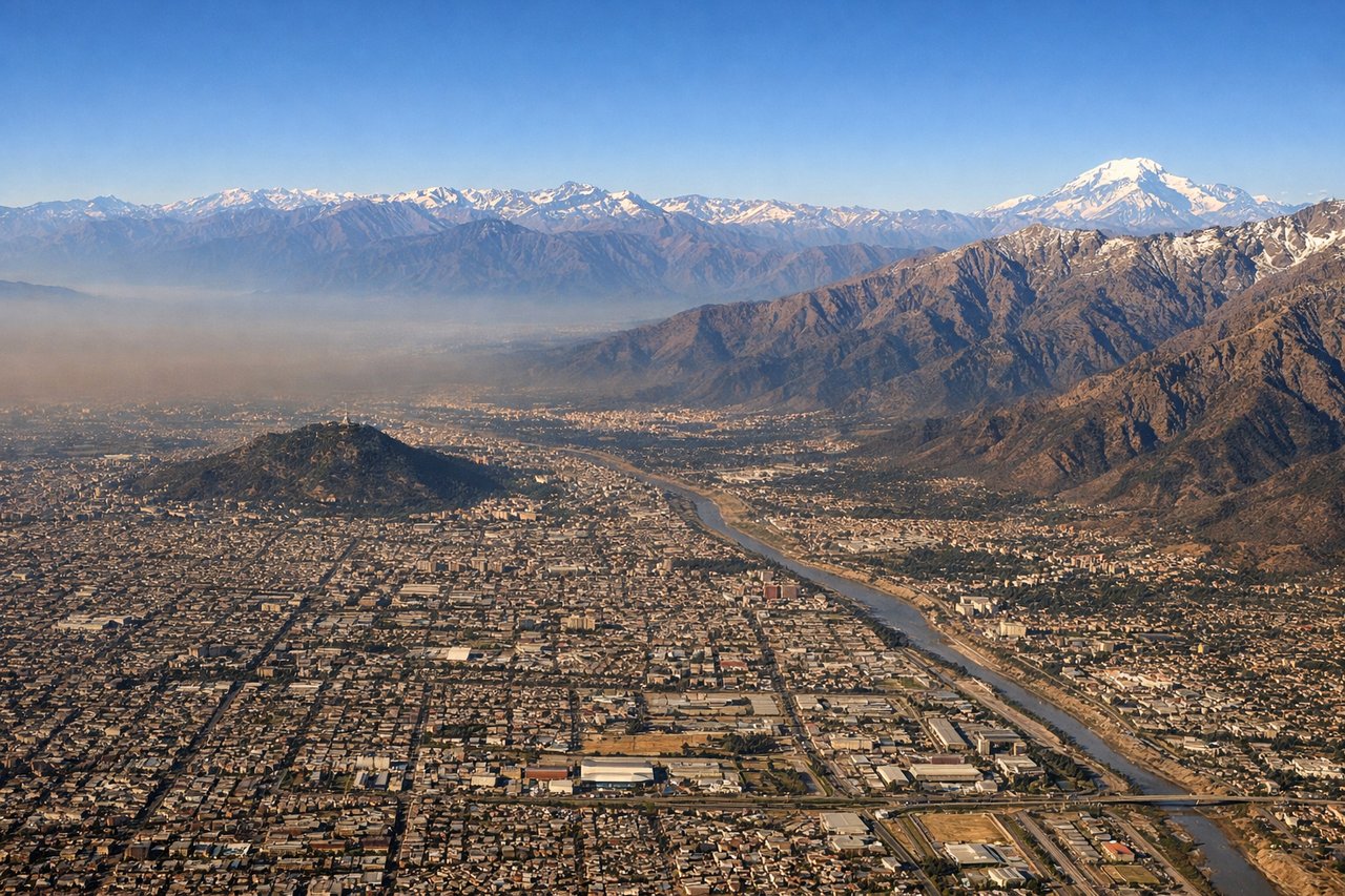
RIGHTRight side offers the dramatic Andes approach during descent into SCL. The cordillera dominates the eastern horizon as the aircraft descends from the north on runway 17, with snow-capped peaks and the high-altitude terrain of central Chile providing striking visual contrast to the flat Santiago basin.
Will your flight be in sunlight?
Pick a date and time in the Sun Map to watch the sun move across your whole flight.
About This Route
Which side of the plane should I sit on flying from La Guardia (LGA) to Arturo Merino Benitez International (SCL)?
Sit on the Left side of the plane for the best views on flights from New York to Santiago. Left side scores higher due to the exceptional NYC departure sequence (Manhattan skyline, East River, urban density) combined with the 9+ hour cruise phase over the Atlantic and South American interior, which offers moderate variety. Right side's Andes landing approach is dramatic but cannot overcome the monotony of the Atlantic crossing and the relatively flat approach path over the Santiago basin. Left captures more total visual interest across the full flight duration.
What can I see during takeoff from La Guardia in New York?
During takeoff from La Guardia (LGA), sit on the Left side for the best views. Left side captures the East River, Manhattan skyline, and Queens during the initial climb-out on runway 22 (northeast heading). Right side faces the residential areas of Queens and Long Island with minimal urban drama. Notable sights include: East River, Manhattan skyline (Empire State Building, Chrysler Building visible at altitude), Flushing Bay, Queens neighborhoods.
What can I see when landing at Arturo Merino Benitez International in Santiago?
When landing at Arturo Merino Benitez International (SCL), sit on the Right side for the best views. Right side offers the dramatic Andes approach during descent into SCL. The cordillera dominates the eastern horizon as the aircraft descends from the north on runway 17, with snow-capped peaks and the high-altitude terrain of central Chile providing striking visual contrast to the flat Santiago basin. Notable sights include: Andes Mountains (Cordillera Central), snow-capped peaks above 13,000 feet, Santiago urban sprawl in the basin, Maipo River valley.
How long is the flight from New York to Santiago?
The flight from La Guardia (LGA) to Arturo Merino Benitez International (SCL) takes about 9 hours 15 minutes. The shortest flight path between them is 5,128 miles (8,253 km); winds and air traffic control usually add a few percent.
What does the New York to Santiago flight path pass over?
Atlantic Ocean (5+ hours of open water with occasional cloud formations), Brazilian coast near Recife or Salvador (if visible during daylight), Amazon River basin (subtle green coloration at altitude), Bolivian highlands and altiplano, Atacama Desert (northern Chile, visible as tan/brown terrain), transition to Andes foothills approaching SCL