Left side scores higher due to superior scenic variety across the full flight. Takeoff offers the dramatic Port of Long Beach and LA skyline; cruise provides views of the California coast, Sierra Nevada foothills, and the transition to Oregon's volcanic landscape; landing features the Columbia River Gorge and Mount Hood—one of the Pacific Northwest's most visually distinctive landmarks. Right side offers less dramatic terrain throughout, with primarily suburban sprawl, agricultural valleys, and fewer recognizable geographic features.
Flown LGB to PDX? Did we get it right?
Flight Path
Long Beach to Portland is 847 miles (1,363 km), a flight of about 2 hours 15 minutes.
California Central Valley agricultural plains, Sierra Nevada foothills to the east, Cascade Range volcanic peaks (Mount Shasta, Mount Lassen visible on clear days), transition from California's interior to Oregon's Willamette Valley, Cascade Range crest near the Oregon-California border
Great circle distance and headings ›


Phase by phase
Takeoff from LGB
LEFTLeft side captures Long Beach Harbor, the Port of Long Beach container terminals, and the Los Angeles metropolitan sprawl during the initial northwest climb on runway 30. The harbor and urban density provide immediate visual interest before the noise abatement turn.
Landing at PDX
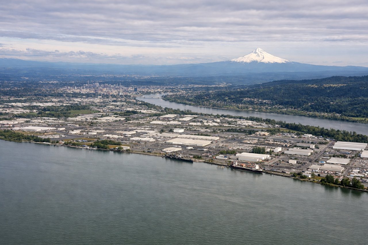
LEFTLeft side (north) provides views of the Columbia River, the Columbia River Gorge's dramatic basalt cliffs, and Mount Hood during the descent and approach to PDX. The gorge is a striking geological feature visible from altitude, and Mount Hood's snow-capped peak is often visible on clear days during the final approach.
Will your flight be in sunlight?
Pick a date and time in the Sun Map to watch the sun move across your whole flight.
About This Route
Which side of the plane should I sit on flying from Long Beach (LGB) to Portland International (PDX)?
Sit on the Left side of the plane for the best views on flights from Long Beach to Portland. Left side scores higher due to superior scenic variety across the full flight. Takeoff offers the dramatic Port of Long Beach and LA skyline; cruise provides views of the California coast, Sierra Nevada foothills, and the transition to Oregon's volcanic landscape; landing features the Columbia River Gorge and Mount Hood—one of the Pacific Northwest's most visually distinctive landmarks. Right side offers less dramatic terrain throughout, with primarily suburban sprawl, agricultural valleys, and fewer recognizable geographic features.
What can I see during takeoff from Long Beach in Long Beach?
During takeoff from Long Beach (LGB), sit on the Left side for the best views. Left side captures Long Beach Harbor, the Port of Long Beach container terminals, and the Los Angeles metropolitan sprawl during the initial northwest climb on runway 30. The harbor and urban density provide immediate visual interest before the noise abatement turn. Notable sights include: Long Beach Harbor with container ships, Los Angeles downtown skyline to the north, San Pedro Bay, Catalina Island visible to the south.
What can I see when landing at Portland International in Portland?
When landing at Portland International (PDX), sit on the Left side for the best views. Left side (north) provides views of the Columbia River, the Columbia River Gorge's dramatic basalt cliffs, and Mount Hood during the descent and approach to PDX. The gorge is a striking geological feature visible from altitude, and Mount Hood's snow-capped peak is often visible on clear days during the final approach. Notable sights include: Columbia River Gorge with basalt walls, Mount Hood (11,240 ft) to the southeast, Columbia River itself, Portland metropolitan area sprawl.
How long is the flight from Long Beach to Portland?
The flight from Long Beach (LGB) to Portland International (PDX) takes about 2 hours 15 minutes. The shortest flight path between them is 847 miles (1,363 km); winds and air traffic control usually add a few percent.
What does the Long Beach to Portland flight path pass over?
California Central Valley agricultural plains, Sierra Nevada foothills to the east, Cascade Range volcanic peaks (Mount Shasta, Mount Lassen visible on clear days), transition from California's interior to Oregon's Willamette Valley, Cascade Range crest near the Oregon-California border