Right-side seats win overall because the departure view over the Andes escarpment and Pacific transition is more dramatic and geographically distinctive than the landing approach. While left seats offer good Santiago valley views on descent, the takeoff panorama of coastal desert meeting high mountains is the flight's most visually striking segment.
Flown LIM to SCL? Did we get it right?
Flight Path
Lima to Santiago is 1,530 miles (2,462 km), a flight of about 4 hours 15 minutes.
The flight path crosses the Atacama Desert (world's driest non-polar region), visible as an almost featureless tan expanse at cruise altitude. The Andes cordillera runs parallel to the route on the east throughout the flight, with peaks visible on clear days. The Chilean coast remains visible intermittently on the western horizon. No major cities are directly overflown in the midpoint; the route passes over sparsely populated desert and mountain terrain.
Great circle distance and headings ›

Phase by phase

Takeoff from LIM
RIGHTRight-side seats capture the dramatic climb-out over the Pacific coastal plain and the Andes escarpment rising inland. LIM typically departs on runway 03 (northbound) or 21 (southbound); either direction banks right during initial climb, exposing the western cordillera and the transition from coastal desert to mountain terrain.
Landing at SCL
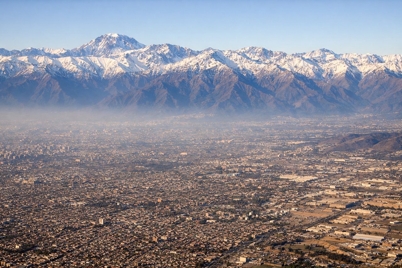
LEFTLeft-side seats offer the best views during descent into SCL. The approach typically comes from the north over the central Chilean valley, and left-side seats face the Andes cordillera to the east and the sprawling Santiago metropolitan area. The descent path provides extended views of the valley floor and mountain backdrop.
Will your flight be in sunlight?
Pick a date and time in the Sun Map to watch the sun move across your whole flight.
About This Route
Which side of the plane should I sit on flying from Jorge Chávez International Airport (LIM) to Arturo Merino Benitez International (SCL)?
Sit on the Right side of the plane for the best views on flights from Lima to Santiago. Right-side seats win overall because the departure view over the Andes escarpment and Pacific transition is more dramatic and geographically distinctive than the landing approach. While left seats offer good Santiago valley views on descent, the takeoff panorama of coastal desert meeting high mountains is the flight's most visually striking segment.
What can I see during takeoff from Jorge Chávez International Airport in Lima?
During takeoff from Jorge Chávez International Airport (LIM), sit on the Right side for the best views. Right-side seats capture the dramatic climb-out over the Pacific coastal plain and the Andes escarpment rising inland. LIM typically departs on runway 03 (northbound) or 21 (southbound); either direction banks right during initial climb, exposing the western cordillera and the transition from coastal desert to mountain terrain. Notable sights include: Pacific Ocean (immediate west), Lima urban sprawl (south and southeast), Andes foothills (east and northeast), Callao port district (southwest).
What can I see when landing at Arturo Merino Benitez International in Santiago?
When landing at Arturo Merino Benitez International (SCL), sit on the Left side for the best views. Left-side seats offer the best views during descent into SCL. The approach typically comes from the north over the central Chilean valley, and left-side seats face the Andes cordillera to the east and the sprawling Santiago metropolitan area. The descent path provides extended views of the valley floor and mountain backdrop. Notable sights include: Andes cordillera (east), Santiago metropolitan area (center and south), Maipo River valley (south), Cerro San Cristóbal (north of city center).
How long is the flight from Lima to Santiago?
The flight from Jorge Chávez International Airport (LIM) to Arturo Merino Benitez International (SCL) takes about 4 hours 15 minutes. The shortest flight path between them is 1,530 miles (2,462 km); winds and air traffic control usually add a few percent.
What does the Lima to Santiago flight path pass over?
The flight path crosses the Atacama Desert (world's driest non-polar region), visible as an almost featureless tan expanse at cruise altitude. The Andes cordillera runs parallel to the route on the east throughout the flight, with peaks visible on clear days. The Chilean coast remains visible intermittently on the western horizon. No major cities are directly overflown in the midpoint; the route passes over sparsely populated desert and mountain terrain.