Left side wins at both ends of the flight. Departing Lima it captures the spectacular Andes wall rising from the Pacific coastal desert, and arriving into Chicago it faces the lakefront skyline and Lake Michigan. The right side offers the open Pacific on departure and featureless suburban sprawl on arrival.
Flown LIM to ORD? Did we get it right?
Flight Path
Lima to Chicago is 3,794 miles (6,105 km), a flight of about 9 hours.
The route tracks northward over the Pacific coast of South America, crossing Ecuador and Colombia before entering Central America over Panama and Costa Rica. It then crosses the Caribbean Sea, the Yucatan Peninsula of Mexico, the Gulf of Mexico, and enters the US over Texas or Louisiana before crossing the Mississippi River valley and the flat agricultural plains of the Midwest toward Chicago. The Amazon basin may be briefly visible on the eastern horizon early in the flight, and the Gulf of Mexico coastline is a notable waypoint roughly two-thirds through the journey.
Great circle distance and headings ›


Phase by phase
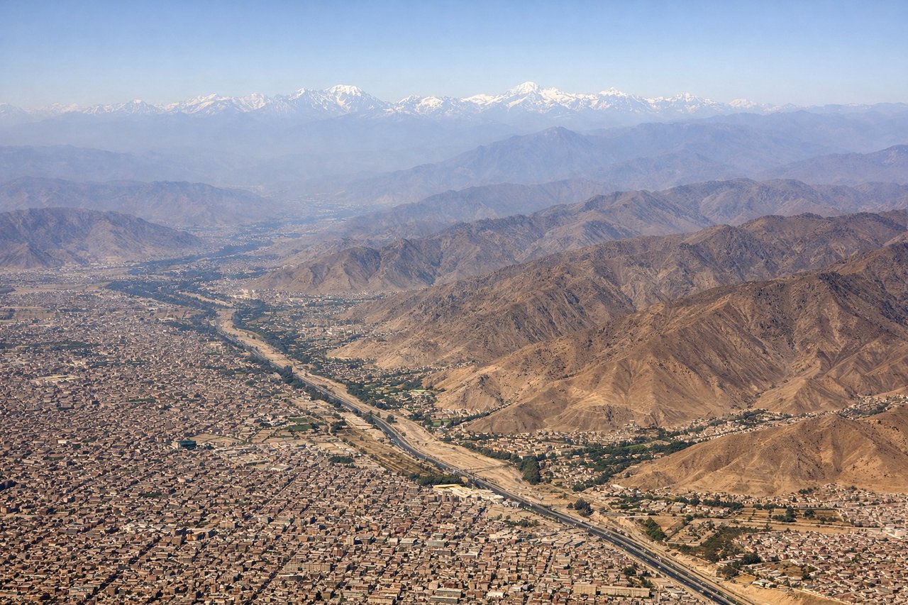
Takeoff from LIM
LEFTJorge Chavez typically departs on runway 15 heading southeast or runway 33 heading northwest. On the dominant northbound departures toward the US, the left side faces east toward the Andes. The Andes rise dramatically from the coastal desert just 30-40 miles inland, with peaks exceeding 18,000 feet visible on clear mornings.
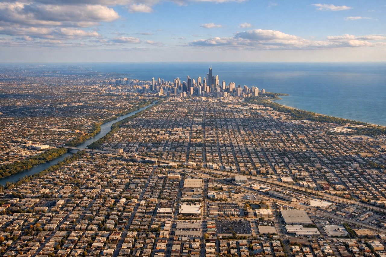
Landing at ORD
LEFTO'Hare predominantly uses runways oriented east-west and northwest-southeast. On typical westerly approaches from the east or southeast, the left side faces south over Chicago's lakefront and downtown skyline. Lake Michigan's western shoreline and the dense downtown grid are clearly visible on approach.
Will your flight be in sunlight?
Pick a date and time in the Sun Map to watch the sun move across your whole flight.
About This Route
Which side of the plane should I sit on flying from Jorge Chávez International Airport (LIM) to Chicago Ohare International (ORD)?
Sit on the Left side of the plane for the best views on flights from Lima to Chicago. Left side wins at both ends of the flight. Departing Lima it captures the spectacular Andes wall rising from the Pacific coastal desert, and arriving into Chicago it faces the lakefront skyline and Lake Michigan. The right side offers the open Pacific on departure and featureless suburban sprawl on arrival.
What can I see during takeoff from Jorge Chávez International Airport in Lima?
During takeoff from Jorge Chávez International Airport (LIM), sit on the Left side for the best views. Jorge Chavez typically departs on runway 15 heading southeast or runway 33 heading northwest. On the dominant northbound departures toward the US, the left side faces east toward the Andes. The Andes rise dramatically from the coastal desert just 30-40 miles inland, with peaks exceeding 18,000 feet visible on clear mornings. Notable sights include: Andes cordillera rising from the coastal desert, Lima's urban sprawl across the flat coastal plain, Pacific Ocean coastline and Callao port district, Rio Rimac valley cutting into the foothills.
What can I see when landing at Chicago Ohare International in Chicago?
When landing at Chicago Ohare International (ORD), sit on the Left side for the best views. O'Hare predominantly uses runways oriented east-west and northwest-southeast. On typical westerly approaches from the east or southeast, the left side faces south over Chicago's lakefront and downtown skyline. Lake Michigan's western shoreline and the dense downtown grid are clearly visible on approach. Notable sights include: Lake Michigan western shoreline, Chicago downtown skyline including Willis Tower, Grant Park and Museum Campus along the lakefront, suburban grid of Cook County.
How long is the flight from Lima to Chicago?
The flight from Jorge Chávez International Airport (LIM) to Chicago Ohare International (ORD) takes about 9 hours. The shortest flight path between them is 3,794 miles (6,105 km); winds and air traffic control usually add a few percent.
What does the Lima to Chicago flight path pass over?
The route tracks northward over the Pacific coast of South America, crossing Ecuador and Colombia before entering Central America over Panama and Costa Rica. It then crosses the Caribbean Sea, the Yucatan Peninsula of Mexico, the Gulf of Mexico, and enters the US over Texas or Louisiana before crossing the Mississippi River valley and the flat agricultural plains of the Midwest toward Chicago. The Amazon basin may be briefly visible on the eastern horizon early in the flight, and the Gulf of Mexico coastline is a notable waypoint roughly two-thirds through the journey.