The takeoff from Liberia offers more dramatic and distinctive scenery with the Guanacaste mountains and Pacific coastline. While the landing into D.C. is historically significant, the departure provides more varied natural terrain and clearer visual landmarks throughout the climb phase.
Flown LIR to DCA? Did we get it right?
Flight Path
Liberia to Washington is 2,022 miles (3,254 km), a flight of about 5 hours 15 minutes.
Gulf of Mexico coastline (Texas and Louisiana), Mississippi River delta region, Appalachian foothills (eastern Tennessee/Kentucky), Ohio River valley
Great circle distance and headings ›

Phase by phase
Takeoff from LIR
RIGHTRight-side seats offer views of the Guanacaste mountain range and the Pacific coastline as the aircraft climbs northeastward from Liberia. The terrain rises dramatically to the southeast, creating a striking visual contrast with the coastal plains below.
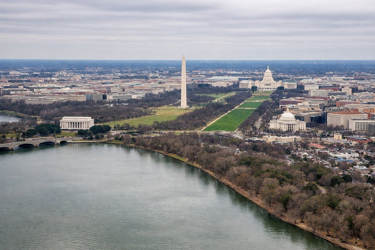
Landing at DCA
LEFTLeft-side seats provide excellent views of the Potomac River, the National Mall, and central Washington D.C. landmarks during the final approach into Reagan National. The aircraft descends over the river corridor, offering a direct perspective of the city's monumental core.
Will your flight be in sunlight?
Pick a date and time in the Sun Map to watch the sun move across your whole flight.
About This Route
Which side of the plane should I sit on flying from Daniel Oduber Quiros International (LIR) to Ronald Reagan Washington National (DCA)?
Sit on the Right side of the plane for the best views on flights from Liberia to Washington. The takeoff from Liberia offers more dramatic and distinctive scenery with the Guanacaste mountains and Pacific coastline. While the landing into D.C. is historically significant, the departure provides more varied natural terrain and clearer visual landmarks throughout the climb phase.
What can I see during takeoff from Daniel Oduber Quiros International in Liberia?
During takeoff from Daniel Oduber Quiros International (LIR), sit on the Right side for the best views. Right-side seats offer views of the Guanacaste mountain range and the Pacific coastline as the aircraft climbs northeastward from Liberia. The terrain rises dramatically to the southeast, creating a striking visual contrast with the coastal plains below. Notable sights include: Guanacaste mountain range, Pacific Ocean coastline, Lake Arenal (visible on clear days during climb), Nicoya Peninsula.
What can I see when landing at Ronald Reagan Washington National in Washington?
When landing at Ronald Reagan Washington National (DCA), sit on the Left side for the best views. Left-side seats provide excellent views of the Potomac River, the National Mall, and central Washington D.C. landmarks during the final approach into Reagan National. The aircraft descends over the river corridor, offering a direct perspective of the city's monumental core. Notable sights include: Potomac River, National Mall (Lincoln Memorial to Capitol Building axis), Arlington National Cemetery, Anacostia River confluence.
How long is the flight from Liberia to Washington?
The flight from Daniel Oduber Quiros International (LIR) to Ronald Reagan Washington National (DCA) takes about 5 hours 15 minutes. The shortest flight path between them is 2,022 miles (3,254 km); winds and air traffic control usually add a few percent.
What does the Liberia to Washington flight path pass over?
Gulf of Mexico coastline (Texas and Louisiana), Mississippi River delta region, Appalachian foothills (eastern Tennessee/Kentucky), Ohio River valley