Right-side seats dominate both segments—Pacific Ocean and mountain views on departure, then the Mississippi River system and Minneapolis skyline on arrival. This provides the most continuous and dramatic geography throughout the flight.
Flown LIR to MSP? Did we get it right?
Flight Path
Liberia to Minneapolis is 2,413 miles (3,883 km), a flight of about 5 hours.
The flight path crosses the Gulf of Mexico (visible as open water for roughly 2-3 hours of flight), with the Yucatan Peninsula passing to the left (east) around the 2-hour mark. The flight then crosses into the southern United States, with the Texas coastline and Louisiana bayou regions visible around 3 hours into the flight. The Mississippi River valley becomes prominent in the final 90 minutes as you approach Minnesota, with the river's characteristic meanders visible from altitude.
Great circle distance and headings ›
Phase by phase
Takeoff from LIR
RIGHTLIR typically departs to the west or northwest. Right-side seats offer views of the Guanacaste Province coastline and the Pacific Ocean immediately after climb-out, with the Cordillera de Guanacaste mountain range visible inland to the southeast.
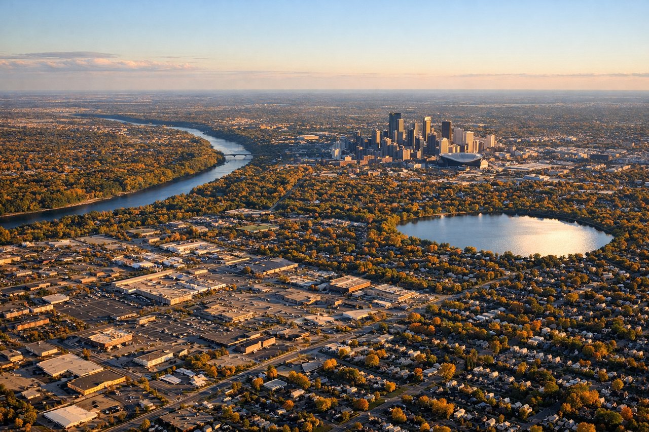
Landing at MSP
RIGHTMSP typically lands from the south or southeast on runways 04R/04L or 22L/22R depending on wind. Right-side seats during approach from the south provide views of the Minnesota River valley, the Mississippi River confluence, and downtown Minneapolis skyline as you descend into the metro area.
Will your flight be in sunlight?
Pick a date and time in the Sun Map to watch the sun move across your whole flight.
About This Route
Which side of the plane should I sit on flying from Daniel Oduber Quiros International (LIR) to Minneapolis St Paul International (MSP)?
Sit on the Right side of the plane for the best views on flights from Liberia to Minneapolis. Right-side seats dominate both segments—Pacific Ocean and mountain views on departure, then the Mississippi River system and Minneapolis skyline on arrival. This provides the most continuous and dramatic geography throughout the flight.
What can I see during takeoff from Daniel Oduber Quiros International in Liberia?
During takeoff from Daniel Oduber Quiros International (LIR), sit on the Right side for the best views. LIR typically departs to the west or northwest. Right-side seats offer views of the Guanacaste Province coastline and the Pacific Ocean immediately after climb-out, with the Cordillera de Guanacaste mountain range visible inland to the southeast. Notable sights include: Pacific Ocean (immediate offshore), Cordillera de Guanacaste (inland ridge), Gulf of Papagayo (northern water body), Nicoya Peninsula (southern landmass).
What can I see when landing at Minneapolis St Paul International in Minneapolis?
When landing at Minneapolis St Paul International (MSP), sit on the Right side for the best views. MSP typically lands from the south or southeast on runways 04R/04L or 22L/22R depending on wind. Right-side seats during approach from the south provide views of the Minnesota River valley, the Mississippi River confluence, and downtown Minneapolis skyline as you descend into the metro area. Notable sights include: Mississippi River (main waterway), Minnesota River (tributary confluence), Minneapolis downtown skyline, Chain of Lakes (southwestern lake system).
How long is the flight from Liberia to Minneapolis?
The flight from Daniel Oduber Quiros International (LIR) to Minneapolis St Paul International (MSP) takes about 5 hours. The shortest flight path between them is 2,413 miles (3,883 km); winds and air traffic control usually add a few percent.
What does the Liberia to Minneapolis flight path pass over?
The flight path crosses the Gulf of Mexico (visible as open water for roughly 2-3 hours of flight), with the Yucatan Peninsula passing to the left (east) around the 2-hour mark. The flight then crosses into the southern United States, with the Texas coastline and Louisiana bayou regions visible around 3 hours into the flight. The Mississippi River valley becomes prominent in the final 90 minutes as you approach Minnesota, with the river's characteristic meanders visible from altitude.