The right side delivers the dramatic Guanacaste volcanoes on departure, then tracks the western side of the Yucatán Peninsula and Gulf of Mexico coast through Mexico, and picks up the Great Lakes shoreline on the descent into Toronto. The volcanic scenery at takeoff is the highlight of the flight and tips the balance to the right.
Flown LIR to YYZ? Did we get it right?
Flight Path
Liberia to Toronto is 2,313 miles (3,723 km), a flight of about 5 hours 45 minutes.
The flight tracks north over Nicaragua and Honduras, crosses the Yucatán Peninsula of Mexico with its flat limestone karst visible, then crosses the Gulf of Mexico. Over the southern United States it passes over the Mississippi lowlands and Tennessee. Approaching Canada it crosses Lake Erie before descending over Lake Ontario into Toronto. The Gulf of Mexico crossing and the Great Lakes are the most visually distinctive midpoint features.
Great circle distance and headings ›

Phase by phase
Takeoff from LIR
RIGHTLIR's primary runway 07/25 means departures heading northeast put the Guanacaste volcanic cordillera on the right side. You get a clear view of Volcán Rincón de la Vieja and Volcán Miravalles rising above the dry tropical lowlands. The Gulf of Nicoya also comes into view to the right as you climb out.
Landing at YYZ
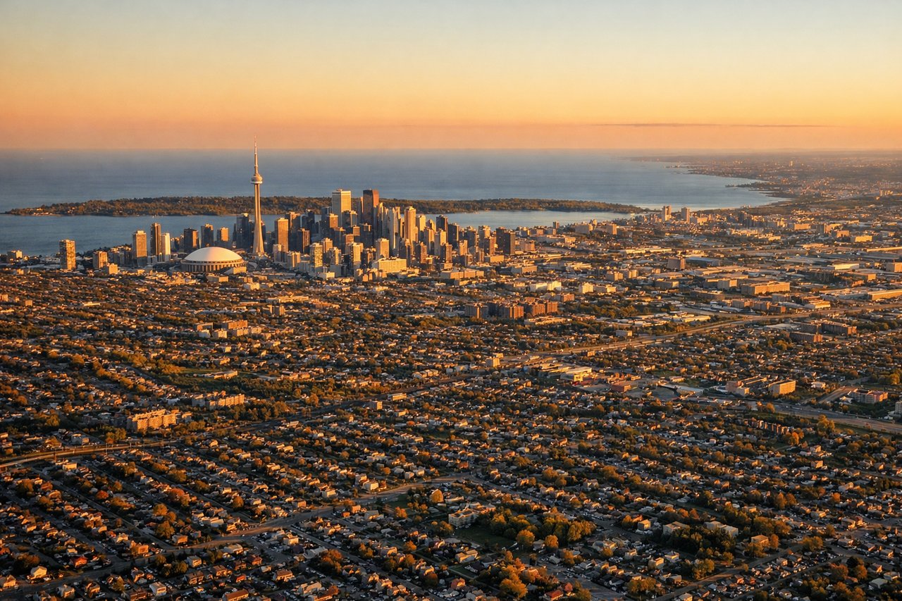
LEFTYYZ arrivals on runway 23 or 24L/24R come in from the northeast over Lake Ontario, putting the Toronto downtown skyline and the CN Tower on the left side. You get a prolonged view of the lake and the city grid as you descend over the water before touching down.
Will your flight be in sunlight?
Pick a date and time in the Sun Map to watch the sun move across your whole flight.
About This Route
Which side of the plane should I sit on flying from Daniel Oduber Quiros International (LIR) to Lester B Pearson International (YYZ)?
Sit on the Right side of the plane for the best views on flights from Liberia to Toronto. The right side delivers the dramatic Guanacaste volcanoes on departure, then tracks the western side of the Yucatán Peninsula and Gulf of Mexico coast through Mexico, and picks up the Great Lakes shoreline on the descent into Toronto. The volcanic scenery at takeoff is the highlight of the flight and tips the balance to the right.
What can I see during takeoff from Daniel Oduber Quiros International in Liberia?
During takeoff from Daniel Oduber Quiros International (LIR), sit on the Right side for the best views. LIR's primary runway 07/25 means departures heading northeast put the Guanacaste volcanic cordillera on the right side. You get a clear view of Volcán Rincón de la Vieja and Volcán Miravalles rising above the dry tropical lowlands. The Gulf of Nicoya also comes into view to the right as you climb out. Notable sights include: Volcán Rincón de la Vieja (1,916m), Volcán Miravalles (2,028m), Gulf of Nicoya coastline, Guanacaste lowland cattle plains.
What can I see when landing at Lester B Pearson International in Toronto?
When landing at Lester B Pearson International (YYZ), sit on the Left side for the best views. YYZ arrivals on runway 23 or 24L/24R come in from the northeast over Lake Ontario, putting the Toronto downtown skyline and the CN Tower on the left side. You get a prolonged view of the lake and the city grid as you descend over the water before touching down. Notable sights include: CN Tower and downtown Toronto skyline, Lake Ontario, Toronto Islands, Highway 427 and suburban grid of Etobicoke.
How long is the flight from Liberia to Toronto?
The flight from Daniel Oduber Quiros International (LIR) to Lester B Pearson International (YYZ) takes about 5 hours 45 minutes. The shortest flight path between them is 2,313 miles (3,723 km); winds and air traffic control usually add a few percent.
What does the Liberia to Toronto flight path pass over?
The flight tracks north over Nicaragua and Honduras, crosses the Yucatán Peninsula of Mexico with its flat limestone karst visible, then crosses the Gulf of Mexico. Over the southern United States it passes over the Mississippi lowlands and Tennessee. Approaching Canada it crosses Lake Erie before descending over Lake Ontario into Toronto. The Gulf of Mexico crossing and the Great Lakes are the most visually distinctive midpoint features.