Both sides score equally low (1.5) due to the short 1h 15m flight over predominantly flat terrain with minimal dramatic geography. However, the right side edges ahead slightly because the landing approach into Houston offers more urban and industrial scenery (refineries, Ship Channel, Galveston Bay) compared to the left side's departure views of Little Rock. For a genuinely flat, featureless route, neither side provides compelling scenic value, but right captures more recognizable landmarks during the final descent.
Flown LIT to IAH? Did we get it right?
Flight Path
Little Rock to Houston is 375 miles (603 km), a flight of about 1 hour 15 minutes.
The flight path crosses central Arkansas and eastern Texas, passing over the Ouachita River valley, pine forests of southeast Arkansas, and the flat coastal plains of southeast Texas. No significant mountains, canyons, or dramatic terrain features are visible. The landscape transitions gradually from forested rolling terrain near Little Rock to increasingly flat, open farmland and then to industrial and suburban sprawl approaching Houston. The Trinity River and its floodplain may be visible during descent into the Houston area.
Great circle distance and headings ›Phase by phase
Takeoff from LIT
LEFTLeft side (north/west) offers slightly better views of Little Rock's urban area and the Arkansas River valley during initial climb. Right side faces open farmland with minimal landmarks.
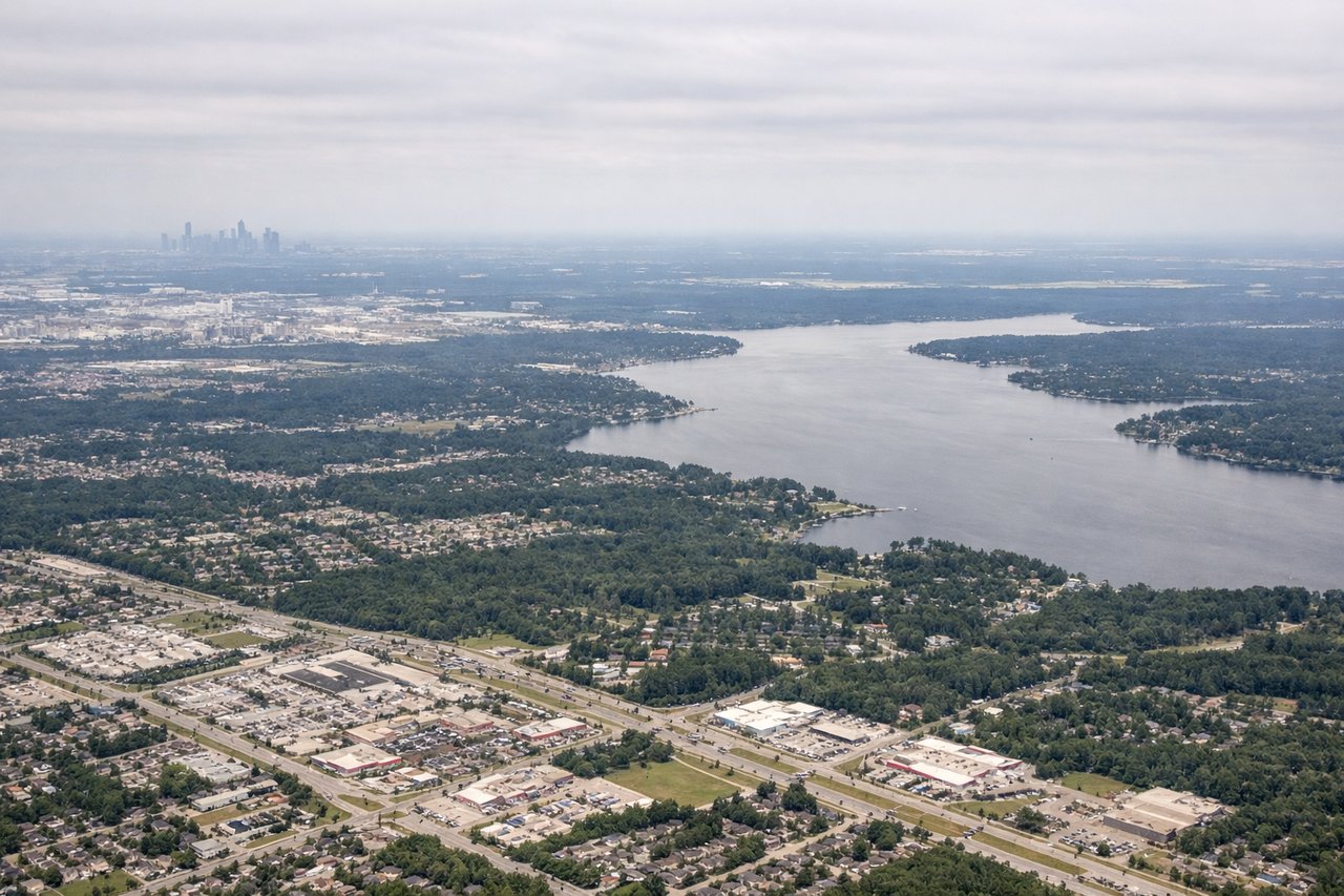
Landing at IAH
RIGHTRight side (south/east) provides views of Houston's sprawling urban development, refineries, and Galveston Bay during descent and approach. Left side faces open Gulf coastal plains with fewer distinctive features.
Will your flight be in sunlight?
Pick a date and time in the Sun Map to watch the sun move across your whole flight.
About This Route
Which side of the plane should I sit on flying from Adams Fld (LIT) to George Bush Intcntl Houston (IAH)?
Sit on the Right side of the plane for the best views on flights from Little Rock to Houston. Both sides score equally low (1.5) due to the short 1h 15m flight over predominantly flat terrain with minimal dramatic geography. However, the right side edges ahead slightly because the landing approach into Houston offers more urban and industrial scenery (refineries, Ship Channel, Galveston Bay) compared to the left side's departure views of Little Rock. For a genuinely flat, featureless route, neither side provides compelling scenic value, but right captures more recognizable landmarks during the final descent.
What can I see during takeoff from Adams Fld in Little Rock?
During takeoff from Adams Fld (LIT), sit on the Left side for the best views. Left side (north/west) offers slightly better views of Little Rock's urban area and the Arkansas River valley during initial climb. Right side faces open farmland with minimal landmarks. Notable sights include: Arkansas River, Little Rock downtown skyline, Pulaski Heights residential area, surrounding pine forest.
What can I see when landing at George Bush Intcntl Houston in Houston?
When landing at George Bush Intcntl Houston (IAH), sit on the Right side for the best views. Right side (south/east) provides views of Houston's sprawling urban development, refineries, and Galveston Bay during descent and approach. Left side faces open Gulf coastal plains with fewer distinctive features. Notable sights include: Galveston Bay, Houston Ship Channel, industrial refineries and petrochemical plants, Houston downtown skyline.
How long is the flight from Little Rock to Houston?
The flight from Adams Fld (LIT) to George Bush Intcntl Houston (IAH) takes about 1 hour 15 minutes. The shortest flight path between them is 375 miles (603 km); winds and air traffic control usually add a few percent.
What does the Little Rock to Houston flight path pass over?
The flight path crosses central Arkansas and eastern Texas, passing over the Ouachita River valley, pine forests of southeast Arkansas, and the flat coastal plains of southeast Texas. No significant mountains, canyons, or dramatic terrain features are visible. The landscape transitions gradually from forested rolling terrain near Little Rock to increasingly flat, open farmland and then to industrial and suburban sprawl approaching Houston. The Trinity River and its floodplain may be visible during descent into the Houston area.