Lulea to Stockholm is 428 miles (689 km), a flight of about 1 hour 15 minutes.
While takeoff offers good Bothnian Bay views on the right, the landing approach provides more visually distinctive features: the Stockholm archipelago and Lake Mälaren are far more dramatic and recognizable than the relatively uniform boreal forest and bay seen during departure. Left-side seats on descent capture these iconic Swedish geographical features.
Flight Path
The flight path crosses central Norrland and Gävleborg County, passing over extensive boreal forests, numerous lakes (Storsjön, Ljustjärn, and smaller systems), and the Ljusnan River valley. The terrain gradually transitions from Norrbotten's flatter landscape to the more varied topography of Uppland. The Tåsjö and Ljusne river systems are visible as linear features. No major mountain ranges are crossed—the Scandinavian Mountains remain far to the west. The flight typically maintains 20,000-25,000 feet over this central section, where individual lakes and forest patterns are visible but not dominant.
Great circle distance and headings ›Phase by phase
Takeoff from LLA
RIGHTKallax typically departs to the south or southeast. Right-side seats capture the Bothnian Bay coastline and the transition from Norrbotten's inland forests to the Gulf of Bothnia, which is the dominant visual feature during climb-out.
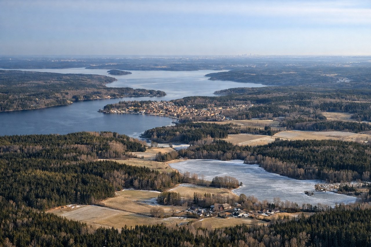
Landing at ARN
LEFTArlanda typically receives aircraft from the north on runway 01L/01R or from the south on runway 19L/19R. On approach from the north, left-side seats offer views of Stockholm's archipelago, Lake Mälaren, and the city's eastern districts. On approach from the south, left seats show the Uppland forests and approach path over the archipelago islands.
Will your flight be in sunlight?
Pick a date and time in the Sun Map to watch the sun move across your whole flight.
About This Route
Which side of the plane should I sit on flying from Kallax (LLA) to Arlanda (ARN)?
Sit on the Left side of the plane for the best views on flights from Lulea to Stockholm. While takeoff offers good Bothnian Bay views on the right, the landing approach provides more visually distinctive features: the Stockholm archipelago and Lake Mälaren are far more dramatic and recognizable than the relatively uniform boreal forest and bay seen during departure. Left-side seats on descent capture these iconic Swedish geographical features.
What can I see during takeoff from Kallax in Lulea?
During takeoff from Kallax (LLA), sit on the Right side for the best views. Kallax typically departs to the south or southeast. Right-side seats capture the Bothnian Bay coastline and the transition from Norrbotten's inland forests to the Gulf of Bothnia, which is the dominant visual feature during climb-out. Notable sights include: Bothnian Bay (Gulf of Bothnia), Luleå city and harbor, Norrbotten pine forests extending inland, Råneå River delta.
What can I see when landing at Arlanda in Stockholm?
When landing at Arlanda (ARN), sit on the Left side for the best views. Arlanda typically receives aircraft from the north on runway 01L/01R or from the south on runway 19L/19R. On approach from the north, left-side seats offer views of Stockholm's archipelago, Lake Mälaren, and the city's eastern districts. On approach from the south, left seats show the Uppland forests and approach path over the archipelago islands. Notable sights include: Stockholm archipelago (Stockholms skärgård), Lake Mälaren, Uppland forests, Arlanda airport infrastructure and surrounding lakes.
How long is the flight from Lulea to Stockholm?
The flight from Kallax (LLA) to Arlanda (ARN) takes about 1 hour 15 minutes. The shortest flight path between them is 428 miles (689 km); winds and air traffic control usually add a few percent.
What does the Lulea to Stockholm flight path pass over?
The flight path crosses central Norrland and Gävleborg County, passing over extensive boreal forests, numerous lakes (Storsjön, Ljustjärn, and smaller systems), and the Ljusnan River valley. The terrain gradually transitions from Norrbotten's flatter landscape to the more varied topography of Uppland. The Tåsjö and Ljusne river systems are visible as linear features. No major mountain ranges are crossed—the Scandinavian Mountains remain far to the west. The flight typically maintains 20,000-25,000 feet over this central section, where individual lakes and forest patterns are visible but not dominant.