The right side captures the spectacular Florida Atlantic coastline on departure and tracks the Eastern Seaboard northward, keeping the Carolinas coast and Chesapeake Bay in view during cruise. The left side wins at landing but the right side delivers more sustained scenery across the full flight.
Flown LNA to IAD? Did we get it right?
Flight Path
West Palm Beach to Washington is 867 miles (1,395 km), a flight of about 2 hours 30 minutes.
The flight tracks north-northeast up the Florida and Georgia coasts, with the Atlantic visible to the right. Over the Carolinas, the Cape Fear River and Cape Hatteras area are notable on the right. The Chesapeake Bay becomes prominent as you enter Virginia airspace, with its wide mouth and tributary rivers visible on the right side. The James River and Richmond metro area pass below before the descent into the DC suburbs.
Great circle distance and headings ›Phase by phase
Takeoff from LNA
RIGHTLNA's primary departure runway 13 sends aircraft southeast before turning north, putting the right side facing east toward the Atlantic coast, Lake Worth Lagoon, and the Palm Beach barrier island. You get a clear look at the Intracoastal Waterway threading between the mainland and the island chain.
Landing at IAD
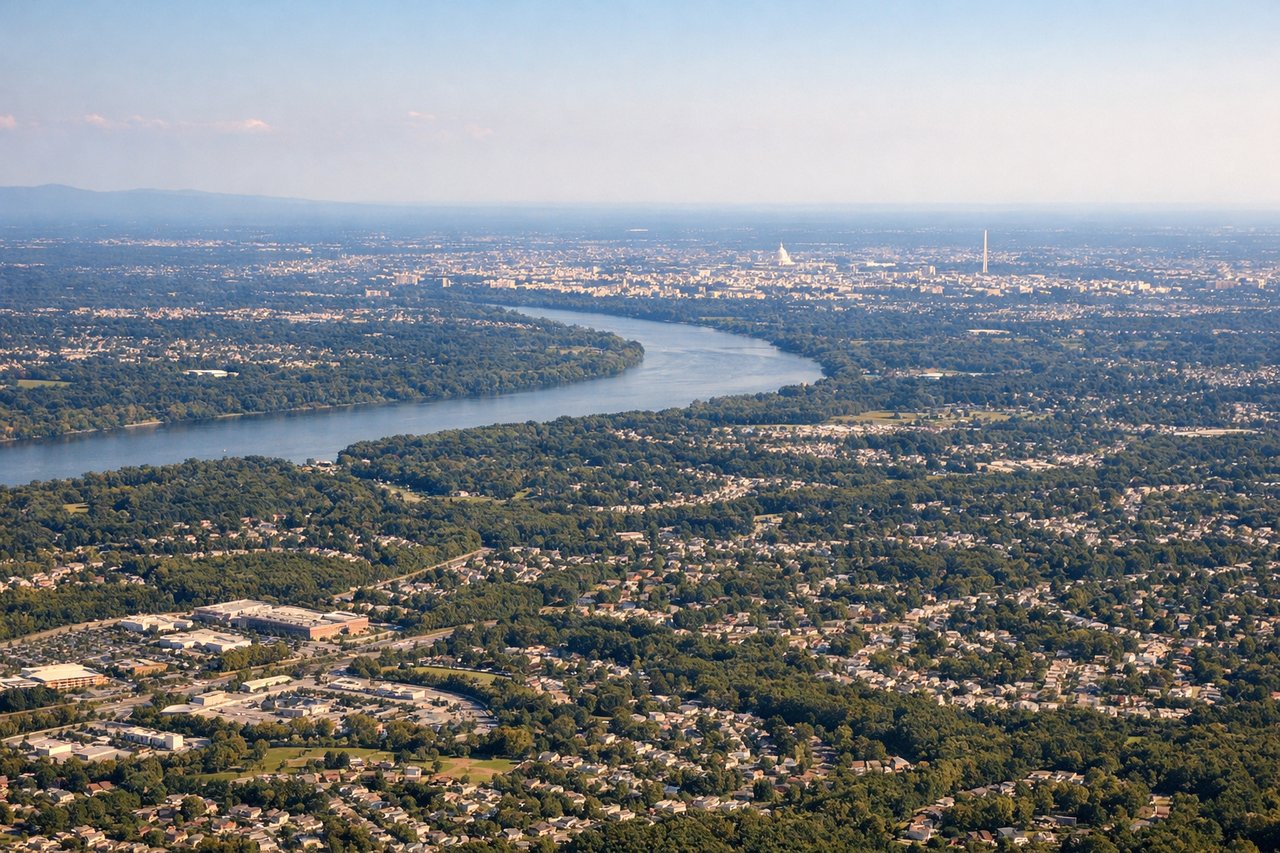
LEFTIAD's primary arrival runway 01R/19L has aircraft approaching from the south, and the left side faces east toward the Potomac River, the Washington DC skyline, and the National Mall corridor. On a clear day you can clearly pick out the Capitol dome and the Washington Monument from the descent path.
Will your flight be in sunlight?
Pick a date and time in the Sun Map to watch the sun move across your whole flight.
About This Route
Which side of the plane should I sit on flying from Palm Beach Co Park (LNA) to Washington Dulles International (IAD)?
Sit on the Right side of the plane for the best views on flights from West Palm Beach to Washington. The right side captures the spectacular Florida Atlantic coastline on departure and tracks the Eastern Seaboard northward, keeping the Carolinas coast and Chesapeake Bay in view during cruise. The left side wins at landing but the right side delivers more sustained scenery across the full flight.
What can I see during takeoff from Palm Beach Co Park in West Palm Beach?
During takeoff from Palm Beach Co Park (LNA), sit on the Right side for the best views. LNA's primary departure runway 13 sends aircraft southeast before turning north, putting the right side facing east toward the Atlantic coast, Lake Worth Lagoon, and the Palm Beach barrier island. You get a clear look at the Intracoastal Waterway threading between the mainland and the island chain. Notable sights include: Palm Beach barrier island and Atlantic Ocean, Lake Worth Lagoon and Intracoastal Waterway, West Palm Beach downtown grid, Palm Beach International Airport (KPBI) to the south.
What can I see when landing at Washington Dulles International in Washington?
When landing at Washington Dulles International (IAD), sit on the Left side for the best views. IAD's primary arrival runway 01R/19L has aircraft approaching from the south, and the left side faces east toward the Potomac River, the Washington DC skyline, and the National Mall corridor. On a clear day you can clearly pick out the Capitol dome and the Washington Monument from the descent path. Notable sights include: Potomac River and its broad bends, Washington DC National Mall and monuments, Tysons Corner urban cluster, Dulles Toll Road corridor leading to the airport.
How long is the flight from West Palm Beach to Washington?
The flight from Palm Beach Co Park (LNA) to Washington Dulles International (IAD) takes about 2 hours 30 minutes. The shortest flight path between them is 867 miles (1,395 km); winds and air traffic control usually add a few percent.
What does the West Palm Beach to Washington flight path pass over?
The flight tracks north-northeast up the Florida and Georgia coasts, with the Atlantic visible to the right. Over the Carolinas, the Cape Fear River and Cape Hatteras area are notable on the right. The Chesapeake Bay becomes prominent as you enter Virginia airspace, with its wide mouth and tributary rivers visible on the right side. The James River and Richmond metro area pass below before the descent into the DC suburbs.