Left side scores significantly higher due to consistent Himalayan scenery throughout the flight. Takeoff captures the dramatic Lhasa plateau edge and northern ranges; cruise crosses the high Tibetan plateau with distant peaks; landing presents the full Himalayan wall as the aircraft descends into Kathmandu Valley. Right side offers only modest terrain variation and lacks the mountain drama that defines this route.
Flown LXA to KTM? Did we get it right?
Flight Path
Lhasa to Kathmandu is 355 miles (571 km), a flight of about 2 hours 10 minutes.
Yamdrok Tso (turquoise glacial lake at ~15,000 ft elevation), Karo La pass area, high Tibetan plateau with sparse settlements, Bhote Kosi River gorge (approaching Nepal), Langtang Valley (northern approach to Kathmandu)
Great circle distance and headings ›Phase by phase
Takeoff from LXA
LEFTLeft side captures the dramatic Lhasa Valley floor and the immediate Himalayan foothills rising steeply to the north and west. The Kyi River valley is visible below during initial climb, with snow-capped peaks of the Nyenchen Tanglha range appearing quickly as the aircraft gains altitude heading southwest toward Kathmandu.
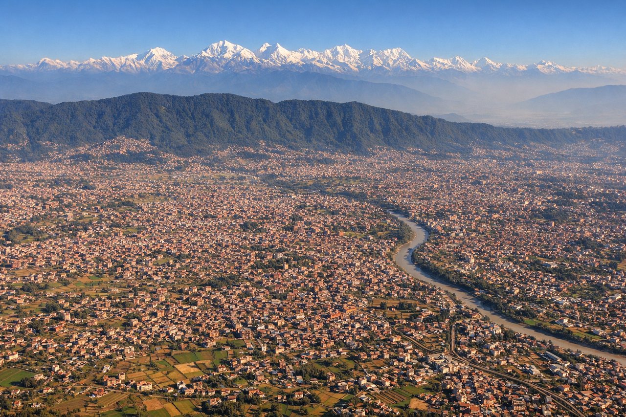
Landing at KTM
LEFTLeft side (north-facing during typical northbound approach to runway 02) presents the full Himalayan wall as the aircraft descends into Kathmandu Valley. The Langtang and Gaurishankar ranges dominate the northern horizon, with the valley floor and Kathmandu city sprawl becoming visible in the final descent. Right side shows only the southern valley rim and lower terrain.
Will your flight be in sunlight?
Pick a date and time in the Sun Map to watch the sun move across your whole flight.
About This Route
Which side of the plane should I sit on flying from Lhasa Gonggar International Airport (LXA) to Tribhuvan International (KTM)?
Sit on the Left side of the plane for the best views on flights from Lhasa to Kathmandu. Left side scores significantly higher due to consistent Himalayan scenery throughout the flight. Takeoff captures the dramatic Lhasa plateau edge and northern ranges; cruise crosses the high Tibetan plateau with distant peaks; landing presents the full Himalayan wall as the aircraft descends into Kathmandu Valley. Right side offers only modest terrain variation and lacks the mountain drama that defines this route.
What can I see during takeoff from Lhasa Gonggar International Airport in Lhasa?
During takeoff from Lhasa Gonggar International Airport (LXA), sit on the Left side for the best views. Left side captures the dramatic Lhasa Valley floor and the immediate Himalayan foothills rising steeply to the north and west. The Kyi River valley is visible below during initial climb, with snow-capped peaks of the Nyenchen Tanglha range appearing quickly as the aircraft gains altitude heading southwest toward Kathmandu. Notable sights include: Lhasa city and Potala Palace area (visible briefly on ground), Kyi River valley, Nyenchen Tanglha range (northern horizon), Yamdrok Tso (turquoise glacial lake, visible during climb-out if routing permits).
What can I see when landing at Tribhuvan International in Kathmandu?
When landing at Tribhuvan International (KTM), sit on the Left side for the best views. Left side (north-facing during typical northbound approach to runway 02) presents the full Himalayan wall as the aircraft descends into Kathmandu Valley. The Langtang and Gaurishankar ranges dominate the northern horizon, with the valley floor and Kathmandu city sprawl becoming visible in the final descent. Right side shows only the southern valley rim and lower terrain. Notable sights include: Langtang Himal (major north-facing peaks), Gaurishankar massif (eastern Himalayan range), Kathmandu Valley floor with city sprawl, Bagmati River valley.
How long is the flight from Lhasa to Kathmandu?
The flight from Lhasa Gonggar International Airport (LXA) to Tribhuvan International (KTM) takes about 2 hours 10 minutes. The shortest flight path between them is 355 miles (571 km); winds and air traffic control usually add a few percent.
What does the Lhasa to Kathmandu flight path pass over?
Yamdrok Tso (turquoise glacial lake at ~15,000 ft elevation), Karo La pass area, high Tibetan plateau with sparse settlements, Bhote Kosi River gorge (approaching Nepal), Langtang Valley (northern approach to Kathmandu)