The left side misses the Sacramento departure views but delivers the dominant spectacle of the flight: the Sierra Nevada crossing and the full Front Range panorama on descent into Denver. The Rocky Mountain approach on the left is simply the most dramatic visual of the entire route.
Flown MCC to DEN? Did we get it right?
Flight Path
Sacramento to Denver is 897 miles (1,444 km), a flight of about 2 hours 10 minutes.
The flight crosses the Sierra Nevada (including the Lake Tahoe basin visible to the south on clear days), then traverses the Great Basin desert of Nevada and Utah with the Bonneville Salt Flats visible, crosses into Colorado over the Rockies including the Wasatch Range transition, and descends across the high plains toward Denver. The Colorado Rockies crossing — including views of the Uinta Mountains and the broad Colorado Plateau — is the visual centerpiece of the mid-flight segment.
Great circle distance and headings ›

Phase by phase
Takeoff from MCC
RIGHTDeparting McClellan eastbound (typical runway 34/16 or eastward departure headings), the right side faces south toward downtown Sacramento, the Sacramento River, and the broad Central Valley floor. You get a clear look at the urban grid and the river bends before climbing out over the valley.
Landing at DEN
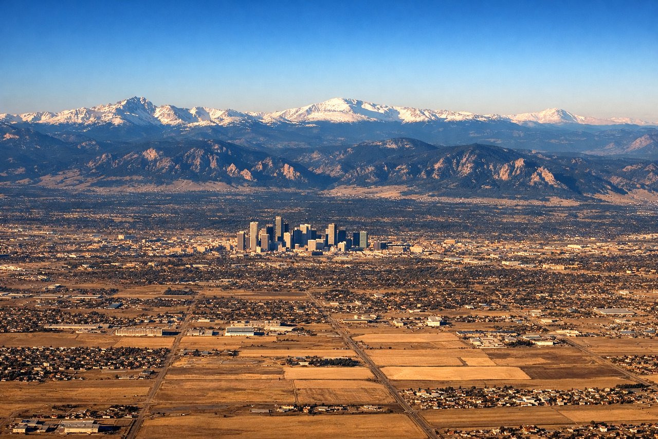
LEFTDenver International sits on the plains east of the city, and aircraft typically approach from the east or southeast on runway 16R/34L or similar headings. On a westward approach, the left side gives you the full panorama of the Front Range — the Rocky Mountains stretching from Pikes Peak in the south to Longs Peak in the north — plus downtown Denver's skyline in the middle distance.
Will your flight be in sunlight?
Pick a date and time in the Sun Map to watch the sun move across your whole flight.
About This Route
Which side of the plane should I sit on flying from Mc Clellan Afld (MCC) to Denver International (DEN)?
Sit on the Left side of the plane for the best views on flights from Sacramento to Denver. The left side misses the Sacramento departure views but delivers the dominant spectacle of the flight: the Sierra Nevada crossing and the full Front Range panorama on descent into Denver. The Rocky Mountain approach on the left is simply the most dramatic visual of the entire route.
What can I see during takeoff from Mc Clellan Afld in Sacramento?
During takeoff from Mc Clellan Afld (MCC), sit on the Right side for the best views. Departing McClellan eastbound (typical runway 34/16 or eastward departure headings), the right side faces south toward downtown Sacramento, the Sacramento River, and the broad Central Valley floor. You get a clear look at the urban grid and the river bends before climbing out over the valley. Notable sights include: Sacramento River bends, downtown Sacramento skyline, Sacramento Valley agricultural grid, Folsom Lake (distant to the southeast).
What can I see when landing at Denver International in Denver?
When landing at Denver International (DEN), sit on the Left side for the best views. Denver International sits on the plains east of the city, and aircraft typically approach from the east or southeast on runway 16R/34L or similar headings. On a westward approach, the left side gives you the full panorama of the Front Range — the Rocky Mountains stretching from Pikes Peak in the south to Longs Peak in the north — plus downtown Denver's skyline in the middle distance. Notable sights include: Front Range Rocky Mountains (Longs Peak to Pikes Peak), downtown Denver skyline, Cherry Creek Reservoir, South Platte River corridor.
How long is the flight from Sacramento to Denver?
The flight from Mc Clellan Afld (MCC) to Denver International (DEN) takes about 2 hours 10 minutes. The shortest flight path between them is 897 miles (1,444 km); winds and air traffic control usually add a few percent.
What does the Sacramento to Denver flight path pass over?
The flight crosses the Sierra Nevada (including the Lake Tahoe basin visible to the south on clear days), then traverses the Great Basin desert of Nevada and Utah with the Bonneville Salt Flats visible, crosses into Colorado over the Rockies including the Wasatch Range transition, and descends across the high plains toward Denver. The Colorado Rockies crossing — including views of the Uinta Mountains and the broad Colorado Plateau — is the visual centerpiece of the mid-flight segment.